PLATE 01 / DERIVED
A small window
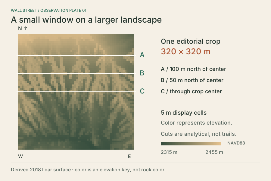
Locate three analytical cuts in the 320 m crop. The colors show the derived elevation, not photographed rock.
Download SVG plate 01BRYCE CANYON CONSERVANCY / FIELD NOTE 080
Read the shape of a narrow canyon through airborne observations, and keep the unseen parts unresolved.
Wall Street is one side of the Navajo Loop below Sunset Point. NPS describes narrow limestone walls along the loop. This exhibit examines a 320 × 320 m editorial crop around the approach and upper passage. It provides no current trail or access information.
First ask where the observer was. An aircraft samples surfaces it can see. A high fraction of populated top-grid cells does not establish complete vertical-wall or floor coverage. The accepted packet is an above-rim terrain study, not a ground scan or a walkable corridor.
2018
USGS airborne lidar
2024
USDA overhead imagery
1 : 1
section axis scale
Derived profile elevations are in NAVD88 metres. Relief is maximum minus minimum along a cut; it is not wall height. Return counts refer only to the accepted display sample in a 5 m strip.
| Cut | North of center | Minimum | Maximum | Relief | Sampled returns |
|---|---|---|---|---|---|
| A | 100 m | 2373.4 m | 2432.7 m | 59.3 m | 1,487 |
| B | 50 m | 2350.7 m | 2420.3 m | 69.6 m | 1,913 |
| C | 0 m | 2343.0 m | 2415.4 m | 72.4 m | 1,905 |
On narrow screens, swipe the table sideways to see all columns.
PLATE 01 / DERIVED
Locate three analytical cuts in the 320 m crop. The colors show the derived elevation, not photographed rock.
Download SVG plate 01PLATE 02 / DERIVED
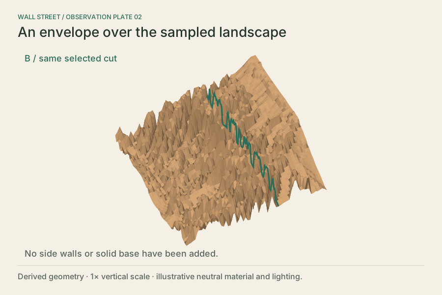
The oblique projection shows how a top surface joins neighboring heights. It does not add the unseen sides of the rock.
Download SVG plate 02PLATE 03 / MEASURED POSITIONS
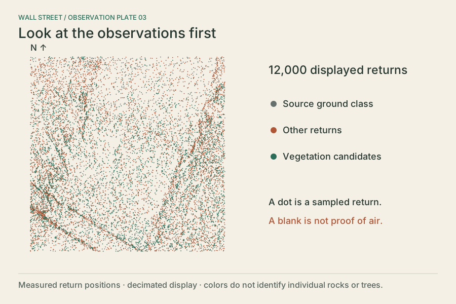
12,000 points, selected every tenth item from the accepted 120,000-return sample. A gap between points is not evidence of empty air.
Download SVG plate 03PLATE 04 / DERIVED
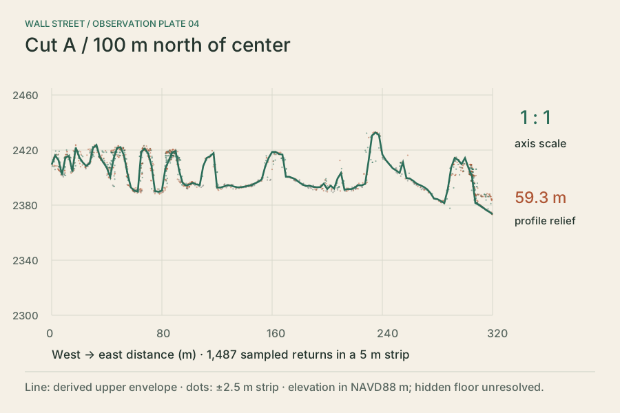
Read a true-scale section 100 m north of center. Dots within ±2.5 m are projected into the cut; they need not lie on the line.
Download SVG plate 04PLATE 05 / DERIVED
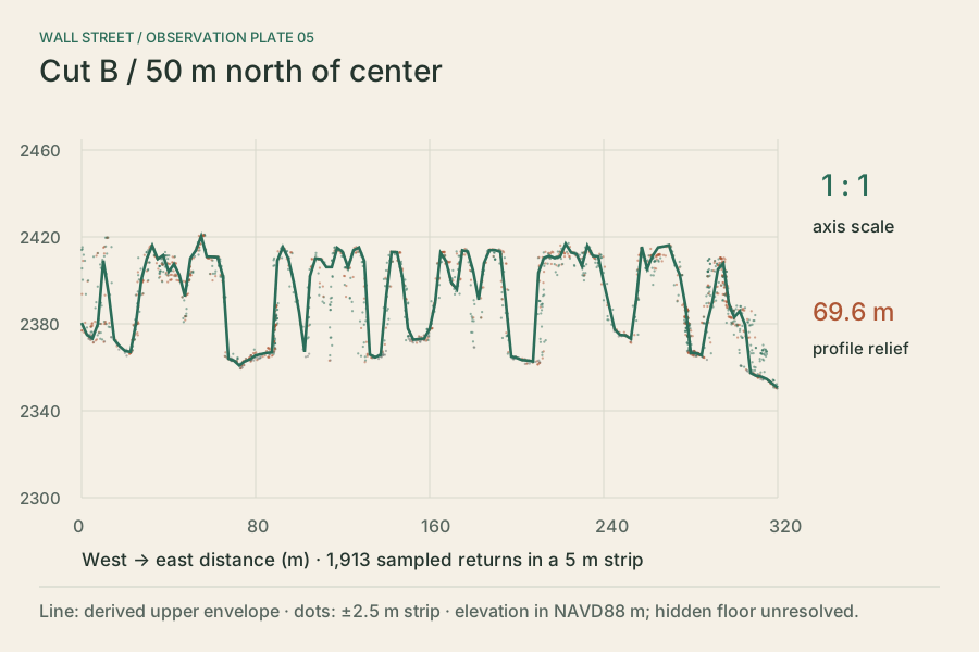
Read a true-scale section 50 m north of center. The profile is a derived upper envelope, with imperfect vegetation filtering.
Download SVG plate 05PLATE 06 / DERIVED
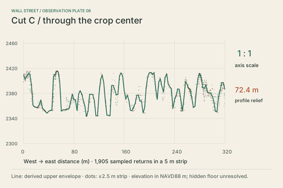
Compare the section at the crop center. Changes between cuts describe this dataset, not changes over time.
Download SVG plate 06PLATE 07 / DERIVED
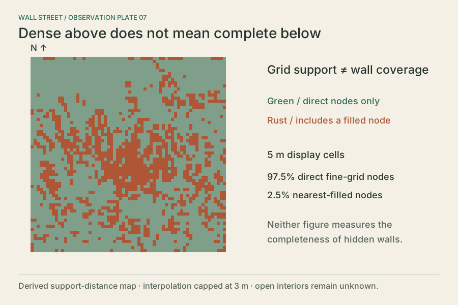
A densely supported horizontal grid can coexist with unobserved vertical walls. Direct and filled nodes describe grid support only.
Download SVG plate 07PLATE 08 / DERIVED
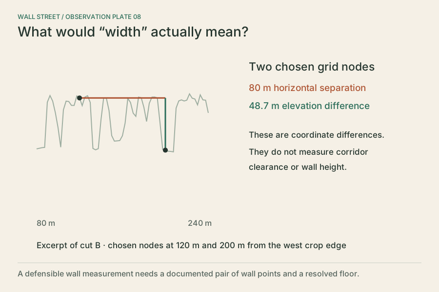
Two chosen nodes are 80 m apart. Their elevation difference is not a wall height; their separation is not passage clearance.
Download SVG plate 08The green line samples the accepted upper-envelope grid every 2.5 m. Its minimum-to-maximum relief is a property of that cut, not a canyon-wall measurement. Nearby measured points are projected from a 5 m strip. Their depth within the strip is lost in the section. Missing support must remain a break; zero elevation is never substituted.
The surface renderer uses a 1.25 m mesh. Original plates 1 and 2 simplify the same source to a 5 m display grid. Fine export spacing and centimetre encoding do not establish measurement accuracy. The source filtering can remove dark rock or retain vegetation; category colors are illustrative.
The 2024 aerial image is 0.6 m imagery from July 23, 2024. It is an overhead reference, not a photograph of the walls. Acquisition shadows, vegetation and registration uncertainty remain. It is not a repeat survey of the 2018 lidar.
Local x is east; z is south; y is height above 2,300 m NAVD88 (Geoid12B). Horizontal export is WGS84 / UTM 12N, centered at E 397071.270, N 4164427.299 m. Native LAS metadata identifies NAD83(2011) / UTM 12N. No survey-grade datum alignment is claimed. Cuts A–C are analytical selections, not mapped paths or named walls.
Map services and data available from U.S. Geological Survey, National Geospatial Program. USGS and USDA NAIP data are public domain. Original BCC diagrams and annotations. NPS text is paraphrased; no NPS photograph is reproduced. This independent educational exhibit does not imply park endorsement.
Source ledger · Reusable annotations · Derived profile data
Local browser review is separate from physical-device, field and independent scientific acceptance.