Skip to content
BRYCE CANYON
CONSERVANCY
A LANDSCAPE READING

Bryce field notes Agua Canyon

Agua Canyon,
closely read.

A familiar shape. A different viewpoint.
A little more to notice.

Follow six observation plates through a photograph, an aerial view and a terrain study. Learn what each can tell you—and where to leave the question open.

6 observation plates4 context comparisons

The complete reading guide

Every plate, in your own time.

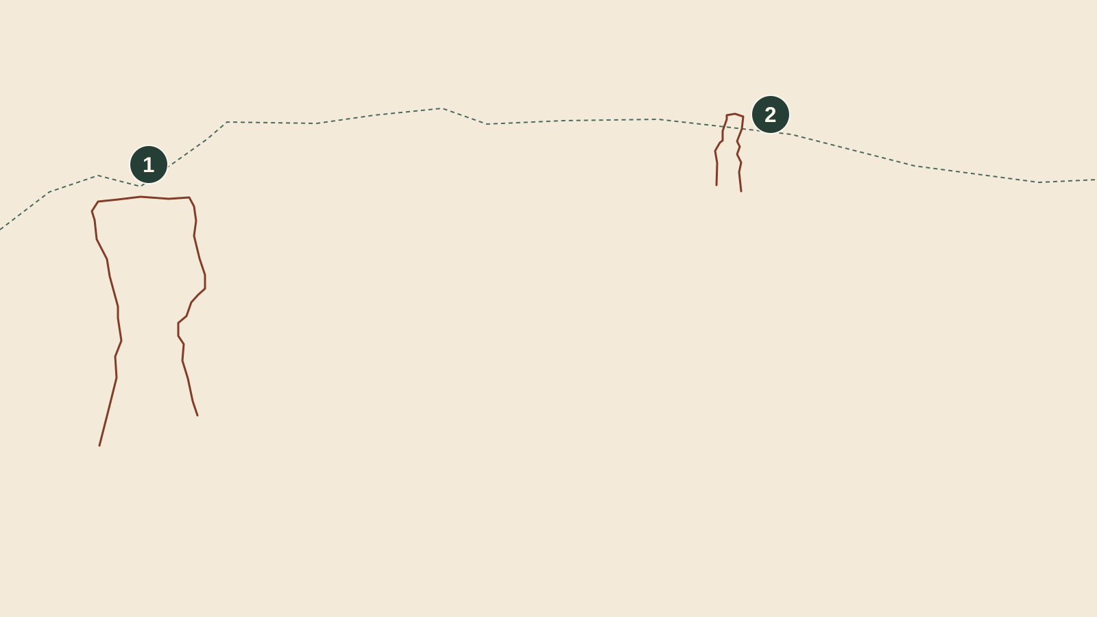
Original drawings; visible contours are simplified. Map units appear only on the locator plate.

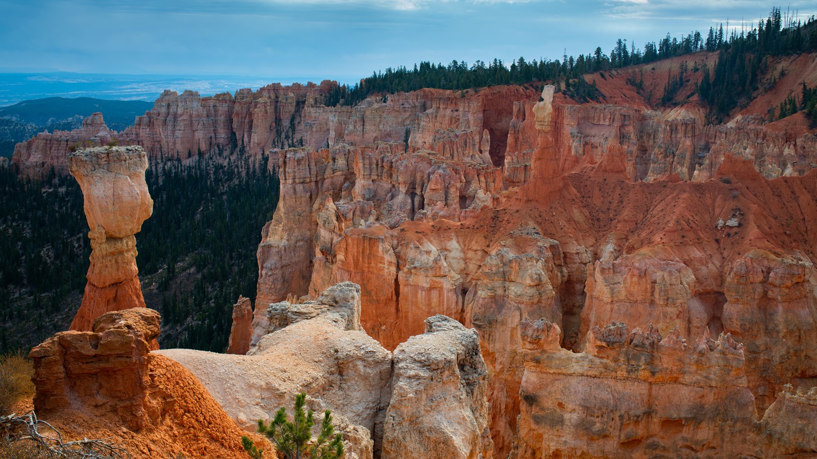
Original line plate: a broad-topped outline at left marked 1 and a smaller pale-topped outline at right marked 2, at their positions in the reference photograph.

Plate 01 · Original illustration

Two names. One shared view.

NPS identifies the Hunter on the left and the Rabbit on the right. Backpacker is another name for the Rabbit.

  • 1 · Hunter: the broad-topped form at left.
  • 2 · Rabbit / Backpacker: the pale-topped form farther right.

Can you find both forms before turning on the marks?

What this can support

The NPS description gives Backpacker as an alternative name for the Rabbit. A name is a useful reference, not a dimensional measurement.

Limit. The labels locate forms in this photograph. They do not supply surveyed positions or a common distance from the camera.
Download SVG plate 01
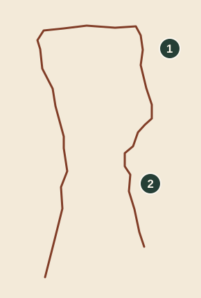
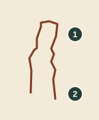
Original Hunter outline plate. Two open edge traces frame the broad top and narrower lower section. Open ends mark where the trace stops; the hidden base is not reconstructed.

Plate 02 · Original illustration

An outline you can follow.

In this view, a broad upper form narrows below. The trace stops where foreground rock obscures the lower outline.

  • 1 · Broad upper outline.
  • 2 · Narrower visible section below.

Where does a clearly visible edge become difficult to follow?

What this can support

You can check those features directly against the photograph. Their appearance does not establish the unseen side or a width in metres.

Limit. The line is a hand-drawn reading aid in image coordinates. It is not a survey, a full perimeter or a measured cross-section.

Download SVG plate 02
Original Rabbit outline plate: a narrow pale summit broadens below, with an open lower end where the shape blends into surrounding rock.

Plate 03 · Original illustration

Rabbit, backpacker, or a shape?

The pale upper outline stands out against redder rock. First describe that contour, then consider the resemblance suggested by a name.

  • 1 · Pale upper contour of the Rabbit.
  • 2 · A lower edge becomes harder to separate from the background.

Which part is visible rock, and which part comes from your imagination?

What this can support

A resemblance is not a dated reconstruction. The source documents names; this single photograph cannot recover a former outline.

Limit. The simplified trace records only this view. It neither restores an earlier shape nor predicts a future one.

Download SVG plate 03
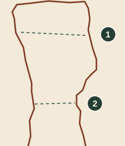
Original shape plate: part of the Hunter outline with two horizontal observation guides, crossing a broad section and a recessed section. The guides are not mapped strata.

Plate 04 · Original illustration

A ledge is a clue, not a clock.

Ledges and recesses interrupt the outline. NPS explains that differences in rock resistance help shape Bryce hoodoos.

  • 1 · Look across the broad upper form.
  • 2 · Compare the recessed section below.

Does a color change always coincide with a change in the outline?

What this can support

No dated layer samples or geological contact map are supplied. The plate supports a visual comparison, not a local chronology.

Limit. This drawing adds no geological contacts, ages or layer thicknesses. Light, shadow and surface color alone cannot establish them.

Download SVG plate 04
Original occlusion plate: the Hunter edge is interrupted by a shaded foreground outline. The obscured region stays blank rather than receiving invented geometry.

Plate 05 · Original illustration

One view leaves things out.

Foreground rock overlaps lower forms. The photograph records a visible face; it does not show every side of the formations.

  • 1 · The Hunter’s visible outline.
  • 2 · Foreground rock obscures the lower scene.

What evidence would you need before drawing the hidden side?

What this can support

The unseen side remains unknown. Additional views or an appropriate ground scan would be needed to support a fuller reconstruction.

Limit. Neither an overhead image nor an upper-envelope terrain surface supplies a complete undercut, back face or closed rock model.

Download SVG plate 05
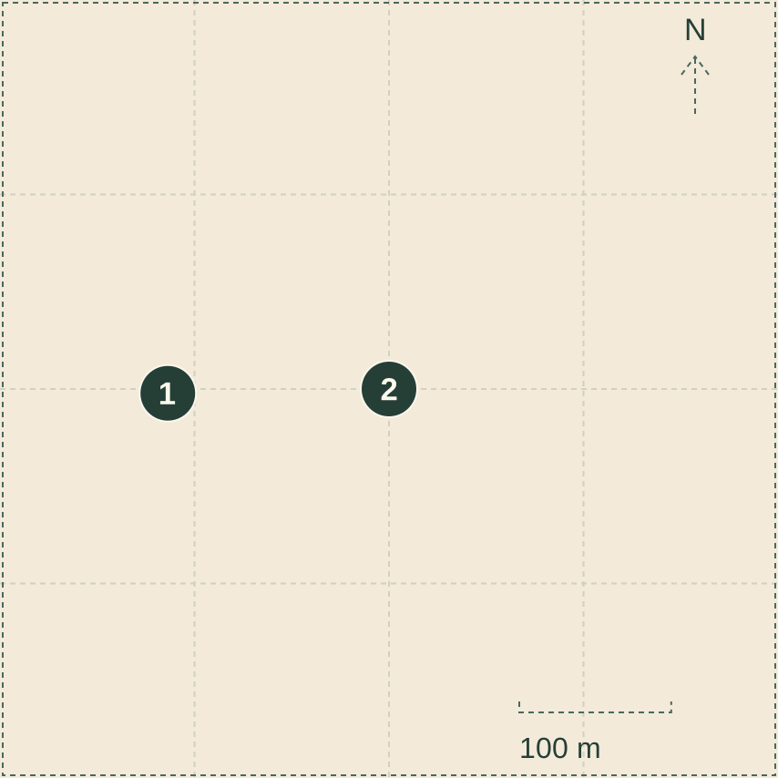
Original north-up footprint diagram. A 512 metre square contains the published overlook point west of its editorial center, with a 100 metre scale bar.

Plate 06 · Derived locator

A point is not a landform.

The ring marks the published NPS overlook point inside the retained 512 m square. The square is an editorial study footprint.

  • 1 · NPS overlook locator; accuracy is recorded as “Scaled”.
  • 2 · Study center; an editorial reference, not a named formation.

Does the overlook marker tell you where the Hunter stands?

What this can support

It is an overlook record, OBJECTID 13658. An access point, a camera position and a rock formation are different things.

Limit. The locator is not the photographer’s recorded camera position. No photo-to-map registration or Hunter/Rabbit coordinate is claimed.

Download SVG plate 06

Change the question

Four ways to put a view in context.

Open a comparison. Inspect each source on its own terms.

01A face and a footprintReference photograph ↔ aerial context

What becomes easier to see when the viewpoint changes?

Agua Canyon: the broad-topped Hunter at left, the pale-topped Rabbit toward the right, and forested slopes among orange cliffs.
Reference photograph

The NPS reference photograph

Capture date not supplied
1600 × 900 pixels

NPS Photo / Peter Densmore

Open image
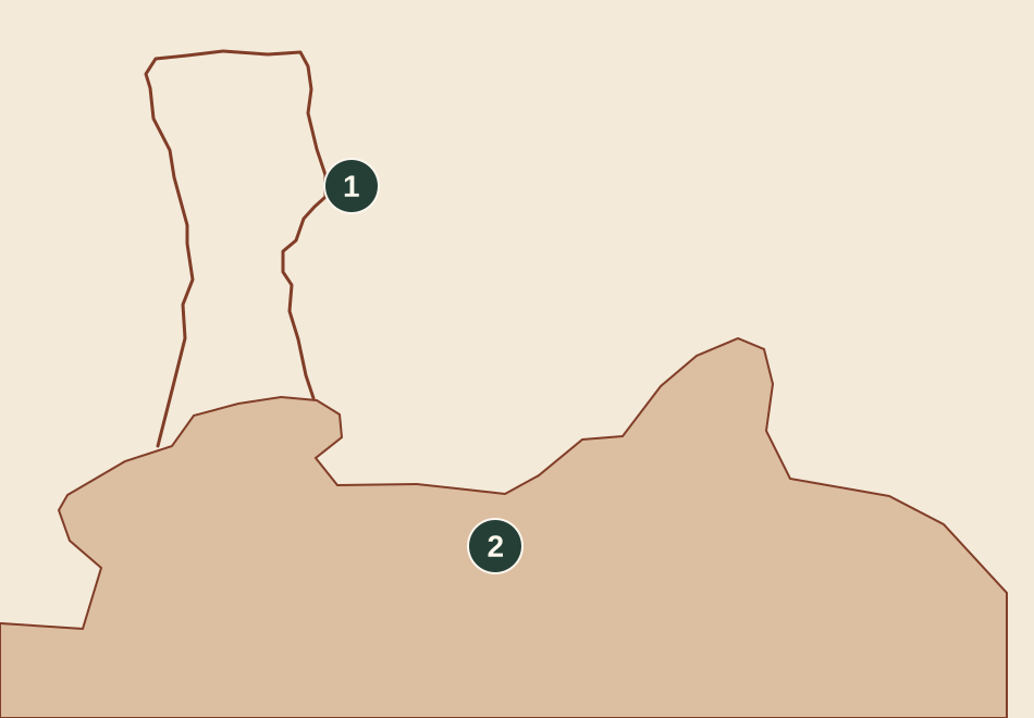
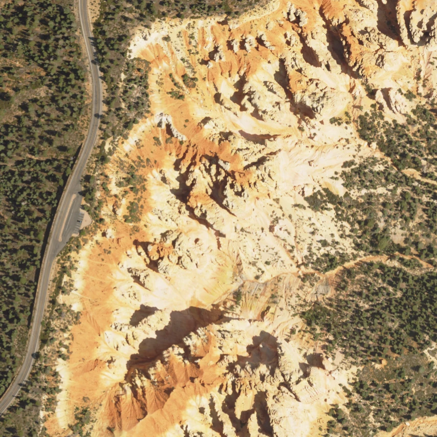
North-up aerial crop of the Agua Canyon study area, with the road at left and exposed rock and forest to the right.
Derived aerial export

The aerial context

Acquired July 23, 2024
854 × 854 pixels · 512 m square

USDA FPAC / Farm Service Agency, NAIP

Open image

Read together. The photograph helps you read visible faces. The aerial view places exposed rock, forest and the road within a bounded footprint.

Keep this boundary. These views are not registered. There is no shared pixel scale or verified photo camera position; a blend would imply an alignment we do not have.

02Elevation and surface color2018 terrain ↔ 2024 aerial imagery

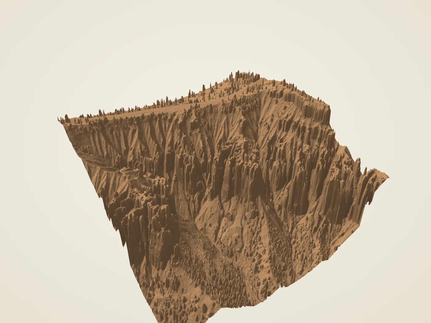
Which details come from height, and which come from imagery?

Oblique render of a square terrain surface around Agua Canyon. Filtering remnants and steep interpolated faces are visible.
Derived terrain render

The retained terrain study

2018 lidar · rendered October 2, 2026
1400 × 1050 pixels · 512 m footprint

USGS 3DEP data; prior BCC landmark collection rendering

Open image
North-up aerial crop of the Agua Canyon study area, with the road at left and exposed rock and forest to the right.
Derived aerial export

The aerial context

Acquired July 23, 2024
854 × 854 pixels · 512 m square

USDA FPAC / Farm Service Agency, NAIP

Open image

Read together. The terrain render conveys broad relief. The aerial export records overhead color and shadows on its acquisition date.

Keep this boundary. The terrain is an upper envelope with filtering remnants, not a full rock scan. The six-year difference and different sensors do not form a change-detection measurement.

03A photograph and an interpretationReference photograph ↔ original edge plate

What did the drawing leave out?

Agua Canyon: the broad-topped Hunter at left, the pale-topped Rabbit toward the right, and forested slopes among orange cliffs.
Reference photograph

The NPS reference photograph

Capture date not supplied
1600 × 900 pixels

NPS Photo / Peter Densmore

Open image
Simplified open trace of the Hunter, showing a broad top and narrower section below.
Illustrative line drawing

The original Hunter edge plate

Drawn October 2, 2026
Image coordinates · no physical scale

Original BCC annotation; reference photograph NPS / Peter Densmore

Open image

Read together. The diagram makes a few selected edges easy to follow. Comparing it to the photograph exposes the simplification.

Keep this boundary. The line has no depth, backside or calibrated physical scale. Enlarging either view adds no source detail.

04A location and a boundaryAerial footprint ↔ locator diagram

What does each mark refer to?

North-up aerial crop of the Agua Canyon study area, with the road at left and exposed rock and forest to the right.
Derived aerial export

The aerial context

Acquired July 23, 2024
854 × 854 pixels · 512 m square

USDA FPAC / Farm Service Agency, NAIP

Open image
An overlook marker west of the center of a square study footprint, with grid north and a 100 metre scale bar.
Derived locator diagram

The original locator plate

Retained NPS point checked October 2, 2026
512 m square · 100 m scale bar

NPS public POI 13658; retained BCC study bounds

Open image

Read together. The overlook is a published NPS point. The 512 m square and its center define the reused terrain study, not the extent of Agua Canyon.

Keep this boundary. No route, camera bearing, formation coordinate, property boundary or current access condition follows from these marks.

Evidence & attribution

Keep the source in view.

A

A named view

Feature identities and alternative names: NPS, Agua Canyon, checked October 2, 2026. The reference photograph is credited NPS Photo / Peter Densmore. Capture date and camera calibration are not supplied.

The image is reused under the NPS ownership policy, with its explicit NPS credit. No claim to original U.S. Government works.

B

A surface, from above

2018 USGS 3DEP terrain provenance and 2024 USDA NAIP imagery provenance are retained from the integrated BCC landmark collection. The rendered terrain, aerial crop and metadata are reused unchanged.

The crop is 512 m square in UTM zone 12N. The terrain retains NAVD88 heights; the detailed grid is 1 m. The aerial source is 0.6 m. Neither figure is a claim of survey accuracy.

C

A located overlook

The marker uses NPS public POI 13658, Agua Canyon Overlook. Its location was digitized from aerial imagery and a park map; accuracy is “Scaled”. Read the exact record and projection.

The marker does not replace a formation position, parking point, camera pose or route.

D

A reading, made explicit

The six plates and observation prompts are original to this exhibit. Hand traces simplify visible edges; no full Hunter or Rabbit mesh is created. General rock-resistance context: NPS, Hoodoos.

These are educational observations. Field, independent geological, physical-device and assistive-user reviews remain separate. Structured source ledger · Reuse notice.