Forty illustrated field cards. Keep the reference sheets with the cards. Diagrams are conceptual, not measured features. Use A4 at 100% scale; turn off browser headers and footers for the intended layout.
FIELD CARD 01 / 40 · Landforms & maps
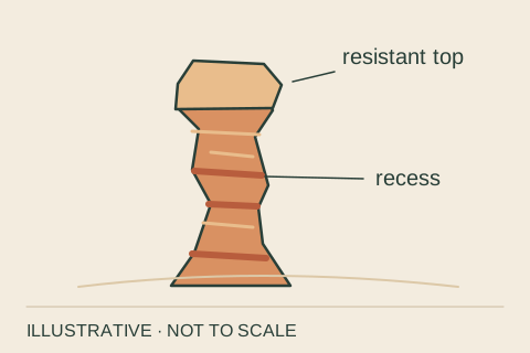
Hoodoo
An irregular pillar of rock left as surrounding material wears away. Its changing width reflects differences in how the layers resist weathering and erosion.
Notice. Trace the outline with your eyes: where does it bulge, and where does it narrow?
Remember. A hoodoo is a landform. It is not a rock type, and its shape alone cannot reveal its age.
Related: Fin, Differential erosion, Claron Formation
References: S01, S02 · gl-hoodoo
BCC · Original illustration, not to scale · October 2026FIELD CARD 02 / 40 · Landforms & maps
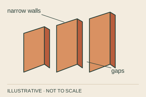
Fin
A narrow wall of rock standing between spaces opened along fractures. At Bryce, fins can develop windows as weathering enlarges weak areas.
Notice. Look for a long wall seen edge-on, rather than an isolated pillar.
Remember. Fin, window and hoodoo describe shapes; they are not a timetable every rock must follow.
Related: Joint, Window, Hoodoo
References: S03 · gl-fin
BCC · Original illustration, not to scale · October 2026FIELD CARD 03 / 40 · Landforms & maps
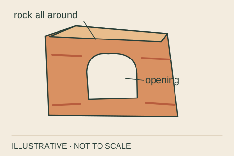
Window
A natural opening through a rock wall. Bryce geology descriptions often use window and arch for the same kind of opening.
Notice. Find a patch of sky framed by continuous rock; light and viewing angle affect its visibility.
Remember. An opening is not evidence of a stream cutting through it. The formation process needs other clues.
Related: Fin, Arch, Frost wedging
References: S03 · gl-window
BCC · Original illustration, not to scale · October 2026FIELD CARD 04 / 40 · Landforms & maps
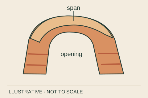
Arch
A natural rock opening with a surviving span overhead. Weathering and erosion can enlarge openings along weaknesses in a rock wall.
Notice. Follow the rock span across the opening without assuming how the opening formed.
Remember. NPS calls Bryce's feature named Natural Bridge an arch. Names do not always match a geologic classification.
Related: Window, Natural bridge, Weathering
References: S03, S04 · gl-arch
BCC · Original illustration, not to scale · October 2026FIELD CARD 05 / 40 · Landforms & maps
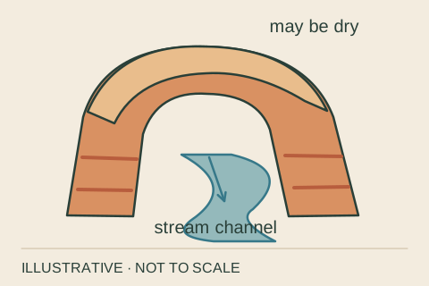
Natural bridge
A natural rock span associated with a stream channel; stream erosion is the usual distinction from other arches. The channel may be dry.
Notice. Ask about the channel and the feature's history, not just its silhouette.
Remember. Bryce's named Natural Bridge is described by NPS as an arch. Arch/bridge terminology is not perfectly uniform.
Related: Arch, Erosion, Runoff
References: S04, S29 · gl-natural-bridge
BCC · Original illustration, not to scale · October 2026FIELD CARD 06 / 40 · Landforms & maps
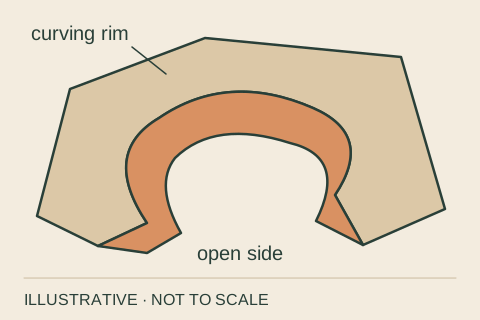
Amphitheater
A broad, bowl-shaped recess in a landscape. Bryce's amphitheaters are cut into the eastern edge of the Paunsaugunt Plateau.
Notice. Look across the curving rim and notice the many rock forms within the larger hollow.
Remember. The word describes an overall shape, not one isolated hoodoo or a mapped trail boundary.
Related: Plateau, Rim, Hoodoo
References: S06, S04 · gl-amphitheater
BCC · Original illustration, not to scale · October 2026FIELD CARD 07 / 40 · Landforms & maps
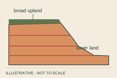
Plateau
A broad region elevated above surrounding land, with a relatively level surface. Relatively level does not mean perfectly flat.
Notice. Compare the extensive upland surface with the steep breaks at its edge.
Remember. A plateau names a landform. Uplift names a process that can raise a region.
Related: Rim, Uplift, Amphitheater
References: S05 · gl-plateau
BCC · Original illustration, not to scale · October 2026FIELD CARD 08 / 40 · Landforms & maps
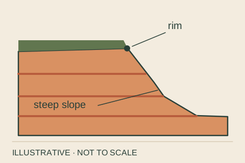
Rim
The upper edge of a steep-sided hollow or escarpment. At Bryce, the rim marks the break between the plateau and the amphitheaters.
Notice. Follow the change from the gentler upland to the steep slope below, from an established viewpoint.
Remember. This is a descriptive edge, not a precise survey line or a guarantee of stable ground.
Related: Plateau, Slope, Amphitheater
References: S04, S06 · gl-rim
BCC · Original illustration, not to scale · October 2026FIELD CARD 09 / 40 · Landforms & maps
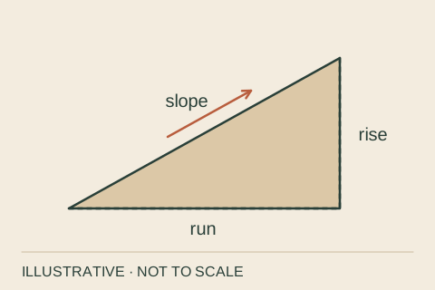
Slope
How quickly elevation changes over horizontal distance. A larger rise over the same horizontal run means a steeper slope.
Notice. Compare two hillside profiles over an equal horizontal distance.
Remember. Percent grade is rise divided by horizontal run, times 100. It is not an angle in degrees.
Related: Contour line, Mass wasting, Rim
References: S07, S08, S31 · gl-slope
BCC · Original illustration, not to scale · October 2026FIELD CARD 10 / 40 · Landforms & maps
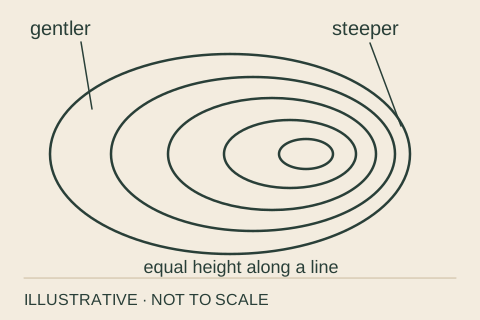
Contour line
A line on a map connecting equal elevations. With a fixed contour interval and map scale, closer lines indicate a steeper slope.
Notice. Read the contour interval before comparing the spacing of the lines.
Remember. Contours show height and shape. They do not identify rock types or tell you that a route is walkable.
Related: Slope, Plateau, Runoff
References: S07, S08, S31 · gl-contour-line
BCC · Original illustration, not to scale · October 2026FIELD CARD 11 / 40 · Forces & change
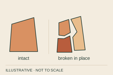
Weathering
The breakdown or chemical alteration of rock at or near its existing position. Weathering can make fragments without carrying them away.
Notice. Look for cracks, loose grains or altered surfaces; then ask separately what moved the material.
Remember. Weathering breaks or alters. Erosion removes and transports. Both can operate together.
Related: Erosion, Frost wedging, Dissolution
References: S09 · gl-weathering
BCC · Original illustration, not to scale · October 2026FIELD CARD 12 / 40 · Forces & change
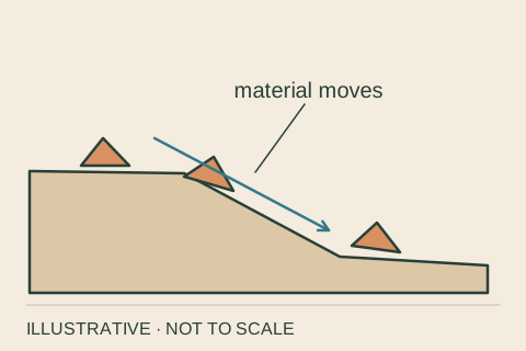
Erosion
The removal and transport of rock or sediment by agents such as moving water, wind, ice or gravity.
Notice. Follow the likely path from a loosened fragment toward a channel or the foot of a slope.
Remember. A cracked rock still in place shows weathering. Material carried elsewhere shows transport.
Related: Weathering, Deposition, Runoff
References: S10, S16 · gl-erosion
BCC · Original illustration, not to scale · October 2026FIELD CARD 13 / 40 · Forces & change
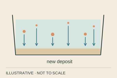
Deposition
The laying down or accumulation of material. Transported sediment can become a new deposit when it settles or is left behind.
Notice. Look for accumulated grains or fragments where moving material has come to rest.
Remember. Deposition makes a sediment deposit. Turning that deposit into solid rock requires further processes.
Related: Erosion, Sediment, Sedimentary rock
References: S16, S13 · gl-deposition
BCC · Original illustration, not to scale · October 2026FIELD CARD 14 / 40 · Forces & change
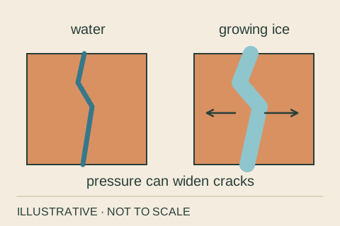
Frost wedging
Physical weathering in which freezing water and growing ice exert pressure within rock cracks, helping widen or break them.
Notice. Notice existing fractures; a single visit cannot show how many freezing events helped open them.
Remember. The demonstration exaggerates crack movement. It is not a temperature, stress or erosion-rate simulation.
Related: Joint, Weathering, Window
References: S01, S09 · gl-frost-wedging
BCC · Original illustration, not to scale · October 2026FIELD CARD 15 / 40 · Forces & change
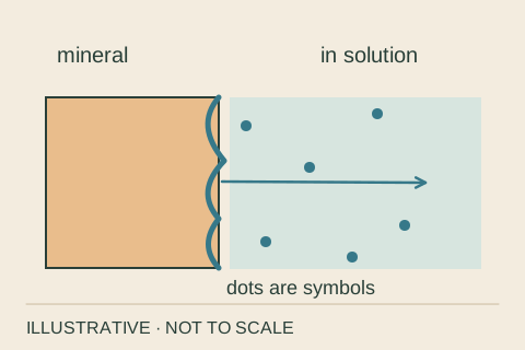
Dissolution
Mineral material enters solution in water. Weakly acidic water can dissolve carbonate minerals, contributing to chemical weathering.
Notice. Consider composition as well as shape: different minerals respond differently to the same water.
Remember. Dissolved material is not the same as visible grains suspended in a stream.
Related: Weathering, Limestone, Differential erosion
References: S09, S02 · gl-dissolution
BCC · Original illustration, not to scale · October 2026FIELD CARD 16 / 40 · Forces & change
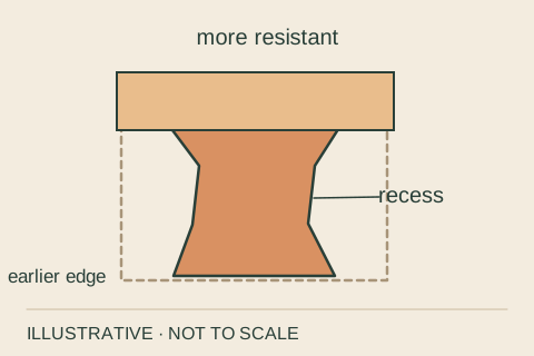
Differential erosion
Unequal wearing away of materials with different resistance. Weathering differences also help produce ledges, recesses and narrow necks.
Notice. Compare protruding layers with the recessed rock immediately above or below them.
Remember. A protective cap is one useful model, not a universal recipe for every hoodoo.
Related: Hoodoo, Bedding, Weathering
References: S01, S02, S04 · gl-differential-erosion
BCC · Original illustration, not to scale · October 2026FIELD CARD 17 / 40 · Forces & change
Runoff
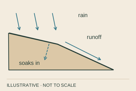
Water that flows over the land surface toward channels or lower ground, including water from rain or melting snow.
Notice. Read the small channels and downhill routes without assuming that they flow all year.
Remember. Not all precipitation becomes surface runoff: some soaks in, evaporates or is used by plants.
Related: Erosion, Slope, Riparian
References: S12 · gl-runoff
BCC · Original illustration, not to scale · October 2026FIELD CARD 18 / 40 · Forces & change
Mass wasting
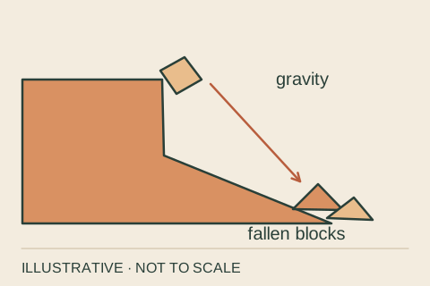
Rock or soil moves downhill under gravity. Rockfalls, slumps and debris flows are examples.
Notice. From a maintained route, look for fallen blocks at a slope's base.
Remember. A diagram of past movement cannot predict the timing or reach of a future rockfall.
Related: Slope, Weathering, Erosion
References: S11 · gl-mass-wasting
BCC · Original illustration, not to scale · October 2026FIELD CARD 19 / 40 · Forces & change
Uplift
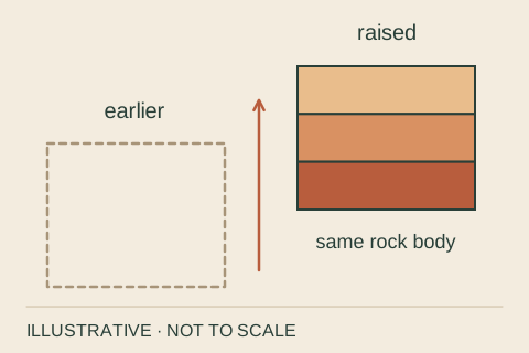
An increase in the elevation of part of Earth's crust. Regional uplift helped raise the rocks now exposed at Bryce.
Notice. Separate the story of rock formation from the later story of rising land.
Remember. Uplift raises land; deposition adds material. Neither is a direct measure of a hoodoo's age.
Related: Plateau, Claron Formation, Deposition
References: S01, S02 · gl-uplift
BCC · Original illustration, not to scale · October 2026FIELD CARD 20 / 40 · Forces & change
Joint
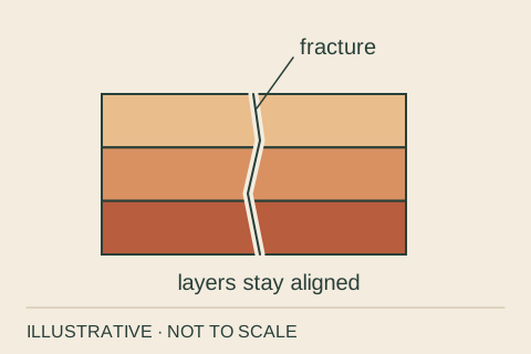
A fracture in rock without appreciable sliding displacement across it. Joints can provide pathways for water and weathering.
Notice. Trace a crack across several layers and compare the layers on its two sides.
Remember. A fault has displacement. A joint is a fracture without that appreciable offset.
Related: Fin, Frost wedging, Bedding
References: S05, S03 · gl-joint
BCC · Original illustration, not to scale · October 2026FIELD CARD 21 / 40 · Rocks & time
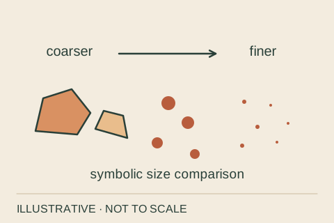
Sediment
Material such as rock fragments, mineral grains or biological remains that accumulates in deposits. Sediment ranges from tiny particles to large fragments.
Notice. Compare the sizes and shapes of visible particles without collecting or disturbing them.
Remember. Loose sediment is not yet necessarily a sedimentary rock.
Related: Deposition, Sedimentary rock, Sandstone
References: S13, S15 · gl-sediment
BCC · Original illustration, not to scale · October 2026FIELD CARD 22 / 40 · Rocks & time
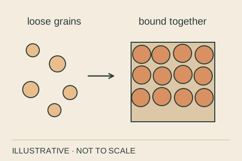
Sedimentary rock
Rock formed from accumulated sediment or material precipitated from water. Burial, compaction and mineral cement can turn loose grains into rock.
Notice. Look for grains, layers or preserved remains that offer clues to the starting material.
Remember. Not every sedimentary rock forms from sand, and not every one forms in the sea.
Related: Sediment, Bedding, Limestone, Fossil
References: S13, S15 · gl-sedimentary-rock
BCC · Original illustration, not to scale · October 2026FIELD CARD 23 / 40 · Rocks & time
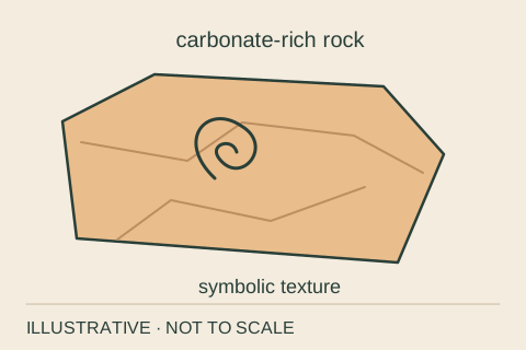
Limestone
A sedimentary rock composed mainly of calcium carbonate. It can form in freshwater or marine settings by biological and chemical processes.
Notice. Use the rock's context and a reliable description; pale color alone is not an identification.
Remember. Limestone does not automatically mean an ancient ocean. Bryce's Claron includes lake and floodplain deposits.
Related: Dissolution, Sedimentary rock, Claron Formation
References: S05, S15, S01 · gl-limestone
BCC · Original illustration, not to scale · October 2026FIELD CARD 24 / 40 · Rocks & time
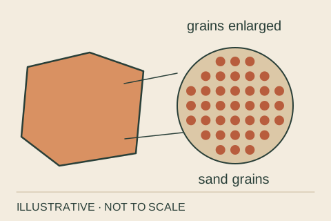
Sandstone
A sedimentary rock made predominantly of sand-sized grains bound into rock.
Notice. Look for a visibly granular texture from a permitted viewing position.
Remember. Sandstone describes grain size and rock character. It does not, by itself, identify a desert or marine origin.
Related: Sediment, Sedimentary rock, Mudstone
References: S16, S15 · gl-sandstone
BCC · Original illustration, not to scale · October 2026FIELD CARD 25 / 40 · Rocks & time
Mudstone
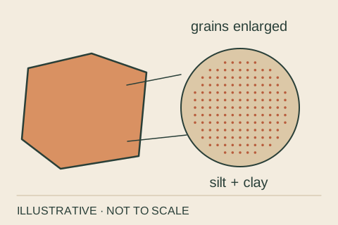
A fine-grained sedimentary rock formed from mud, including silt- and clay-sized particles.
Notice. Compare its apparently smooth texture with a visibly sandy rock.
Remember. An illustration enlarges the particles so you can see the idea; it cannot show real grain size at this scale.
Related: Sandstone, Sediment, Claron Formation
References: S16, S15 · gl-mudstone
BCC · Original illustration, not to scale · October 2026FIELD CARD 26 / 40 · Rocks & time
Bedding
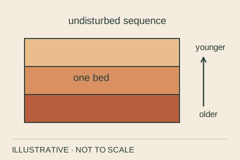
The arrangement of sedimentary rock into layers, or beds. Layer boundaries can record changes during deposition.
Notice. Follow one visible layer sideways and note where its thickness or appearance changes.
Remember. In a sequence that has not been overturned, lower beds are older than those above. Not every color stripe marks a separate formation.
Related: Formation, Deposition, Unconformity
References: S13, S14 · gl-bedding
BCC · Original illustration, not to scale · October 2026FIELD CARD 27 / 40 · Rocks & time
Formation
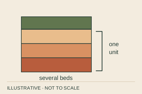
A named, mappable body of rock recognized by its physical characteristics. A formation can contain more than one rock type.
Notice. Read a geologic map's legend to learn which rock unit is being described.
Remember. In everyday speech, formation may mean a striking shape. In stratigraphy it means a defined rock unit.
Related: Claron Formation, Bedding, Hoodoo
References: S05, S28 · gl-formation
BCC · Original illustration, not to scale · October 2026FIELD CARD 28 / 40 · Rocks & time
Unconformity
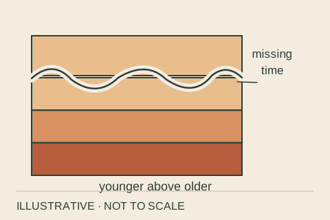
A surface representing missing time in the rock record because material was eroded away or was not deposited.
Notice. Imagine the history that may be absent between the rocks below and above a contact.
Remember. A wavy line in a diagram is a symbol. Recognizing a real unconformity requires geologic evidence.
Related: Bedding, Erosion, Deposition
References: S05, S28 · gl-unconformity
BCC · Original illustration, not to scale · October 2026FIELD CARD 29 / 40 · Rocks & time
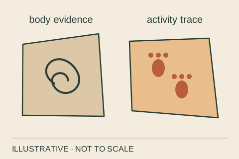
Fossil
Naturally preserved evidence of past life, including remains and traces such as tracks or burrows.
Notice. Distinguish a preserved body part from a trace of an organism's activity.
Remember. Fossils need not be turned to stone. A ripple mark without evidence of life is not a trace fossil.
Related: Sedimentary rock, Deposition, Bedding
References: S15 · gl-fossil
BCC · Original illustration, not to scale · October 2026FIELD CARD 30 / 40 · Rocks & time
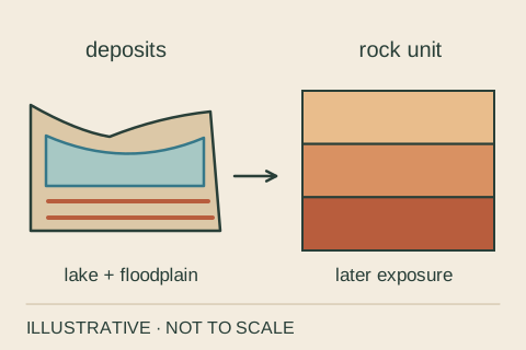
Claron Formation
The rock unit that supplies much of Bryce's famous hoodoo landscape, including carbonate-rich rocks deposited in ancient lake and floodplain settings.
Notice. Read the landscape at two scales: the rock unit, then the shapes carved from it.
Remember. The age of the deposited rocks is much older than the age of today's individual hoodoo shapes.
Related: Formation, Limestone, Hoodoo
References: S01, S02 · gl-claron-formation
BCC · Original illustration, not to scale · October 2026FIELD CARD 31 / 40 · Living systems
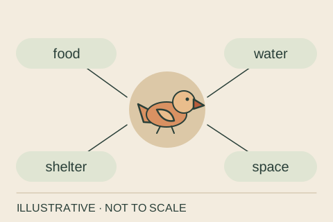
Habitat
The place and conditions that provide an organism with its needs, including food, water, shelter and space.
Notice. Choose one organism and ask what it needs from the place around it.
Remember. A habitat is relative to an organism. Different species can use the same landscape in different ways.
Related: Ecosystem, Riparian, Adaptation
References: S18 · gl-habitat
BCC · Original illustration, not to scale · October 2026FIELD CARD 32 / 40 · Living systems
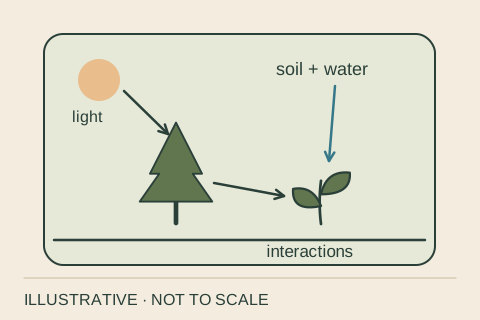
Ecosystem
Organisms and their physical surroundings interacting as a system: living things, water, air, soil and light all matter.
Notice. Name one living component and one nonliving component, then look for a connection between them.
Remember. An ecosystem includes the physical setting as well as the community of organisms.
Related: Habitat, Food web, Succession, Biological soil crust
References: S18 · gl-ecosystem
BCC · Original illustration, not to scale · October 2026FIELD CARD 33 / 40 · Living systems
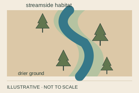
Riparian
Relating to land and habitats along water sources such as streams, rivers, springs and washes, including some that flow only intermittently.
Notice. Compare vegetation beside water with vegetation farther away; avoid assuming that greener always means permanently wet.
Remember. Riparian describes a relationship to water. It is not a single tree species or a claim of year-round flow.
Related: Runoff, Habitat, Deciduous
References: S19, S17 · gl-riparian
BCC · Original illustration, not to scale · October 2026FIELD CARD 34 / 40 · Living systems
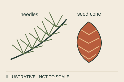
Conifer
A cone-bearing tree or shrub, commonly with needle-like or scale-like leaves. Pines, firs and spruces are examples.
Notice. Look for both leaf form and cones; a general silhouette is not enough to identify a species.
Remember. Most conifers are evergreen, but some are deciduous. Conifer and evergreen are not synonyms.
Related: Deciduous, Habitat, Adaptation
References: S20 · gl-conifer
BCC · Original illustration, not to scale · October 2026FIELD CARD 35 / 40 · Living systems
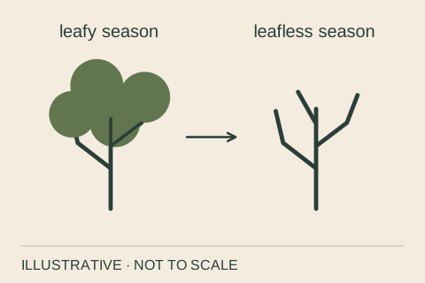
Deciduous
Shedding leaves seasonally. At Bryce, quaking aspen is a familiar deciduous tree.
Notice. Compare a leafy crown with its winter branching pattern rather than treating bare branches as proof of death.
Remember. Deciduous describes a seasonal habit, not a single family of plants.
Related: Conifer, Habitat, Succession
References: S20, S21 · gl-deciduous
BCC · Original illustration, not to scale · October 2026FIELD CARD 36 / 40 · Living systems
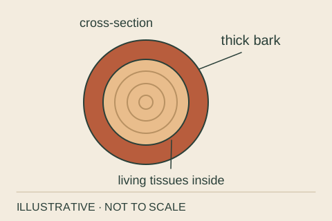
Adaptation
An inherited feature that can help organisms survive and reproduce in a particular environment.
Notice. Consider how thick bark can help a mature ponderosa pine withstand some fires.
Remember. Adaptations do not make an organism invulnerable. Fire resistance depends on conditions, including the tree and the fire.
Related: Conifer, Habitat, Succession
References: S22, S27 · gl-adaptation
BCC · Original illustration, not to scale · October 2026FIELD CARD 37 / 40 · Living systems
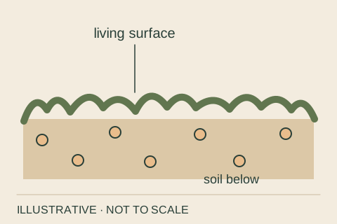
Biological soil crust
A living surface community that can include cyanobacteria, lichens, mosses and fungi. It helps bind soil particles together in many dry landscapes.
Notice. Look from an existing trail. Some young crusts look much like bare soil.
Remember. This is a regional concept illustration, not a map or a claim of crust at a particular Bryce location.
Related: Erosion, Ecosystem, Decomposition
References: S23 · gl-biological-soil-crust
BCC · Original illustration, not to scale · October 2026FIELD CARD 38 / 40 · Living systems
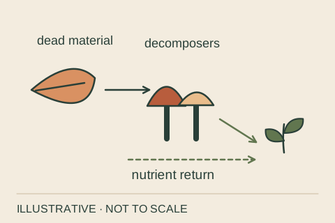
Decomposition
The breakdown of dead organic material. Decomposers such as fungi and bacteria help release nutrients that other organisms can use.
Notice. Notice fallen leaves and wood as parts of the living system, not simply waste.
Remember. Nutrients can cycle through an ecosystem. Energy flows through it and is eventually dissipated as heat.
Related: Food web, Ecosystem, Succession
References: S25, S30 · gl-decomposition
BCC · Original illustration, not to scale · October 2026FIELD CARD 39 / 40 · Living systems
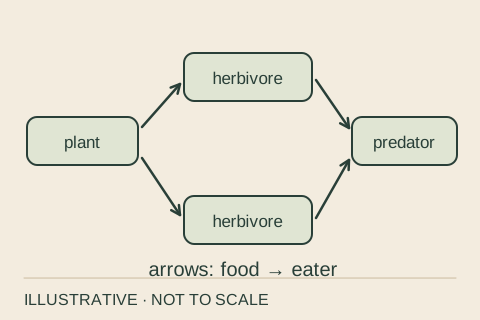
Food web
A network of feeding relationships. Multiple food chains connect organisms through what eats what.
Notice. Ask where an organism's food comes from and what may feed on it.
Remember. Here arrows point from food to eater. The demonstration uses generic roles, not a surveyed Bryce feeding network.
Related: Decomposition, Habitat, Ecosystem
References: S24, S25, S32 · gl-food-web
BCC · Original illustration, not to scale · October 2026FIELD CARD 40 / 40 · Living systems
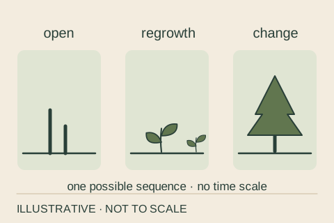
Succession
Change in a biological community over time. After disturbance, shifts in light, resources and surviving organisms can shape what grows next.
Notice. Compare open ground, young growth and older vegetation without assigning ages from appearance alone.
Remember. This is not a fixed ladder with an inevitable endpoint. Actual recovery depends on place and conditions.
Related: Ecosystem, Adaptation, Decomposition
References: S26 · gl-succession
BCC · Original illustration, not to scale · October 2026