Source register · retrieved 2 October 2026
Every frame
has a source.
Ten NPS photographs, individually credited. The notes and selections are BCC's.
Each image's rights basis combines its explicit NPS Photo / Peter Densmore credit with the NPS ownership statement. A government host by itself is not a rights grant. No third-party exception was found in these image credits. No claim to original U.S. Government works.
Published master sizes were read from the corresponding NPS JPEG header. The 2400-pixel reference editions below preserve the publisher's full frame within one-pixel rounding; camera-original files and dimensions are not verified. Local WebP versions are simple resizes. Color, content and sharpness were not edited. Crops on the collection page are display choices, reversible by opening the photograph.
Reference photograph
Agua Canyon
- Photographer
- Peter Densmore / NPS
- Place record
- Agua Canyon · NPS ↗
- Published master
- 7890 × 4438 px · publisher's frame
- Available here
- 2400 × 1350 px · NPS reference edition
- Photograph date
- Not supplied
- Camera direction
- Not supplied
- Page updated
- August 31, 2026 · not a capture date
- Rights
- NPS-authored U.S. Government work; public domain under NPS ownership policy.
Location basis: NPS publishes this image as the named place's hero photograph. The photograph is not assigned an invented camera coordinate.
Retrieved: 2026-10-02T17:46:07.678746+00:00
NPS published master ↗ · Retained JPEG reference edition

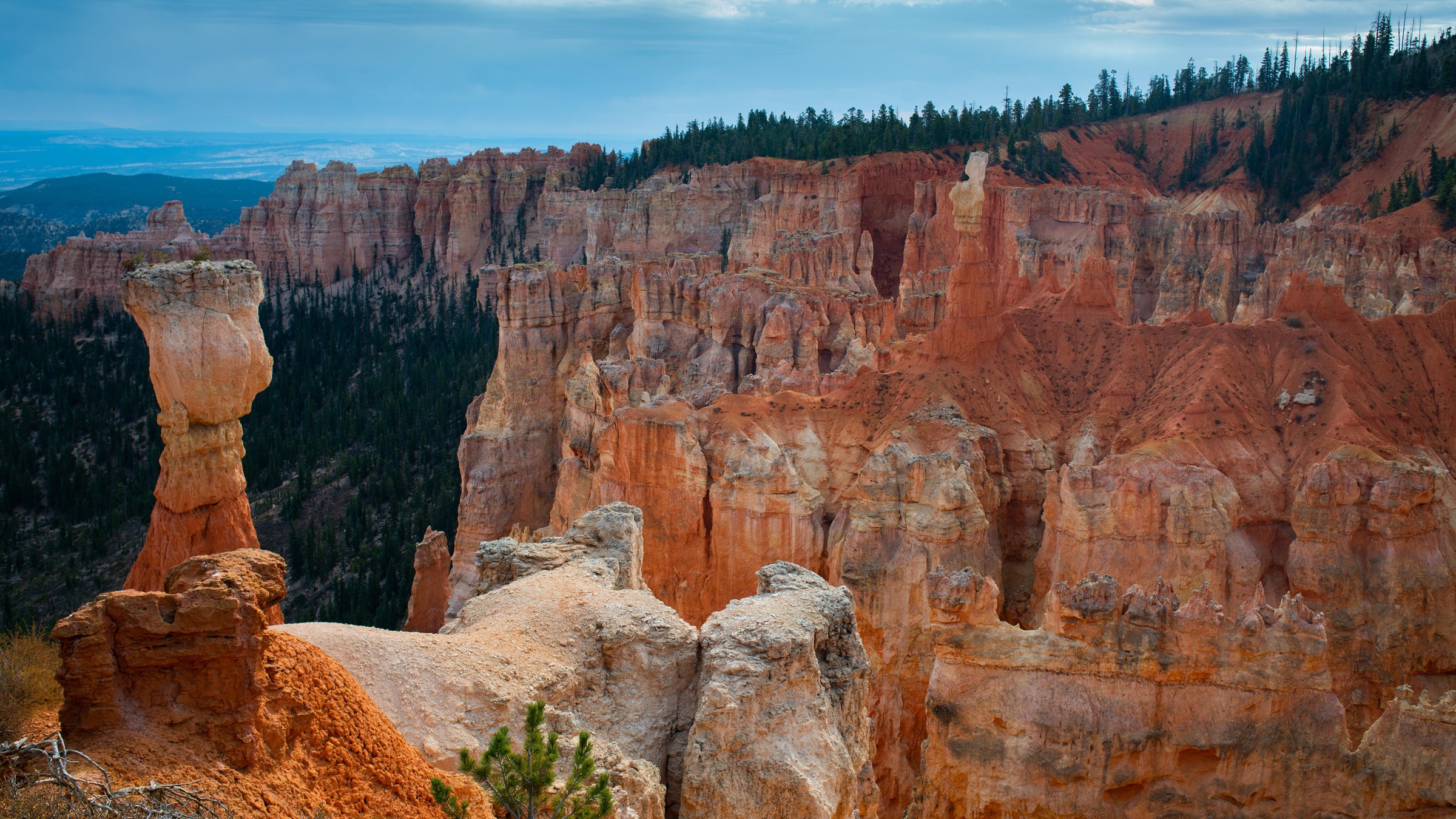
Retained JPEG SHA-256: 7e1650e65e890fa07847cb122aeca0fd08849810a8fe650d8bf1651987f5f4ab
Supported interpretation: NPS identifies the tall hoodoo on the left as the Hunter. Its place account also describes how old resemblance-based names can outlast the shapes that inspired them.
Reference photograph
Swamp Canyon
- Photographer
- Peter Densmore / NPS
- Place record
- Swamp Canyon · NPS ↗
- Published master
- 7952 × 4473 px · publisher's frame
- Available here
- 2400 × 1350 px · NPS reference edition
- Photograph date
- Not supplied
- Camera direction
- Not supplied
- Page updated
- August 15, 2026 · not a capture date
- Rights
- NPS-authored U.S. Government work; public domain under NPS ownership policy.
Location basis: NPS publishes this image as the named place's hero photograph. The photograph is not assigned an invented camera coordinate.
Retrieved: 2026-10-02T17:46:07.831079+00:00
NPS published master ↗ · Retained JPEG reference edition

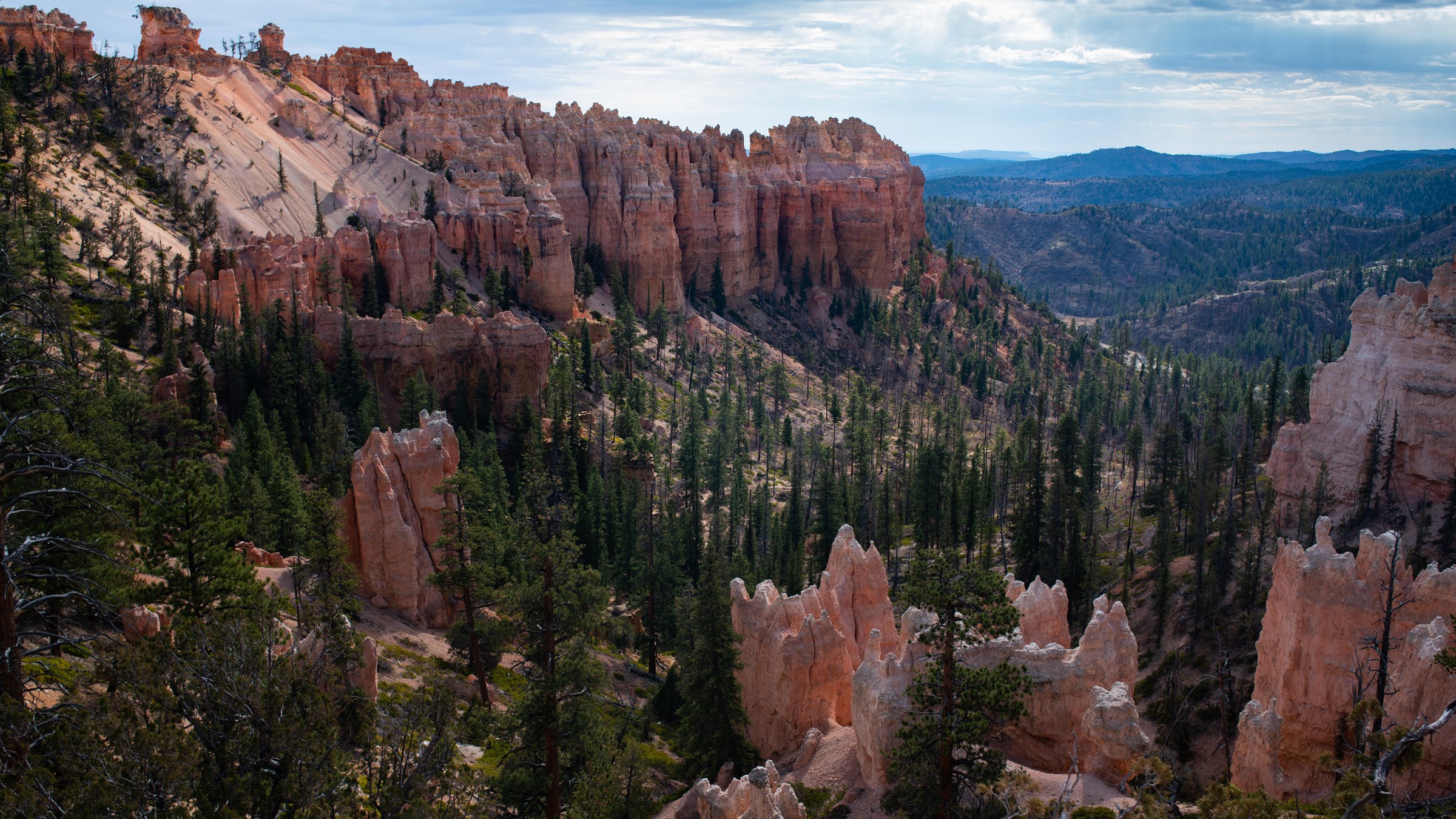
Retained JPEG SHA-256: b1e65f626c3a59b23f42fd5d7c74169aad6a59e45e3c523a622c37e7017b337b
Supported interpretation: NPS describes Swamp Canyon as a transition from the Bryce Amphitheater's hoodoos to the more forested cliffs and buttes of the southern park.
Reference photograph
Farview Point
- Photographer
- Peter Densmore / NPS
- Place record
- Farview Point · NPS ↗
- Published master
- 7952 × 4473 px · publisher's frame
- Available here
- 2400 × 1350 px · NPS reference edition
- Photograph date
- Not supplied
- Camera direction
- Not supplied
- Page updated
- February 1, 2021 · not a capture date
- Rights
- NPS-authored U.S. Government work; public domain under NPS ownership policy.
Location basis: NPS publishes this image as the named place's hero photograph. The photograph is not assigned an invented camera coordinate.
Retrieved: 2026-10-02T17:46:11.478849+00:00
NPS published master ↗ · Retained JPEG reference edition

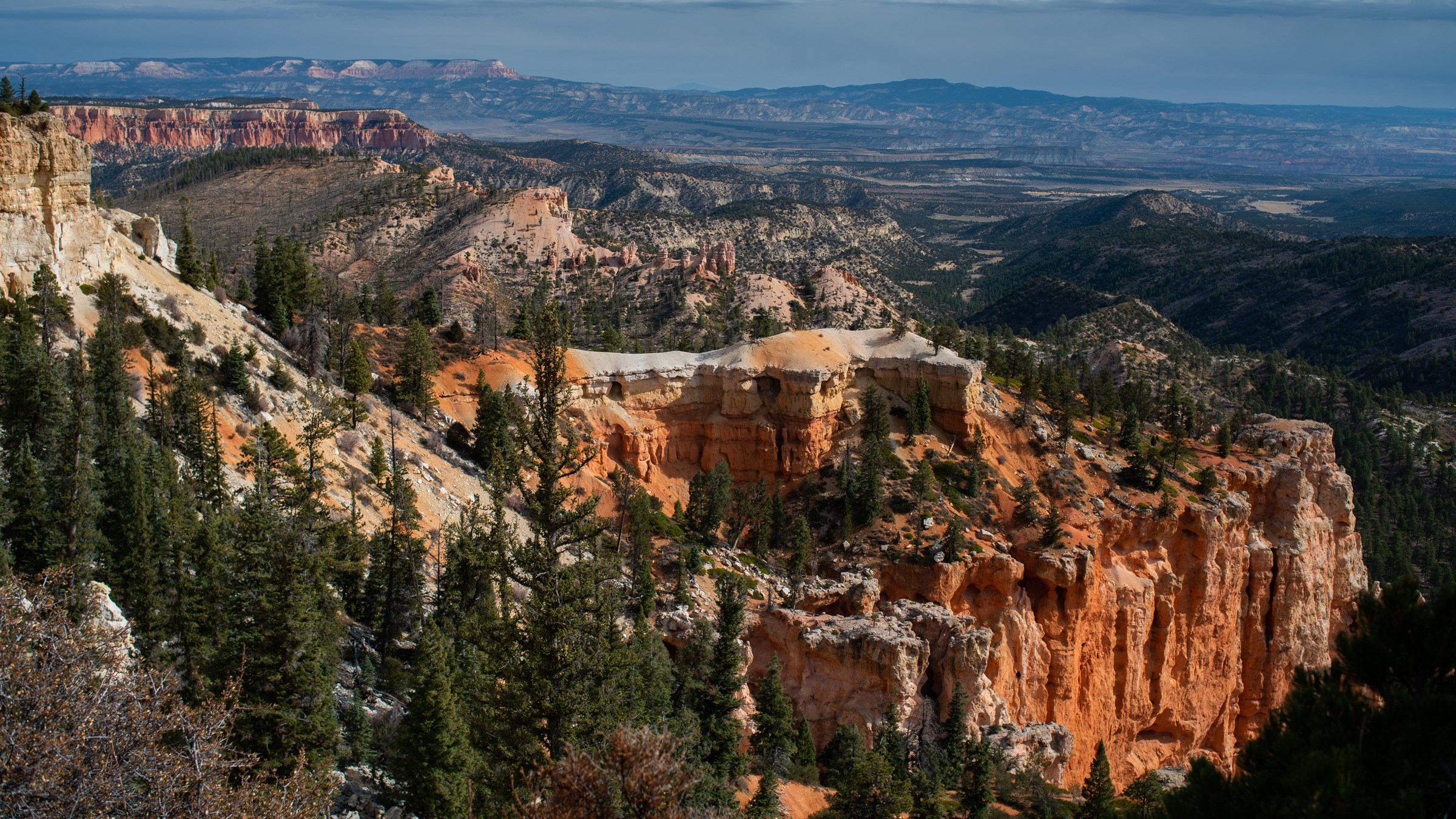
Retained JPEG SHA-256: 5d4b410c1aaede0b66795742079065191396da8802164de34f79b45776e2a515
Supported interpretation: The NPS place account emphasizes long views from Farview Point and describes the short connecting path to Piracy Point. This photograph records one view, not today's visibility.
Reference photograph
Piracy Point
- Photographer
- Peter Densmore / NPS
- Place record
- Piracy Point · NPS ↗
- Published master
- 7952 × 4473 px · publisher's frame
- Available here
- 2400 × 1350 px · NPS reference edition
- Photograph date
- Not supplied
- Camera direction
- Not supplied
- Page updated
- January 28, 2021 · not a capture date
- Rights
- NPS-authored U.S. Government work; public domain under NPS ownership policy.
Location basis: NPS publishes this image as the named place's hero photograph. The photograph is not assigned an invented camera coordinate.
Retrieved: 2026-10-02T17:46:11.522727+00:00
NPS published master ↗ · Retained JPEG reference edition

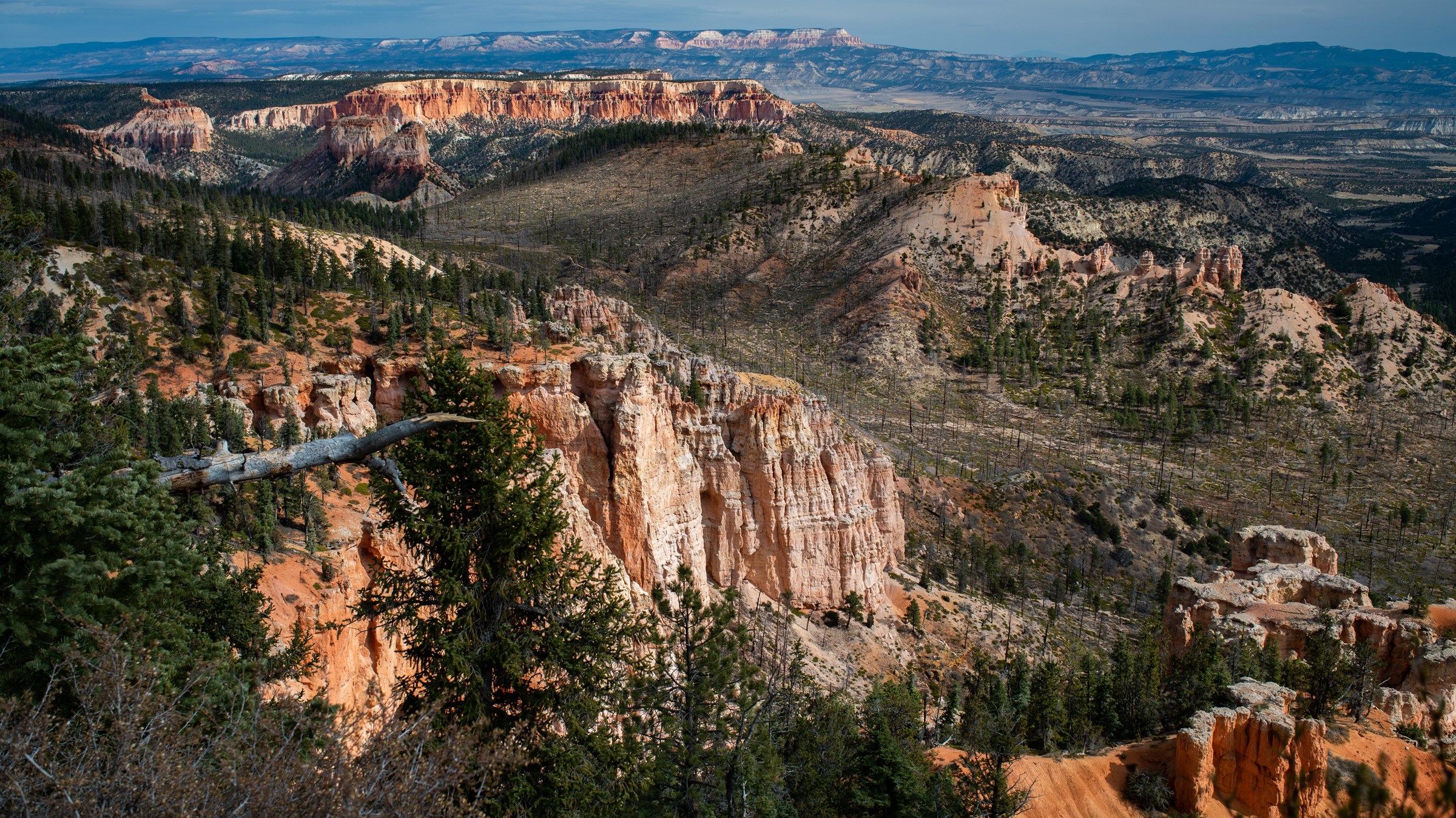
Retained JPEG SHA-256: 09e952def0dd025666e46f2086aa334a4263fd90e81231fb60d0bb2815232c67
Supported interpretation: NPS relates Piracy Point to neighboring drainage systems and the process of stream piracy. The photograph cannot measure drainage capture or establish when it will happen.
Reference photograph
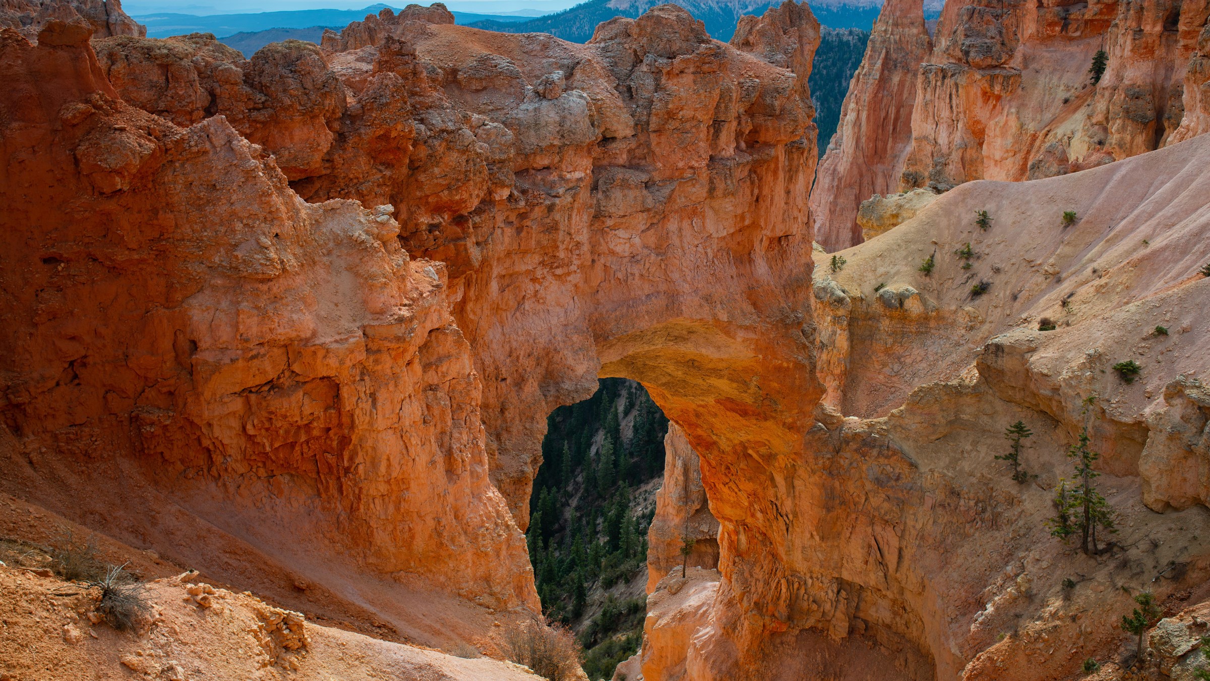
Natural Bridge
- Photographer
- Peter Densmore / NPS
- Place record
- Natural Bridge · NPS ↗
- Published master
- 7911 × 4449 px · publisher's frame
- Available here
- 2400 × 1350 px · NPS reference edition
- Photograph date
- Not supplied
- Camera direction
- Not supplied
- Page updated
- August 15, 2026 · not a capture date
- Rights
- NPS-authored U.S. Government work; public domain under NPS ownership policy.
Location basis: NPS publishes this image as the named place's hero photograph. The photograph is not assigned an invented camera coordinate.
Retrieved: 2026-10-02T17:46:14.461757+00:00
NPS published master ↗ · Retained JPEG reference edition

Retained JPEG SHA-256: 6447dfa633e220398418d8a4111800980a28fb5b484691058e44a0e320dde560
Supported interpretation: Despite its name, NPS describes Natural Bridge as an arch formed by weathering, rather than a bridge cut by a stream. This single view does not reveal its hidden surfaces.
Reference photograph
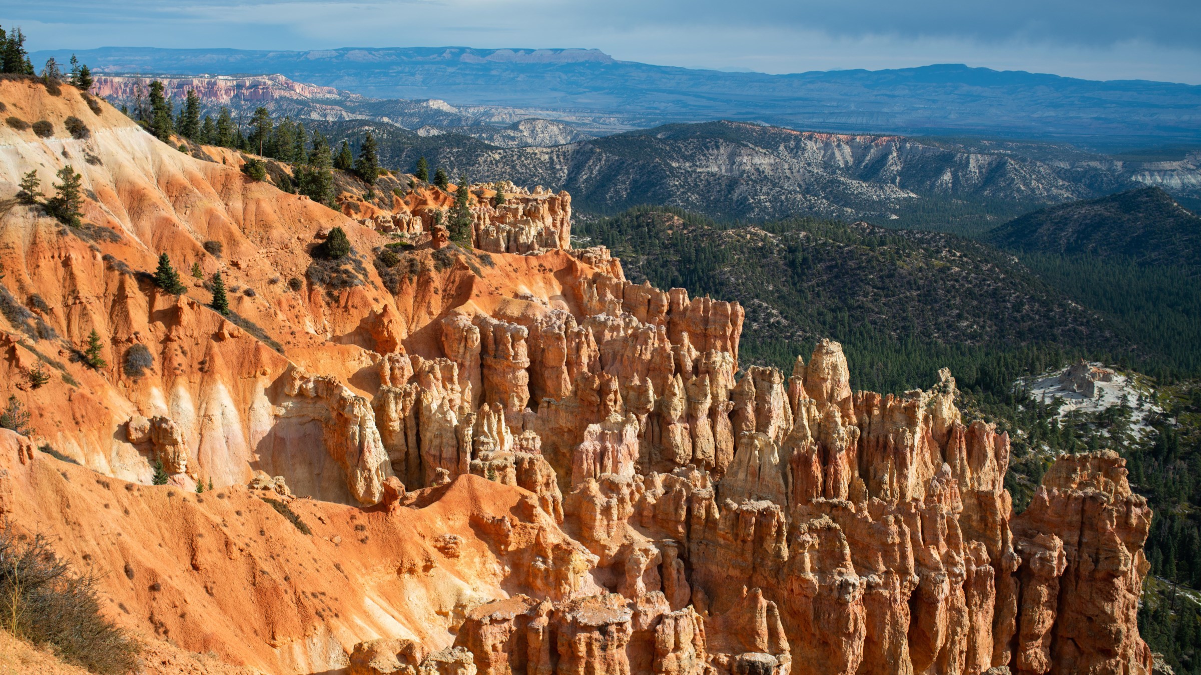
Ponderosa Canyon
- Photographer
- Peter Densmore / NPS
- Place record
- Ponderosa Canyon · NPS ↗
- Published master
- 7890 × 4438 px · publisher's frame
- Available here
- 2400 × 1350 px · NPS reference edition
- Photograph date
- Not supplied
- Camera direction
- Not supplied
- Page updated
- October 10, 2024 · not a capture date
- Rights
- NPS-authored U.S. Government work; public domain under NPS ownership policy.
Location basis: NPS publishes this image as the named place's hero photograph. The photograph is not assigned an invented camera coordinate.
Retrieved: 2026-10-02T17:46:14.475415+00:00
NPS published master ↗ · Retained JPEG reference edition

Retained JPEG SHA-256: d1ba56161fcf8892c6398a54a64b84405a82b2e4993e94b7e79e75100ef54131
Supported interpretation: NPS explains that the canyon is named for ponderosa pines below the rim, while the higher viewpoint sits among a different forest community. Individual tree species are not identified from this photograph.
Reference photograph
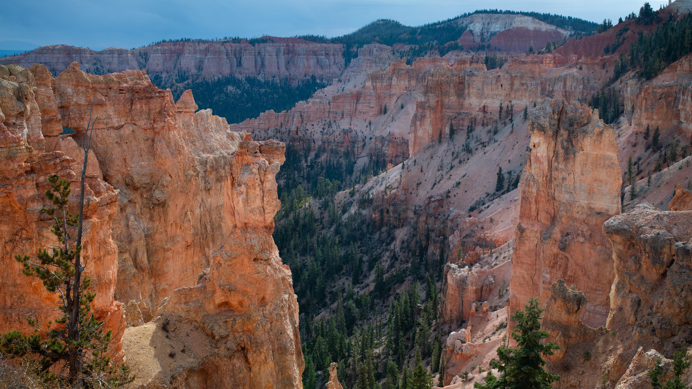
Black Birch Canyon
- Photographer
- Peter Densmore / NPS
- Place record
- Black Birch Canyon · NPS ↗
- Published master
- 7952 × 4473 px · publisher's frame
- Available here
- 2400 × 1350 px · NPS reference edition
- Photograph date
- Not supplied
- Camera direction
- Not supplied
- Page updated
- October 10, 2024 · not a capture date
- Rights
- NPS-authored U.S. Government work; public domain under NPS ownership policy.
Location basis: NPS publishes this image as the named place's hero photograph. The photograph is not assigned an invented camera coordinate.
Retrieved: 2026-10-02T17:46:16.167182+00:00
NPS published master ↗ · Retained JPEG reference edition

Retained JPEG SHA-256: 6f0b0a1c7d43a2ab237c0aba2f76a373e7b594b3c046840c436e537b3c185fc1
Supported interpretation: NPS notes that the name Black Birch is misleading: black birch does not naturally occur here, and the name may have arisen from confusion with quaking aspen. This photograph does not identify either tree.
Reference photograph
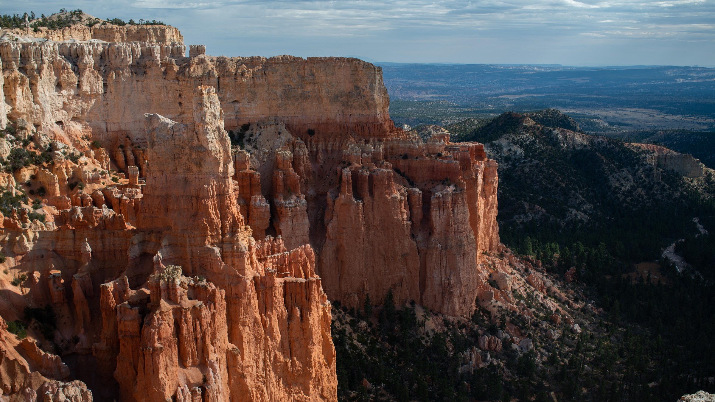
Paria View
- Photographer
- Peter Densmore / NPS
- Place record
- Paria View · NPS ↗
- Published master
- 7775 × 4373 px · publisher's frame
- Available here
- 2400 × 1350 px · NPS reference edition
- Photograph date
- Not supplied
- Camera direction
- Not supplied
- Page updated
- October 10, 2024 · not a capture date
- Rights
- NPS-authored U.S. Government work; public domain under NPS ownership policy.
Location basis: NPS publishes this image as the named place's hero photograph. The photograph is not assigned an invented camera coordinate.
Retrieved: 2026-10-02T17:46:17.555595+00:00
NPS published master ↗ · Retained JPEG reference edition

Retained JPEG SHA-256: cf2fe2e1426e8dba7a93fd60d00e4b453c8984b1ff3462fcd04553692e51217e
Supported interpretation: NPS describes an amphitheater shaped by Yellow Creek, which drains toward the Paria River. The river itself is not identified in this frame.
Reference photograph
Fairyland Point
- Photographer
- Peter Densmore / NPS
- Place record
- Fairyland Point · NPS ↗
- Published master
- 3061 × 1721 px · publisher's frame
- Available here
- 2400 × 1349 px · NPS reference edition
- Photograph date
- Not supplied
- Camera direction
- Not supplied
- Page updated
- October 10, 2024 · not a capture date
- Rights
- NPS-authored U.S. Government work; public domain under NPS ownership policy.
Location basis: NPS publishes this image as the named place's hero photograph. The photograph is not assigned an invented camera coordinate.
Retrieved: 2026-10-02T17:46:22.452221+00:00
NPS published master ↗ · Retained JPEG reference edition

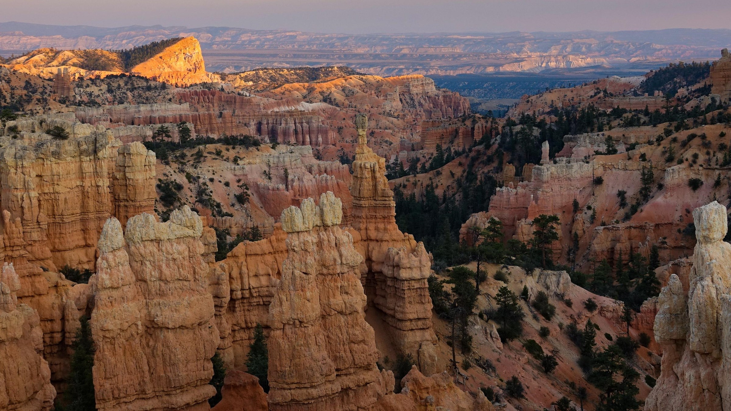
Retained JPEG SHA-256: 9e95c547216b2bff8a6cc6c9c2398dac09d1b0da883a52891e24db35de0ae97c
Supported interpretation: NPS identifies Fairyland Point as the park's northernmost viewpoint along this plateau rim. The record places the scene; the photograph does not date the individual formations.
Reference photograph
Yovimpa Point
- Photographer
- Peter Densmore / NPS
- Place record
- Yovimpa Point · NPS ↗
- Published master
- 7617 × 4284 px · publisher's frame
- Available here
- 2400 × 1350 px · NPS reference edition
- Photograph date
- Not supplied
- Camera direction
- Not supplied
- Page updated
- October 10, 2024 · not a capture date
- Rights
- NPS-authored U.S. Government work; public domain under NPS ownership policy.
Location basis: NPS publishes this image as the named place's hero photograph. The photograph is not assigned an invented camera coordinate.
Retrieved: 2026-10-02T17:46:25.004013+00:00
NPS published master ↗ · Retained JPEG reference edition

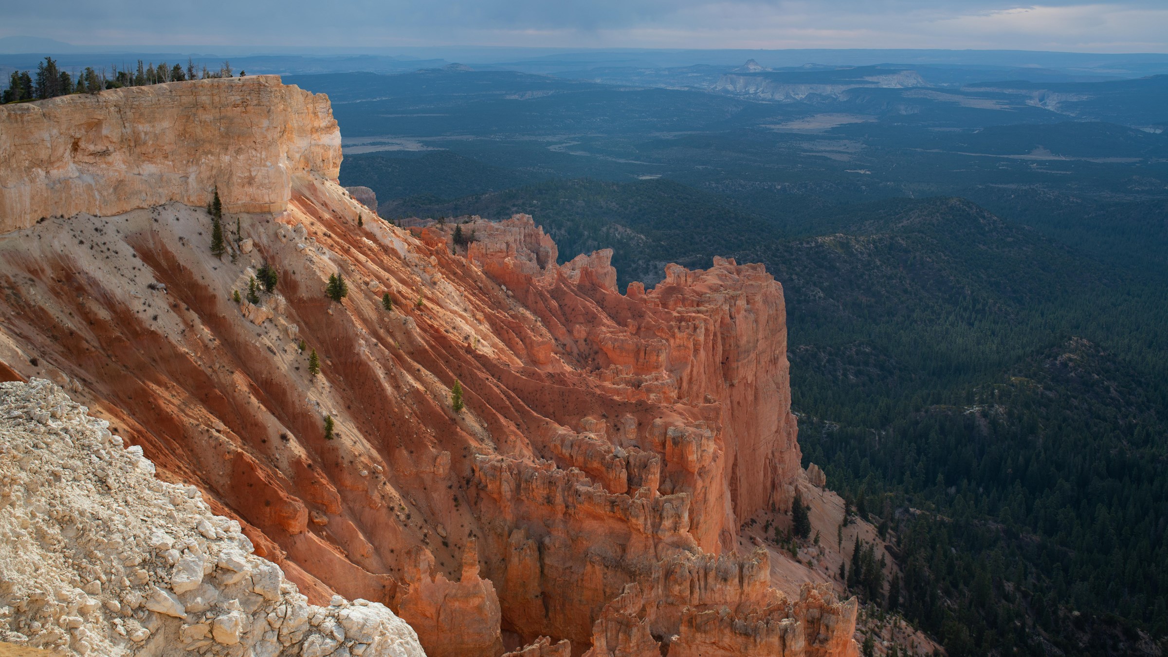
Retained JPEG SHA-256: 4ec1b39e33f6106b85f25ca1945b68cffa6ed299d84a3c3d7ed94d82f489a5a3
Supported interpretation: NPS places Yovimpa Point at the southern tip of the Paunsaugunt Plateau and describes views across the Grand Staircase. Its directional landscape descriptions do not establish this camera's exact bearing.
Scene annotation positions are normalized image coordinates, not a surveyed map. No photograph is a ground scan or a promise of current access, weather or visibility. No NPS endorsement is implied.
Rights notice · Machine-readable collection · Gelasio font license · Inter font license