Skip to reading edition
BCC Park Poster StudioSource records

TWELVE FIELD IMPRESSIONS / READING EDITION

Bryce, in lines
and layers.

Complete descriptions, evidence limits and downloads. This edition works without JavaScript.

Screen SVGs are 1080 × 1350 or 1600 × 900. Print SVGs are A3 (297 × 420 mm or 420 × 297 mm), RGB vectors with editable text and embedded open fonts. Print at actual size; physical output has not been proofed. Reuse notice and font licenses.
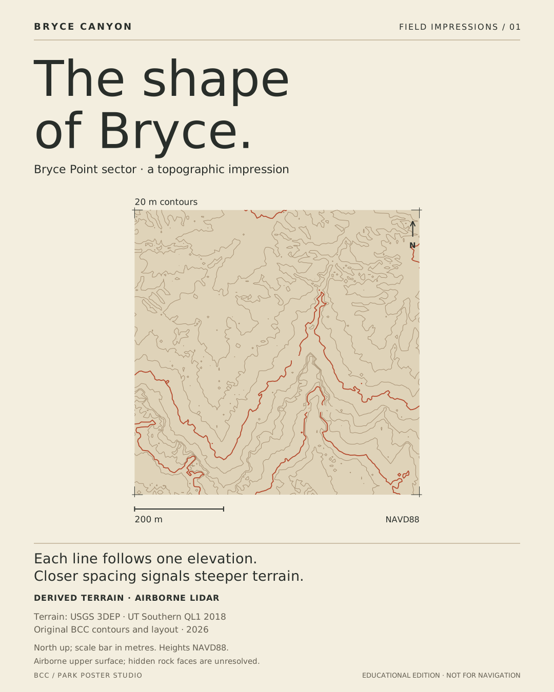
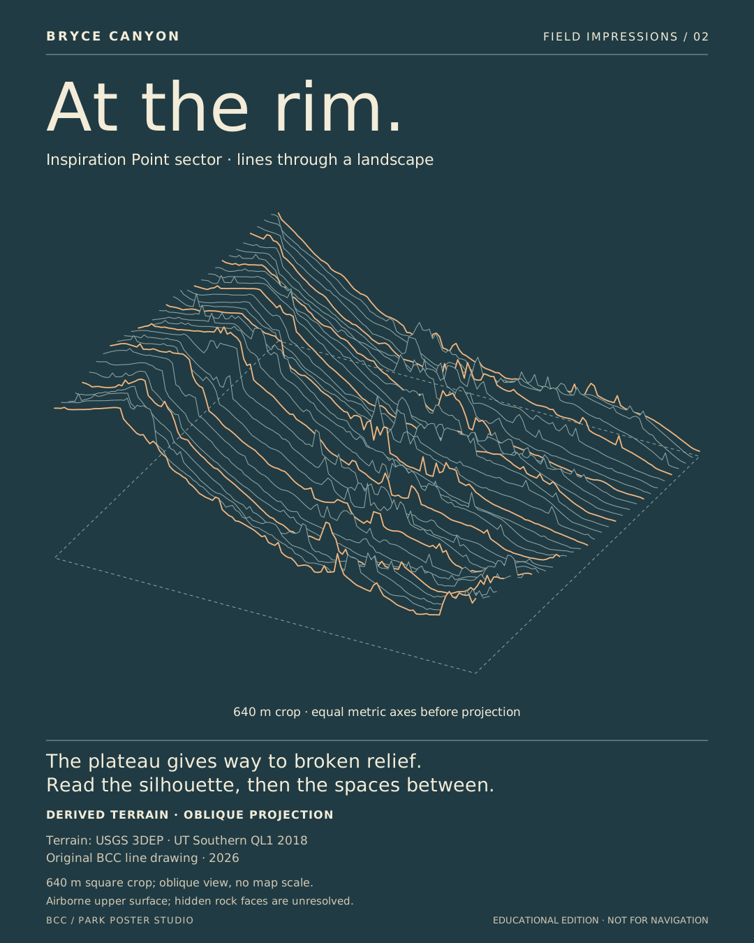
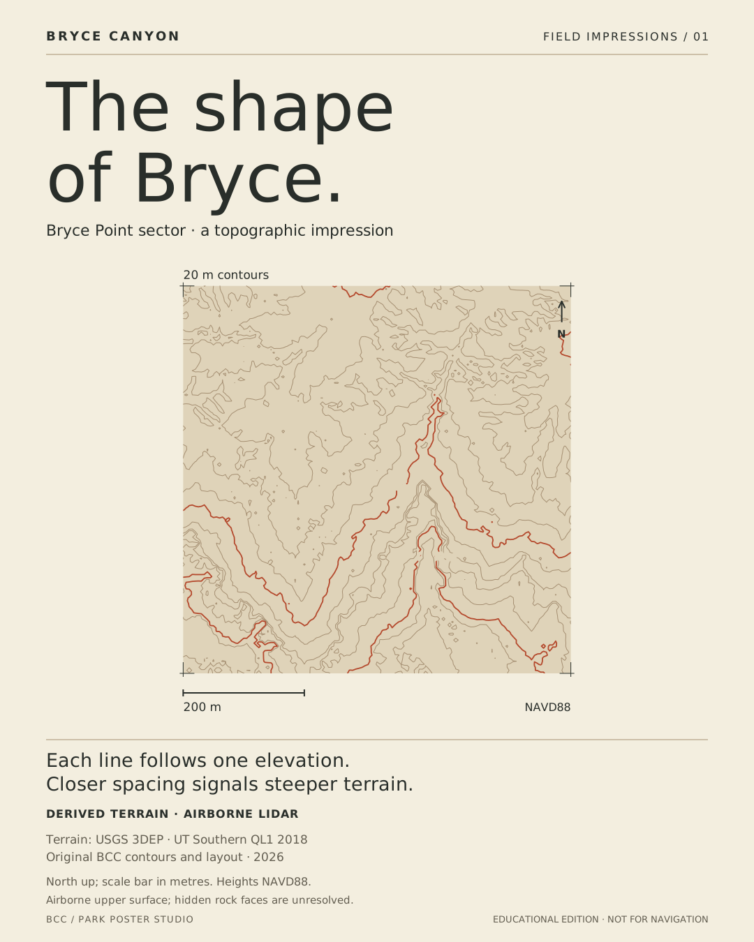
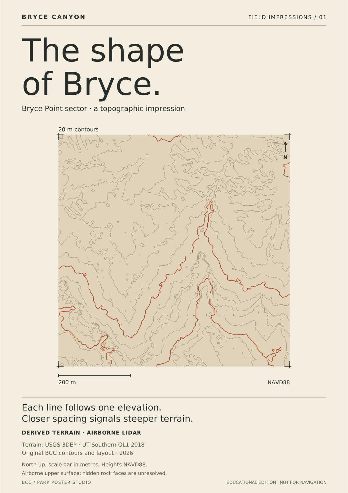
PLATE 01 / TERRAIN

The shape of Bryce

Follow a contour and every point stays at the same modeled height. These nested lines trace a 640-metre terrain crop near Bryce Point, turning an airborne height surface into an editorial map.

Derived terrain · airborne lidar. 20 m contours from a 5 m display grid. An upper surface cannot reveal hidden walls or undercuts. Not a ground scan or navigation map.

North up; scale bar in metres. Heights NAVD88.

Screen SVGA3 print SVGPrint sheet
Bryce Point sector · a topographic impression. Derived terrain · airborne lidar.

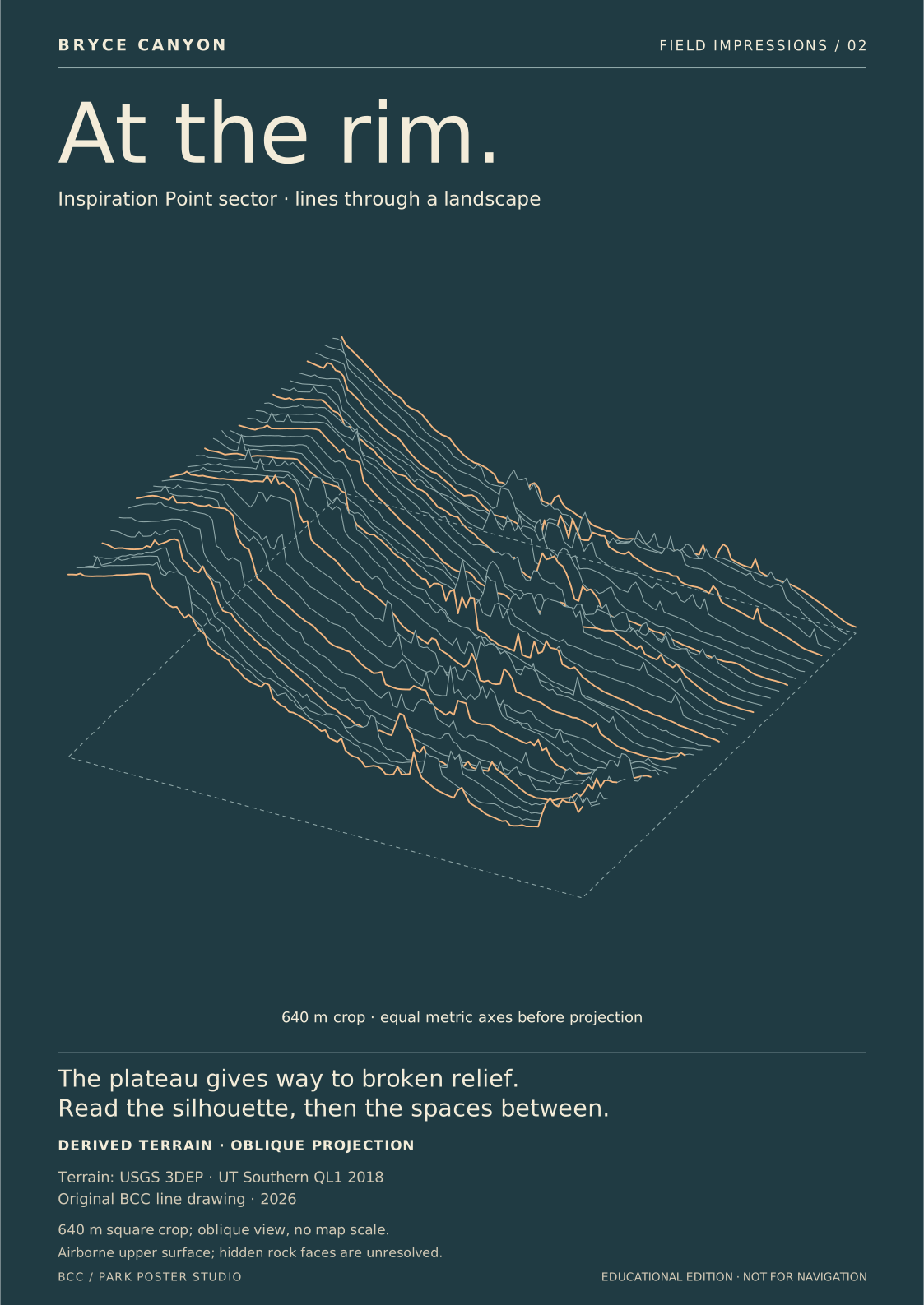
PLATE 02 / TERRAIN

At the rim

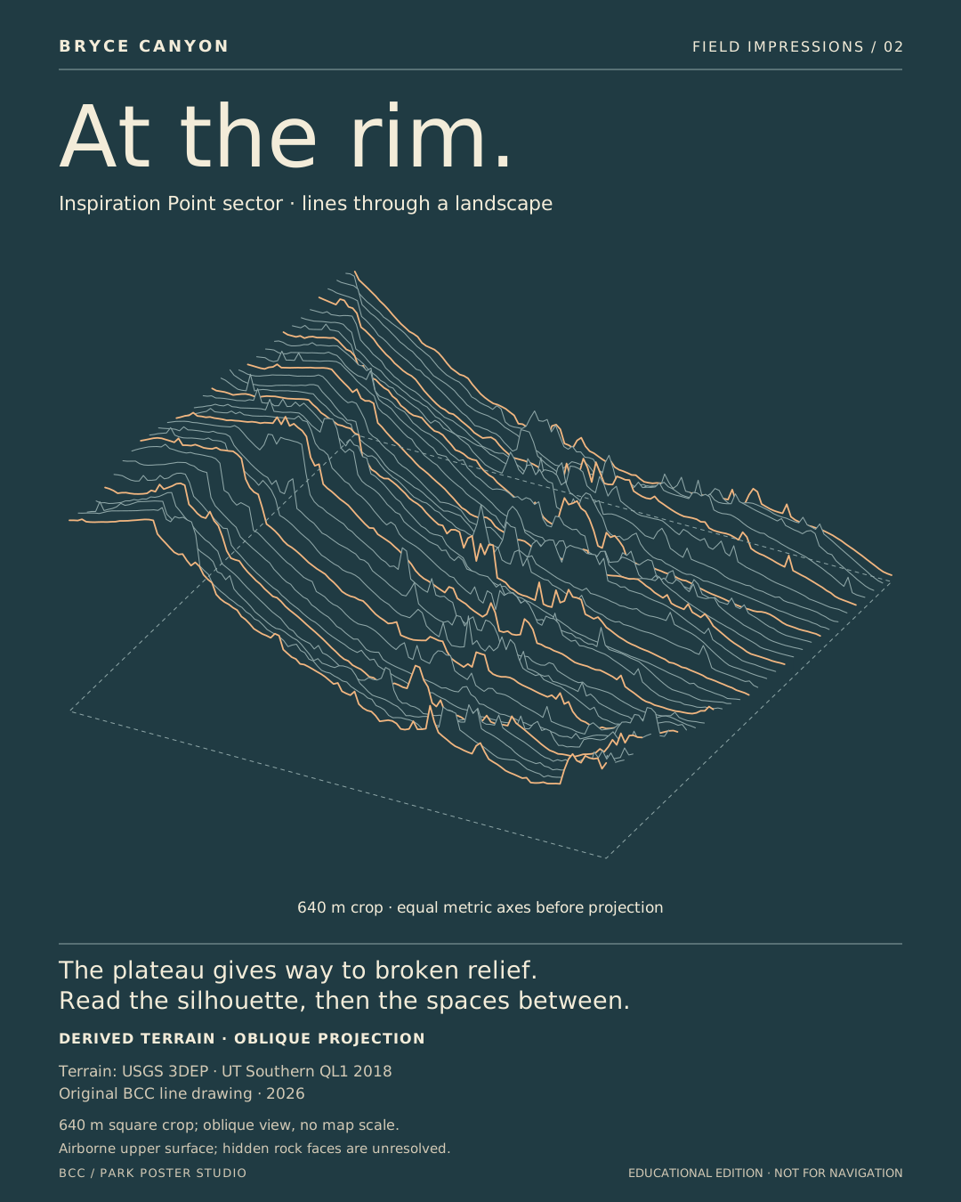
An oblique drawing of parallel east–west sections through a 640-metre crop. Each line comes from the accepted lidar-derived upper surface; foreground fills hide the lines behind it.

Derived terrain · oblique projection. 5 m sampled upper surface; section spacing 20 m. Equal metric scale on all three source axes before projection. Color and lighting are editorial.

640 m square crop; oblique view, no map scale.

Screen SVGA3 print SVGPrint sheet
Inspiration Point sector · lines through a landscape. Derived terrain · oblique projection.

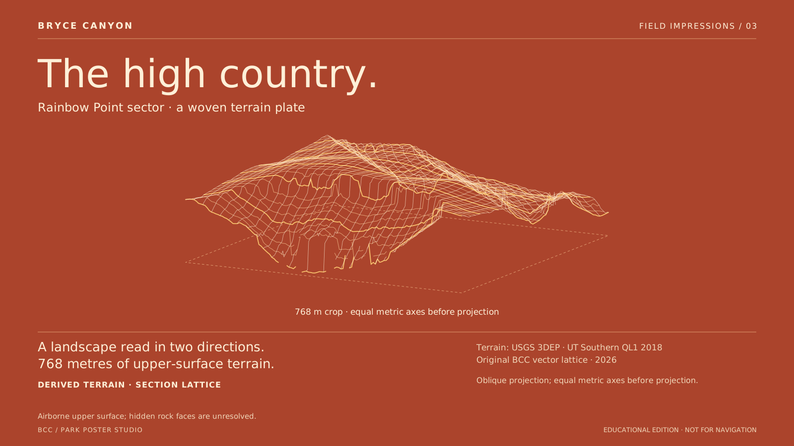
PLATE 03 / TERRAIN

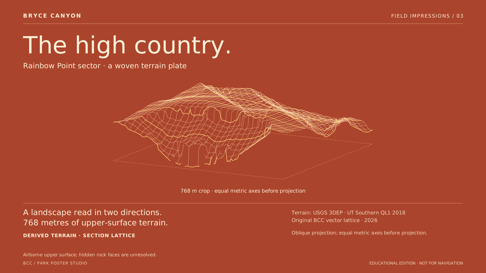
The high country

East–west and north–south sections form a woven reading of the upland terrain near Rainbow Point. The drawing uses a 768-metre crop; it is a projection of a derived surface, not a photograph.

Derived terrain · section lattice. 6 m grid; displayed lines every 24 m. Upper-envelope surface may include residual vegetation and interpolation; hidden faces are absent.

Oblique projection; equal metric axes before projection.

Screen SVGA3 print SVGPrint sheet
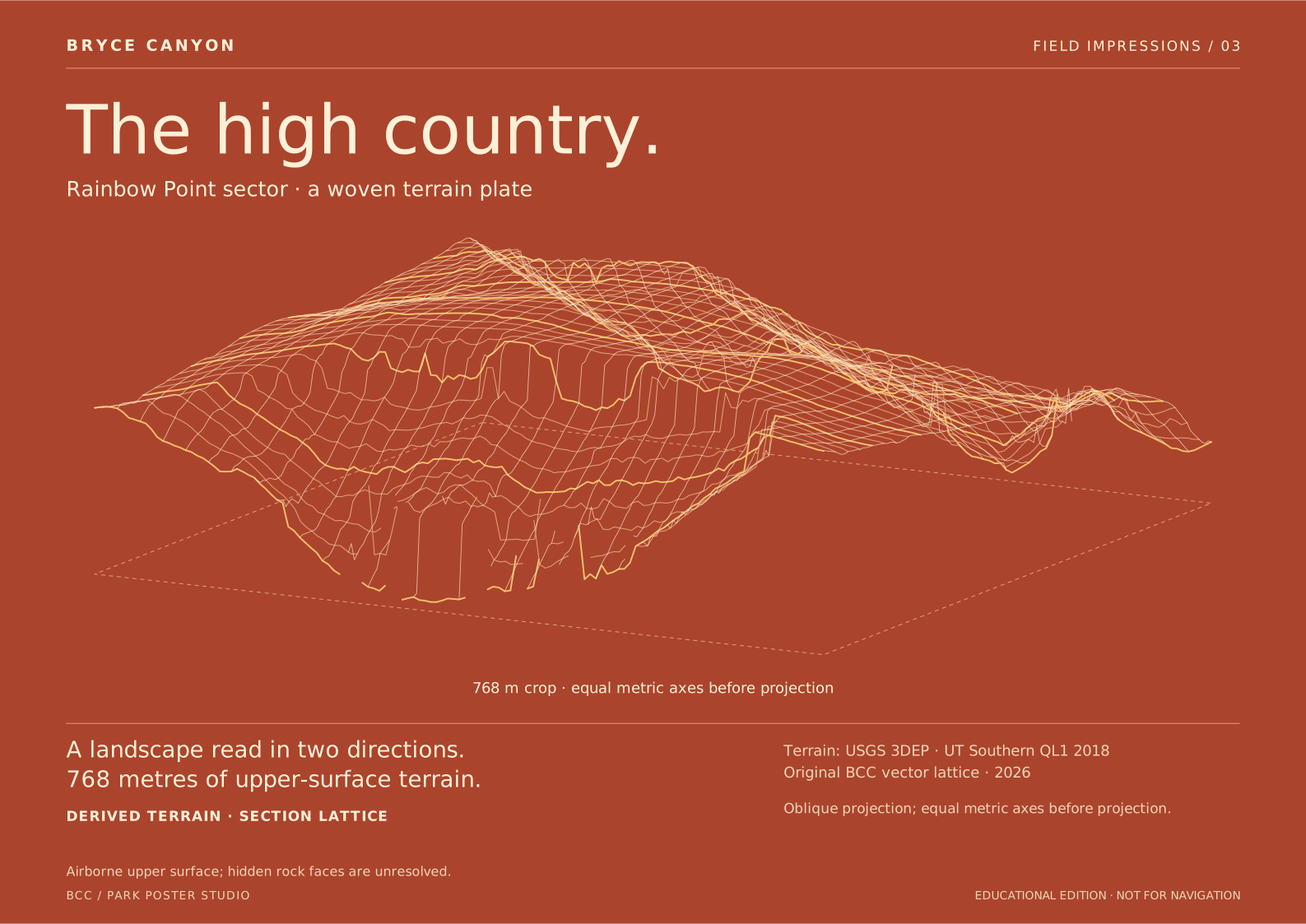
Rainbow Point sector · a woven terrain plate. Derived terrain · section lattice.

PLATE 04 / TERRAIN

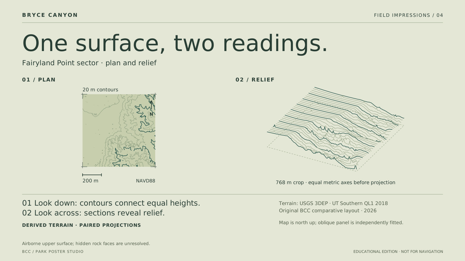
One surface, two readings

A north-up contour map and an oblique line drawing share one 768-metre source crop. They describe the same modeled heights, while the two projections reveal different patterns.

Derived terrain · paired projections. 20 m contours from a 6 m display grid. The panels fit independently; only the map panel has a scale bar. Neither resolves hidden rock faces.

Map is north up; oblique panel is independently fitted.

Screen SVGA3 print SVGPrint sheet
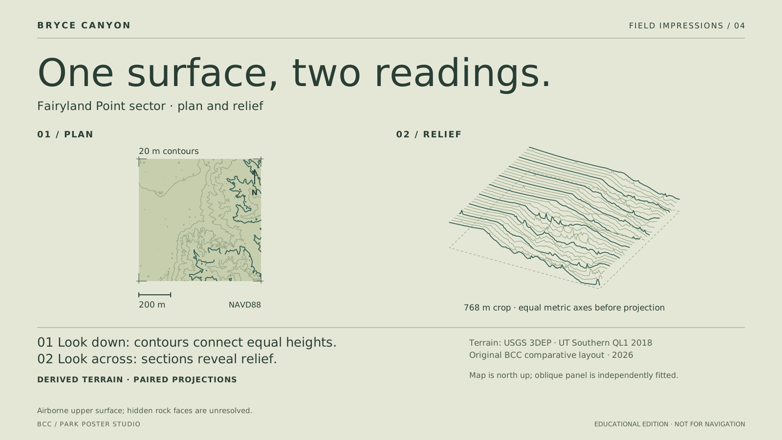
Fairyland Point sector · plan and relief. Derived terrain · paired projections.

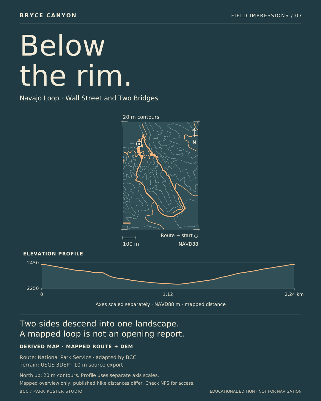
PLATE 05 / TRAILS

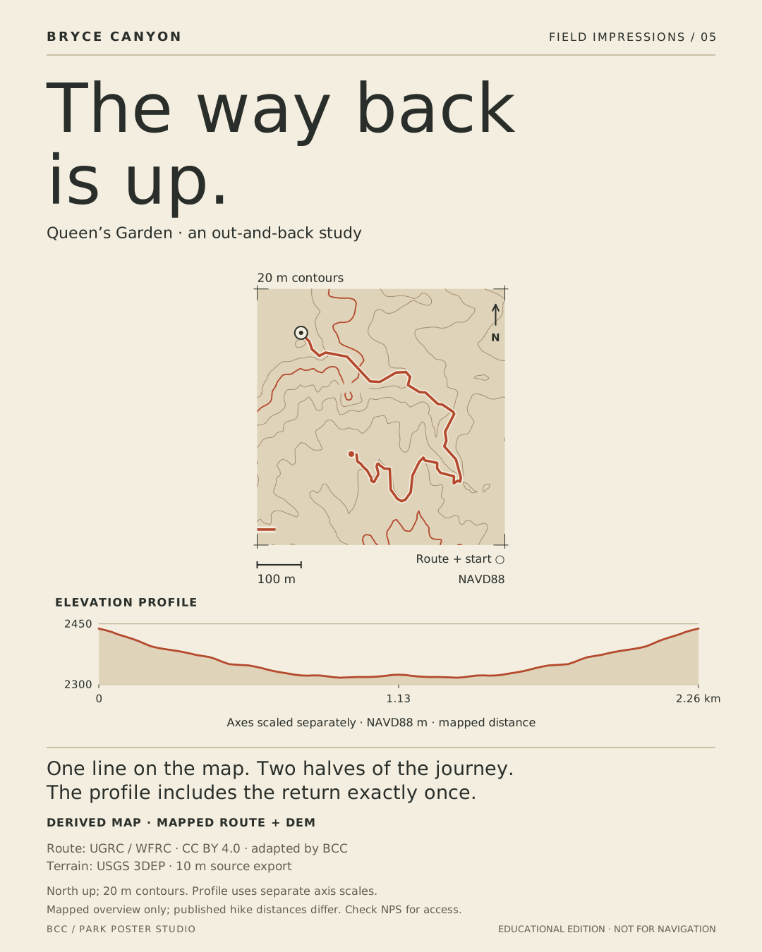
The way back is up

The mapped descent and return share a line on the map but occupy different halves of the profile. The selected compilation is shorter than the published NPS hike; its shape is retained without inventing extra distance.

Derived map · mapped route + DEM. Generalized mapped line, not surveyed tread. Educational overview only. Its 2.26 km mapped length differs from NPS’s published 2.9 km hike.

North up; 20 m contours. Profile uses separate axis scales.

Screen SVGA3 print SVGPrint sheet
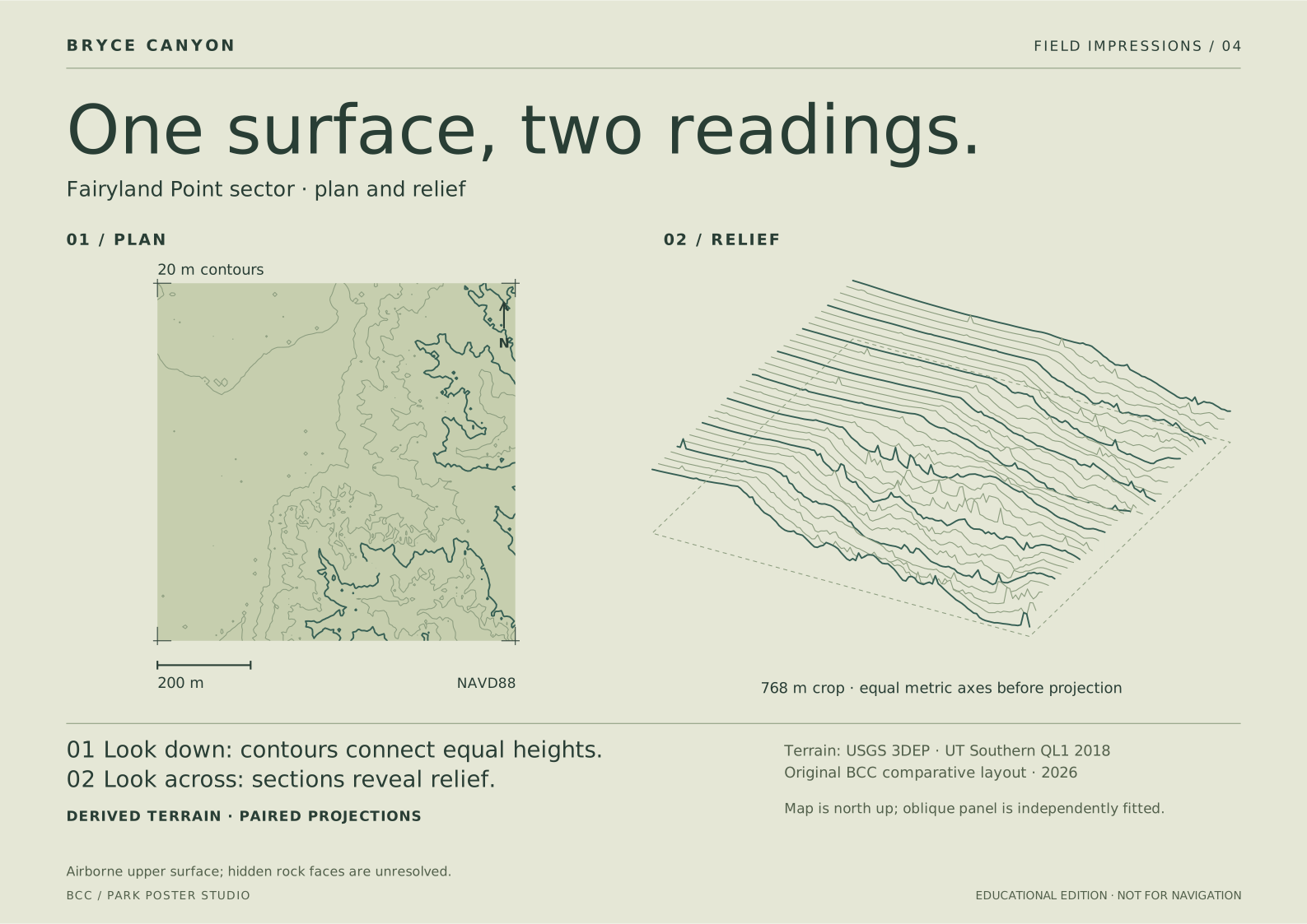
Queen’s Garden · an out-and-back study. Derived map · mapped route + DEM.

PLATE 06 / TRAILS

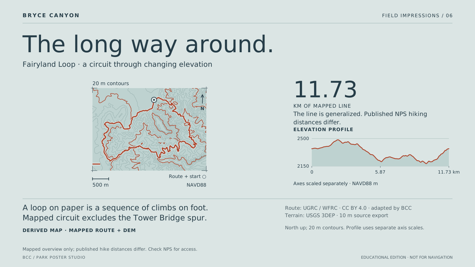
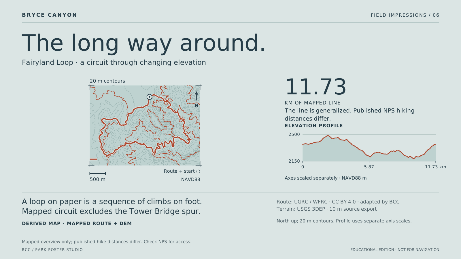
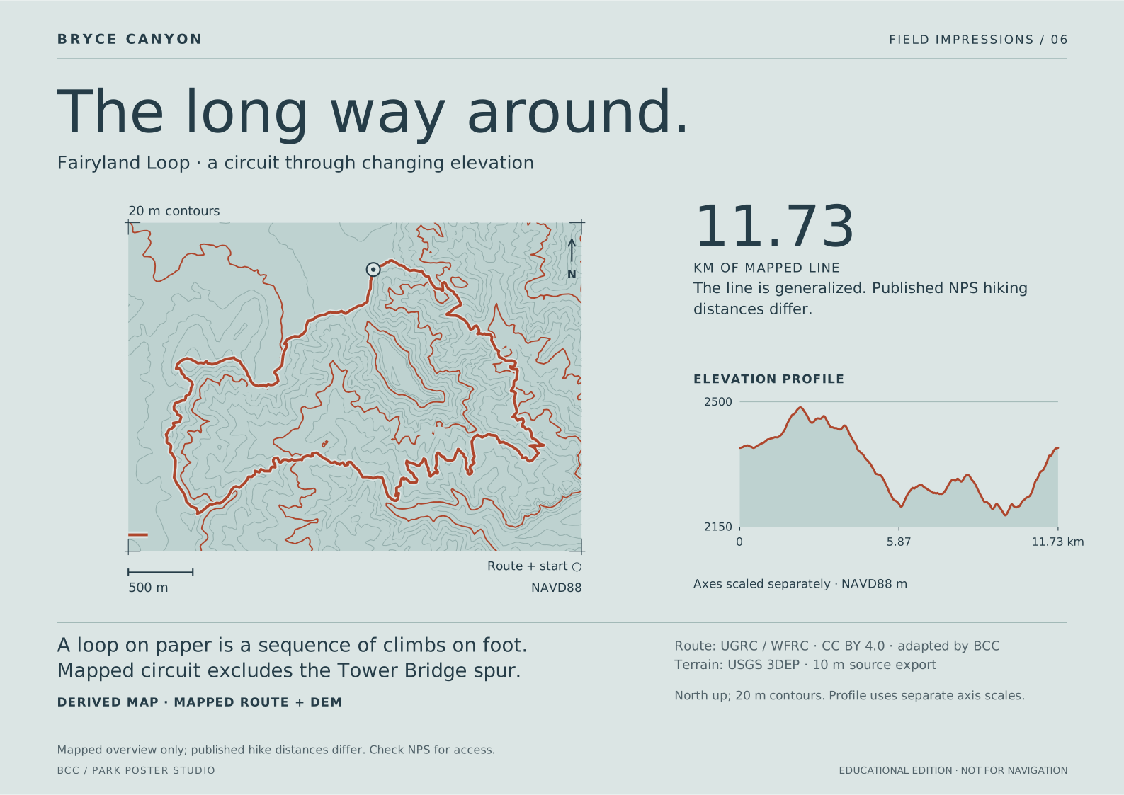
The long way around

The loop folds across a broad terrain crop. A separate profile translates the mapped circuit into distance and height, showing repeated descents and climbs. The Tower Bridge spur is excluded.

Derived map · mapped route + DEM. 11.73 km mapped line; NPS publishes 12.9 km in its main hike details. Generalization and route scope differ. This is not a current access report.

North up; 20 m contours. Profile uses separate axis scales.

Screen SVGA3 print SVGPrint sheet
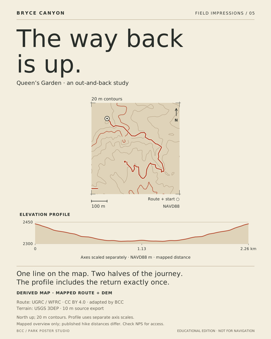
Fairyland Loop · a circuit through changing elevation. Derived map · mapped route + DEM.

PLATE 08 / TRAILS

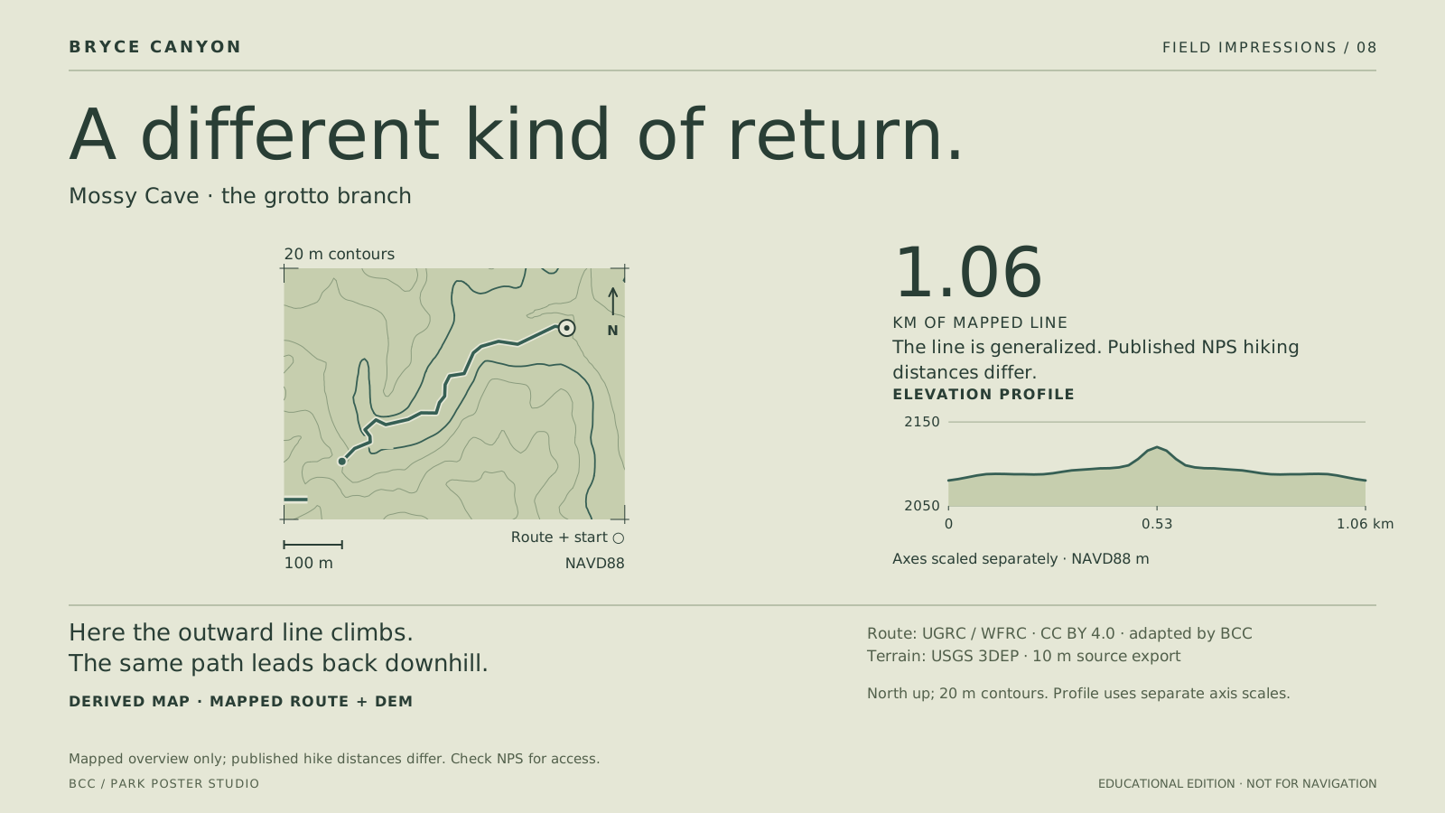
A different kind of return

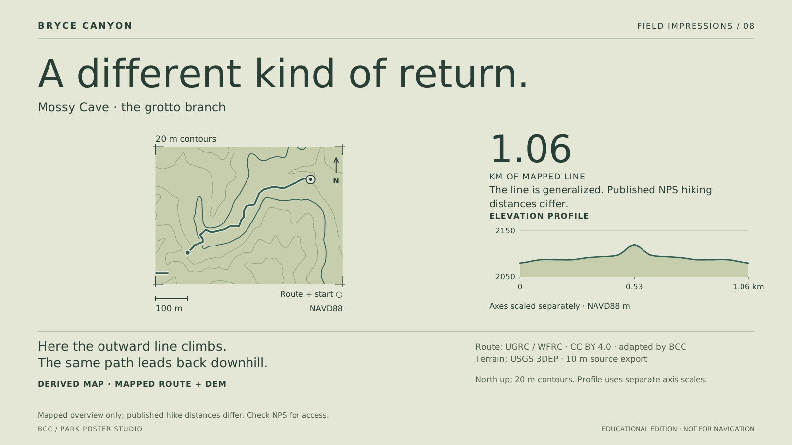
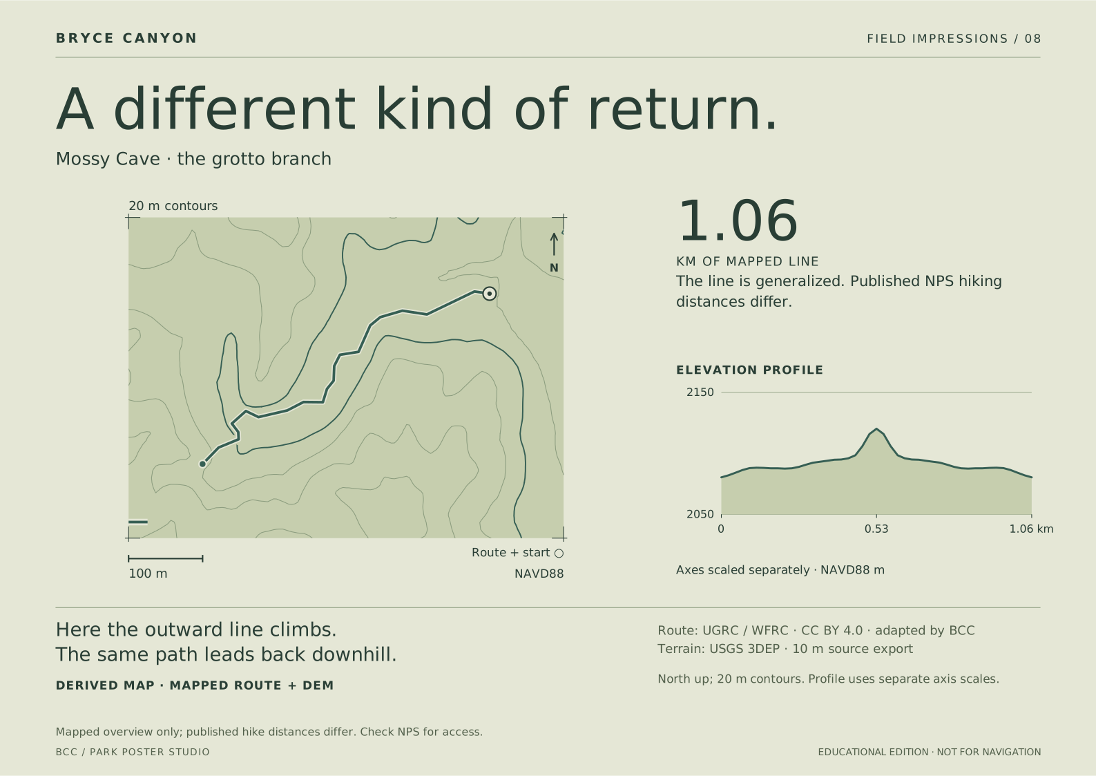
This selected branch climbs on the outward leg and descends on the return. Its profile contrasts with Queen’s Garden. The waterfall detour is not included, and the endpoint does not authorize entry into the alcove.

Derived map · mapped route + DEM. 1.06 km mapped grotto branch; NPS’s 1.3 km figure describes the broader hike. No current water flow, cave entry or trail condition is depicted.

North up; 20 m contours. Profile uses separate axis scales.

Screen SVGA3 print SVGPrint sheet
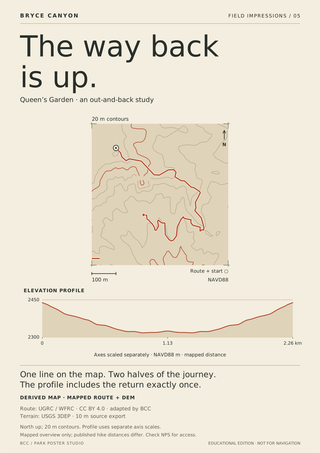
Mossy Cave · the grotto branch. Derived map · mapped route + DEM.

PLATE 09 / GEOLOGY

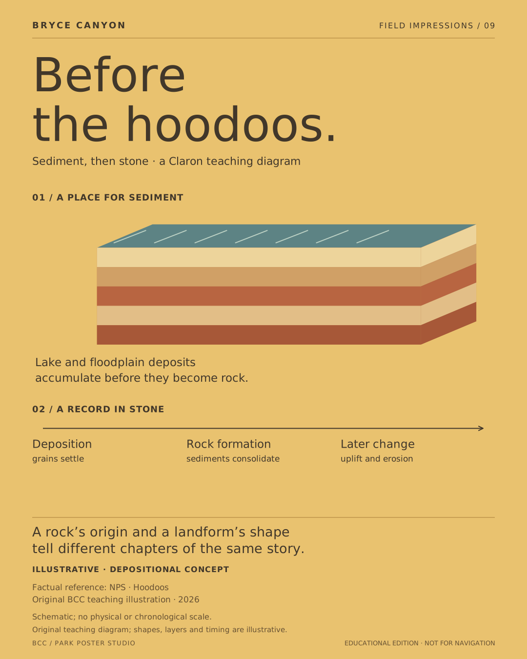
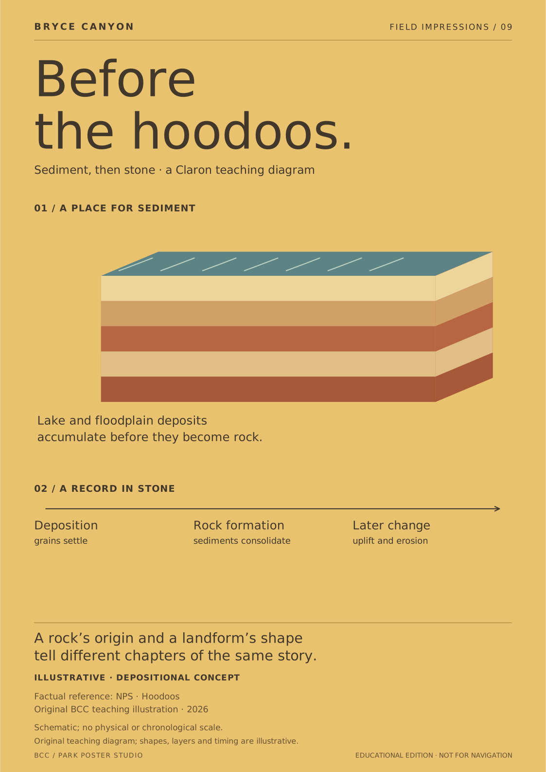
Before the hoodoos

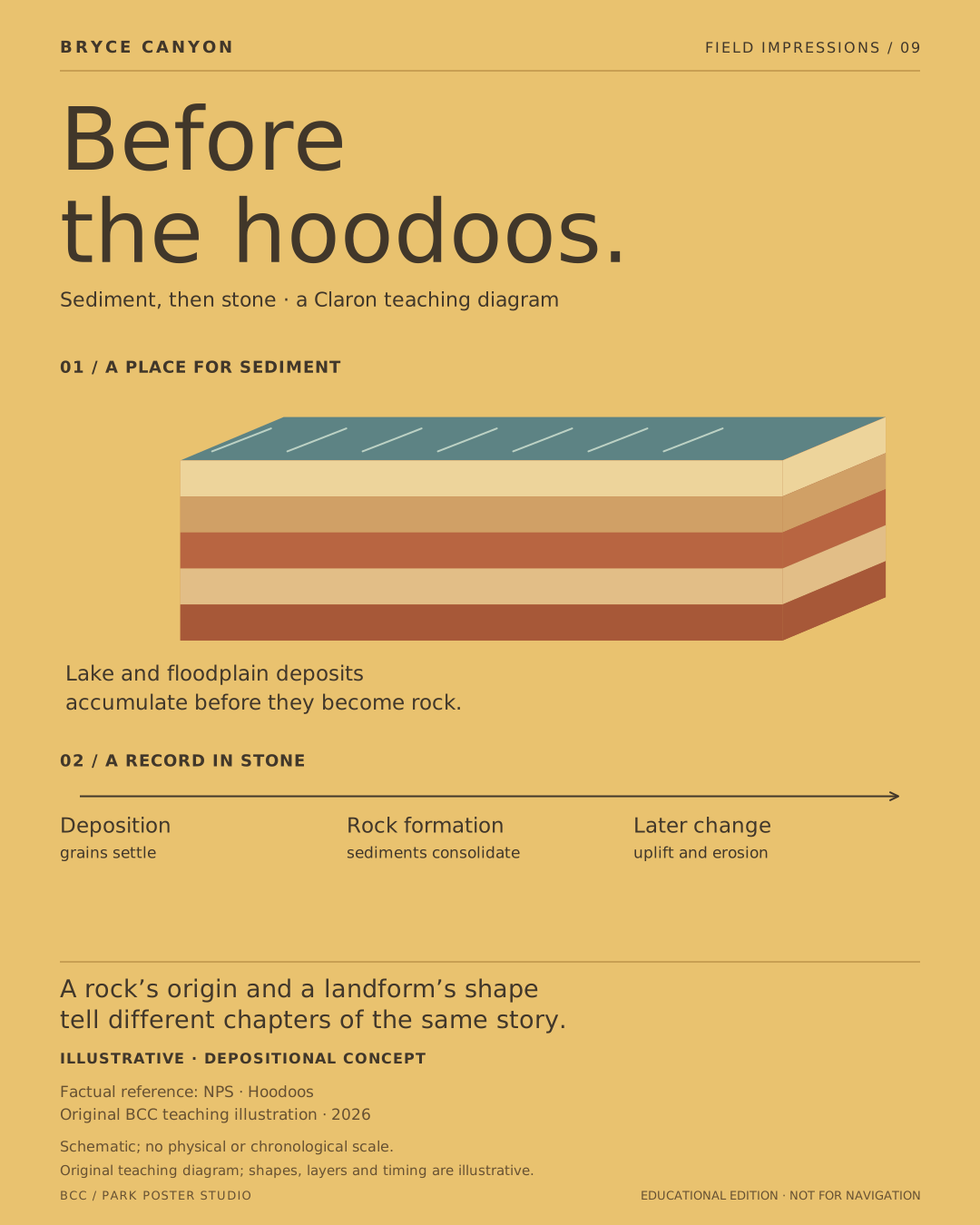
The rocks came first. Sediments accumulated in a lake and floodplain system, then became rock. The modern sculpted landforms belong to a later chapter involving uplift, weathering and erosion.

Illustrative · depositional concept. Original diagram, not a reconstructed lake, measured outcrop, stratigraphic column or dated sequence. Layer thicknesses, shapes and colors are explanatory.

Schematic; no physical or chronological scale.

Screen SVGA3 print SVGPrint sheet
Sediment, then stone · a Claron teaching diagram. Illustrative · depositional concept.

PLATE 10 / GEOLOGY

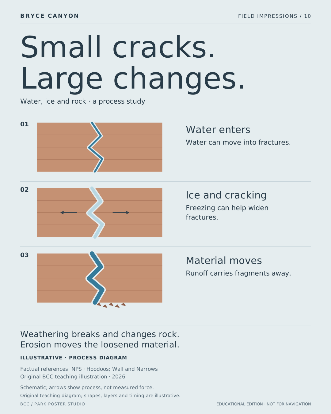
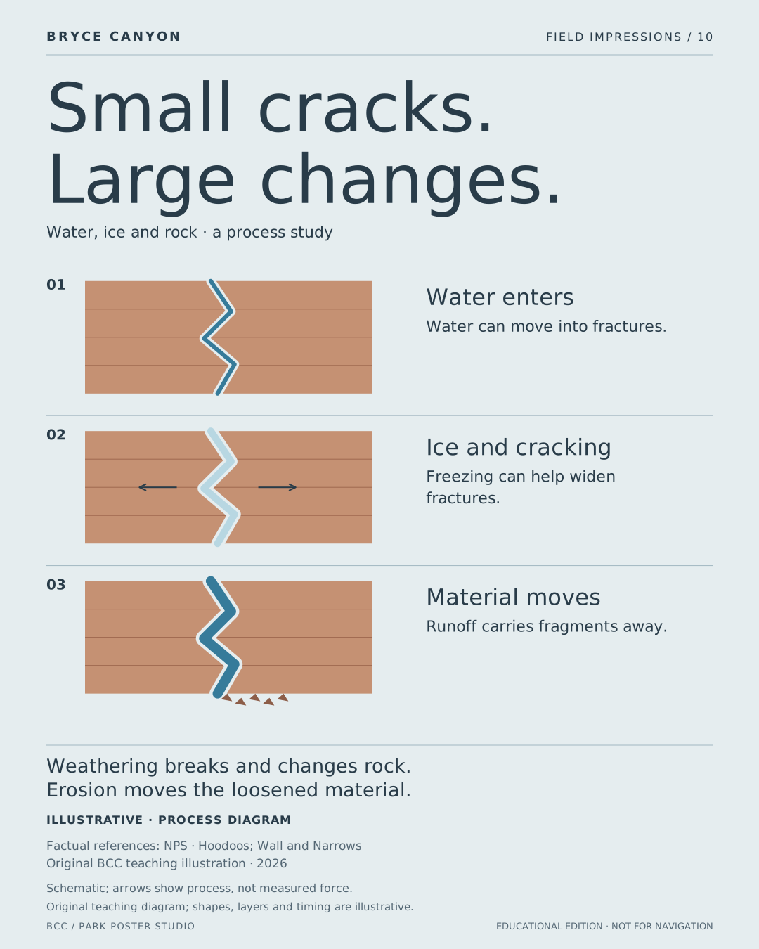
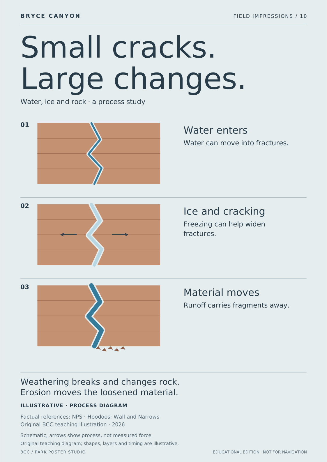
Small cracks, large changes

Water enters fractures; freezing conditions can promote cracking; runoff carries loosened material away. The three drawings separate processes to make them readable, not to set a clock for real rock.

Illustrative · process diagram. Simplified frost-weathering concept. No freeze-cycle count, pressure, erosion rate or guaranteed progression. Rock and water shapes are original illustrations.

Schematic; arrows show process, not measured force.

Screen SVGA3 print SVGPrint sheet
Water, ice and rock · a process study. Illustrative · process diagram.

PLATE 11 / GEOLOGY

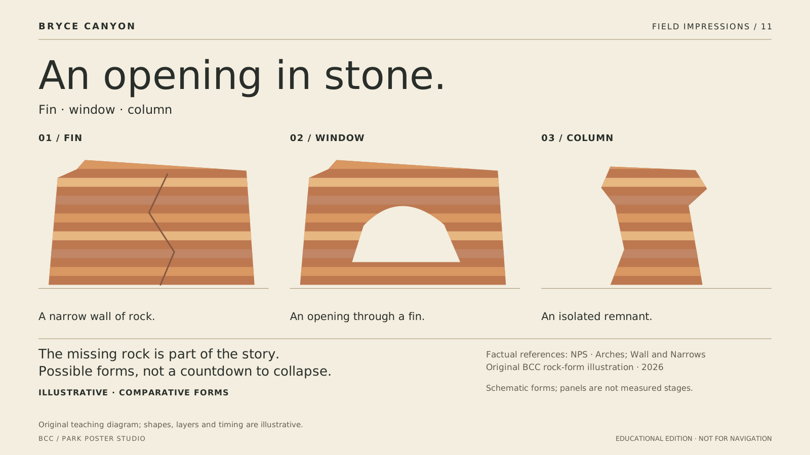
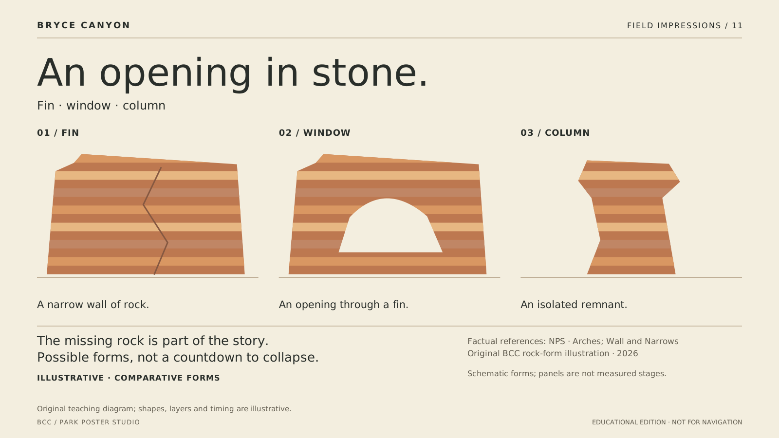
An opening in stone

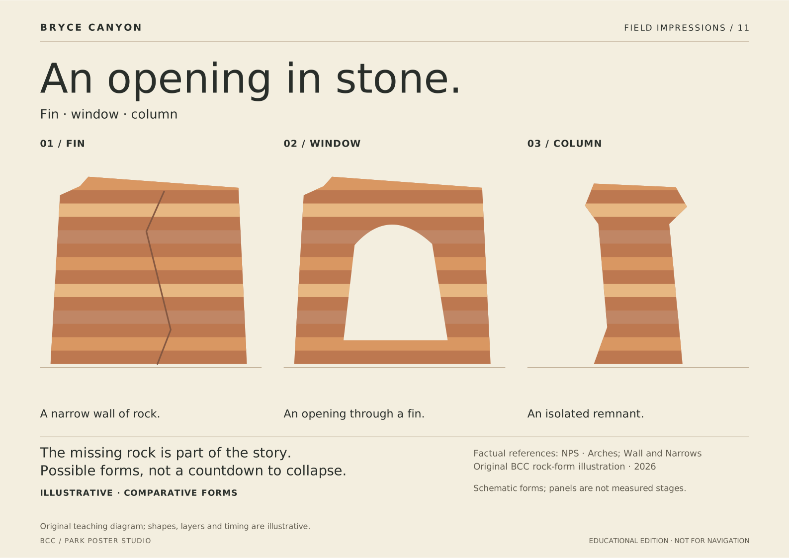
Fractures and weaker zones can widen into openings within fins. Loss of a window’s roof can leave isolated columns. The drawings compare possible forms rather than predicting the fate of a specific landmark.

Illustrative · comparative forms. Original generic forms; not Thor’s Hammer, Natural Bridge or a ground scan. No measured dimensions or timescale; real development is more varied.

Schematic forms; panels are not measured stages.

Screen SVGA3 print SVGPrint sheet
Fin · window · column. Illustrative · comparative forms.

PLATE 12 / GEOLOGY

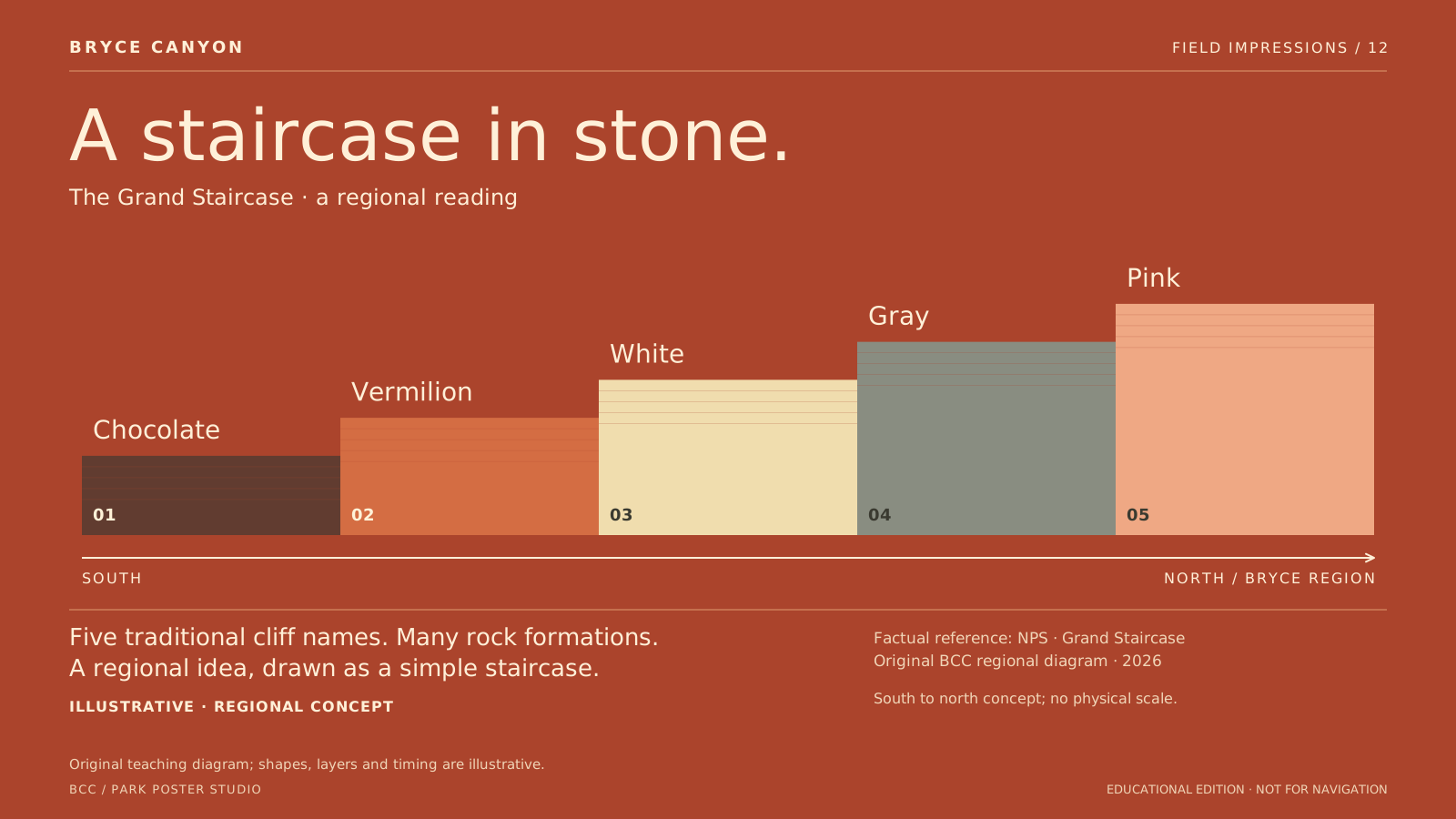
A staircase in stone

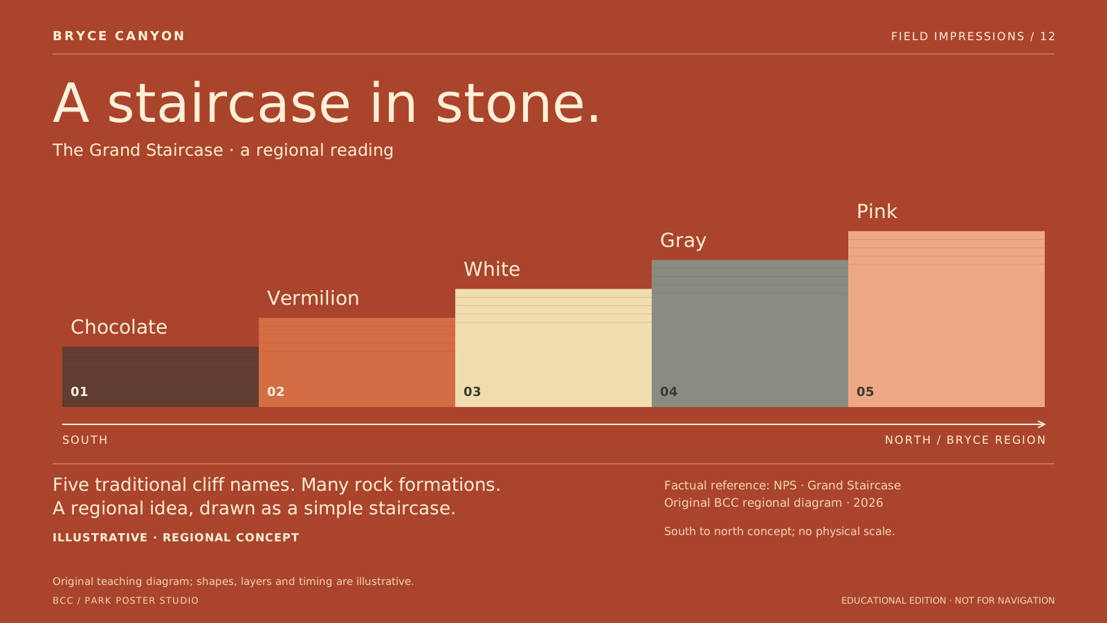
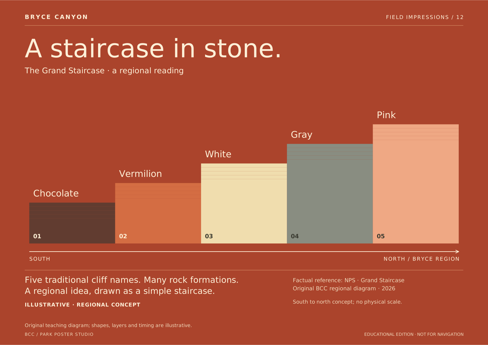
The traditional five cliff names provide a broad way to read the Grand Staircase: Chocolate, Vermilion, White, Gray and Pink. This conceptual staircase rises north toward the Bryce region.

Illustrative · regional concept. Not a geologic cross-section or map. No surveyed contacts, thicknesses, distances, ages or continuous rock record are claimed. Colors are an editorial key.

South to north concept; no physical scale.

Screen SVGA3 print SVGPrint sheet
The Grand Staircase · a regional reading. Illustrative · regional concept.

Return to the studio