 01
A familiar silhouette
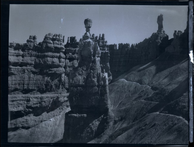
Thor’s Hammer & Navajo Loop
Courtesy Bryce Canyon National Park, Photographer Maurice Cope, Museum Catalog Number BRCA 532/001-#027

Weather unavailable
Observed at Bryce Canyon Airport. Conditions at the rim can differ.
NWS · KBCE airport · time unavailable
Forecast unavailable. Use the NWS source below.
Forecast issue time unavailable
Park updates unavailable
Check NPS for the latest closures and conditions.
The page reads in full without it; the interactive tools load only when you ask.
Historic Bryce · 1920–1940
Paths through the pines. Places to stay. A familiar skyline seen by an earlier camera.
Explore ten archival photographs, with the evidence—and the uncertainties—kept in view.
Open the collection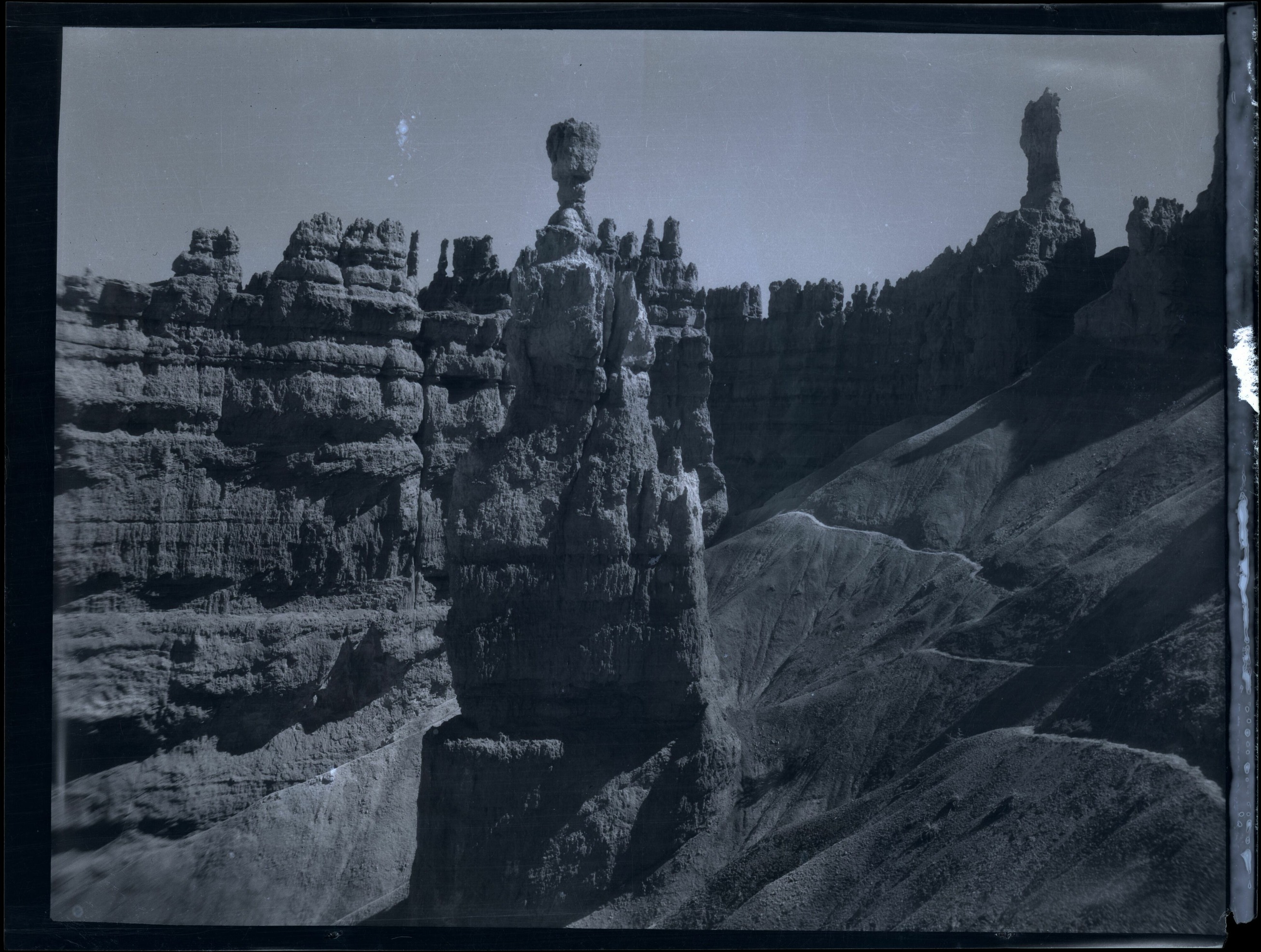
Courtesy Bryce Canyon National Park, Photographer Maurice Cope, Museum Catalog Number BRCA 532/001-#027
Dates & places
Eight photographs carry a broad 1920–1940 catalogue range. Two have a 1929 caption. A year filter includes every range that overlaps it; it does not assign that year to a photograph.
Park history · contextual dates
Ruby and Minnie Syrett establish Tourist Rest near what is now Sunset Point.
On June 8, Bryce Canyon National Monument is proclaimed under Forest Service administration.
Construction begins on Bryce Canyon Lodge.
On September 15, establishment conditions are met and management passes to the National Park Service.
North Campground is built, adding to the park’s visitor infrastructure.
State crews arrange to plow the park road so the park can remain open year-round.
Events from the NPS centennial timeline. They do not date the photographs. Select a year to explore overlapping catalogue dates.
 Derived Subjects and areas, not camera positions. Named locators derive from NPS/USGS records; the shaded shapes are illustrative. The road photograph remains unlocated. Place evidence.
The collection
Open a plate for its full frame, source record and story. Read or print every plate.
No photographs match these filters.
01
Thor’s Hammer & Navajo Loop
Courtesy Bryce Canyon National Park, Photographer Maurice Cope, Museum Catalog Number BRCA 532/001-#027
 02
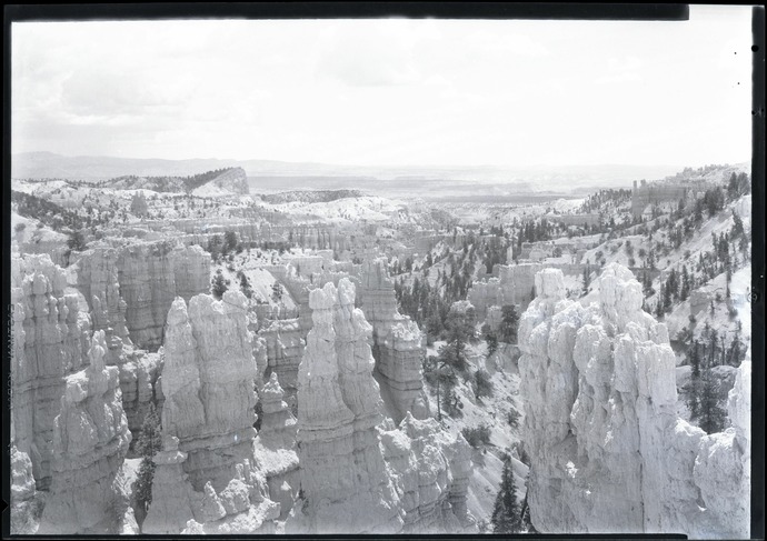
Sinking Ship
Courtesy Bryce Canyon National Park, Photographer Maurice Cope, Museum Catalog Number BRCA 532/001-#003
 03
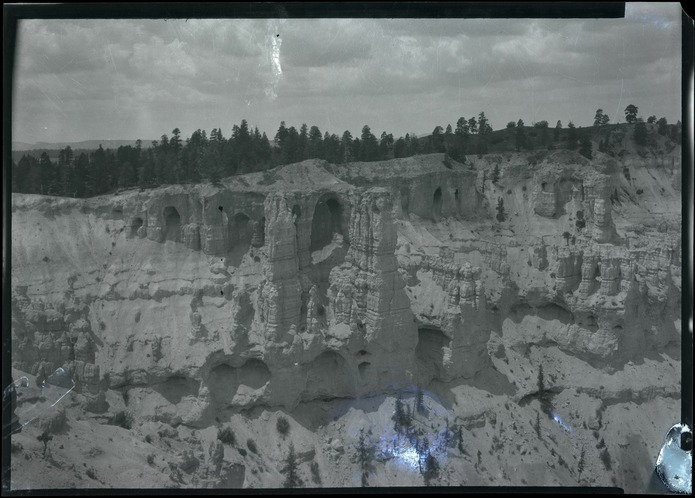
Silent City, as catalogued
Courtesy Bryce Canyon National Park, Photographer Maurice Cope, Museum Catalog Number BRCA 532/001-#004
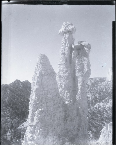 04
Hat Shop Trail
Courtesy Bryce Canyon National Park, Photographer Maurice Cope, Museum Catalog Number BRCA 532/001-#023
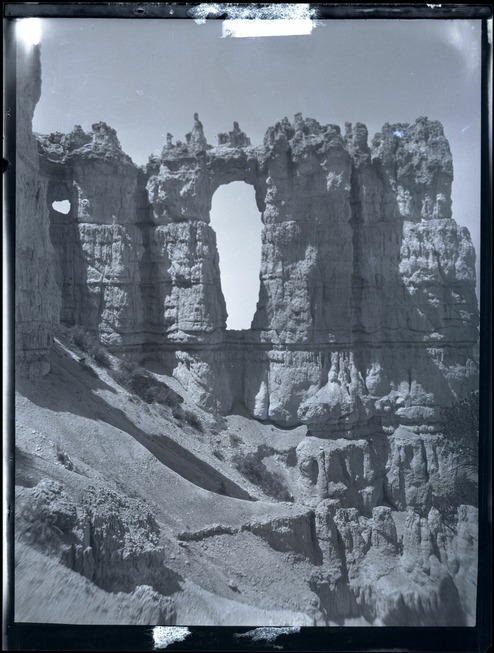 05
Wall of Windows / Peekaboo Trail
Courtesy Bryce Canyon National Park, Photographer Maurice Cope, Museum Catalog Number BRCA 532/001-#028
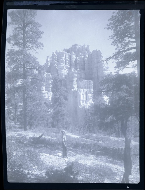 06
Queen’s Garden area
Courtesy Bryce Canyon National Park, Photographer Maurice Cope, Museum Catalog Number BRCA 532/001-#035
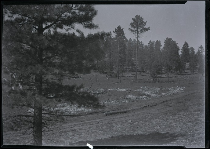 07
A park road, location unresolved
Courtesy Bryce Canyon National Park, Photographer Maurice Cope, Museum Catalog Number BRCA 532/001-#002
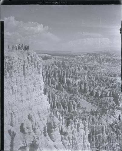 08
Ranger-led walk at the amphitheater
Courtesy Bryce Canyon National Park, Photographer Maurice Cope, Museum Catalog Number BRCA 532/001-#174
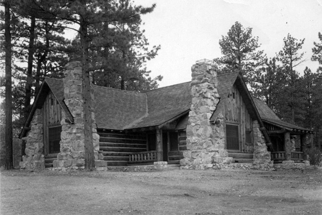 09
Deluxe Quadruplex Cabin
NPS / Bryce Canyon National Park Archives 00350
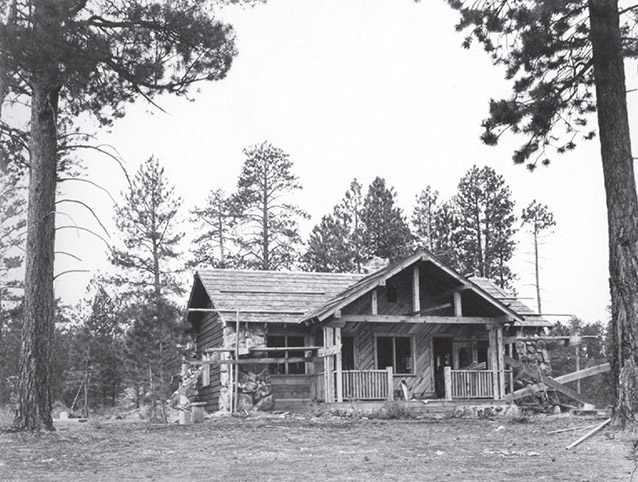 10
Ranger Station / Residence
NPS
A careful comparison
Both sources name Thor’s Hammer. Their viewpoints, lighting and photographic processes differ. The camera positions have not been matched.
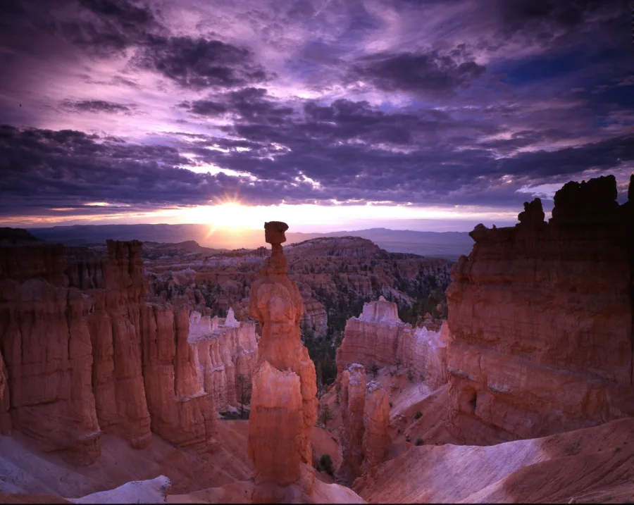
Read the silhouette, the trail and the framing. These photographs do not establish an amount or rate of change. Both full frames are retained, at independent scales.
Embedded file timestamp: 2007-11-29; catalogue create date: 2010-07-16. Neither is asserted as the capture date. The existing 900-pixel reference is reused unchanged. Its NPGallery record explicitly identifies it as public domain.
Reading the archive
These ten records come from NPS museum and cultural-landscape collections. They document selected scenery, visitors and park buildings. They cannot stand for everyone who lived in, worked in, or understood this landscape.
No Indigenous-authored account is included in this selection. Archival captions are not a substitute for Southern Paiute voices, and an unidentified person in a photograph is not an invitation to invent a biography.
Dates, catalogue wording and photographic imperfections remain visible. No missing scenery has been generated, no camera match has been invented, and no historical image is used as a measurement of change.
Full supplied frame · no image retouching
Plate 01 · Thor’s Hammer & Navajo Loop
1920–1940 Catalogue range
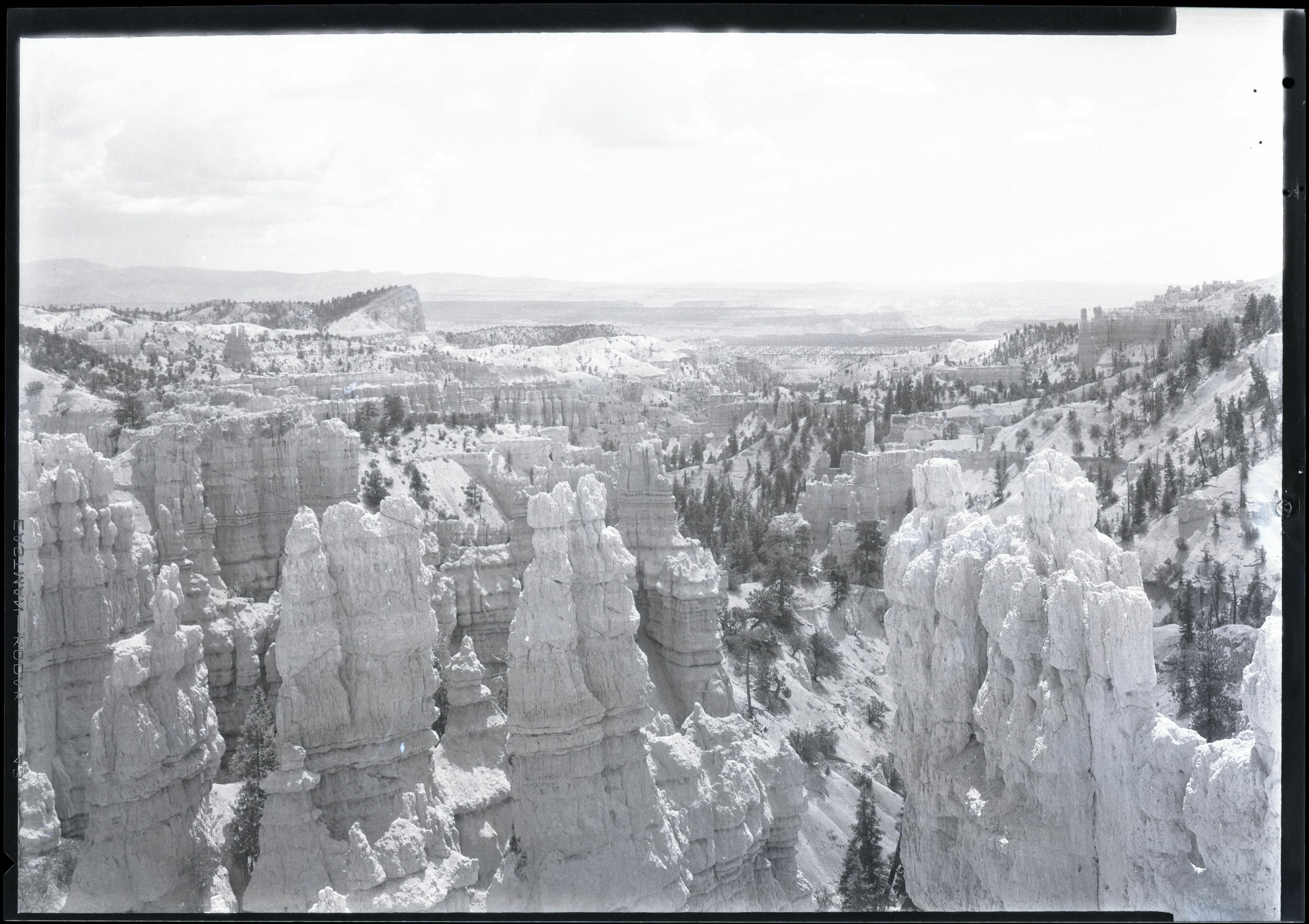
A cap of rock, a narrow neck, and a trail threading across the slope. Cope’s photograph brings a recognizable landmark and the visitor’s route into the same frame. The museum catalogue names both Thor’s Hammer and Navajo Loop.
Look closer. Follow the trail across the right-hand slope. Its presence is evidence of a route in this photograph, not proof of today’s exact trail alignment.
Courtesy Bryce Canyon National Park, Photographer Maurice Cope, Museum Catalog Number BRCA 532/001-#027
Public-domain reference photograph. NPS JPEG of a nitrate-negative scan; original framing retained. 2613 × 1973 pixels in this edition.
Original archive record ↗Open full supplied image ↗
This digital asset is in the public domain. When publishing this asset for any use, including online, image must credit: Courtesy Bryce Canyon National Park, Photographer Maurice Cope, Museum Catalog Number BRCA 532/001-#027
Catalogue title: Nitrate negative of Thors hammer, hoodoos, and Navajo Loop Trail in BRCA. ; BRCA Museum and Archives Image BRCA8875_001_027 ; BRCA 8875
Archive Number: BRCA 532/001-#027
Source checked 2 October 2026. NPS ownership policy.
Full supplied frame · no image retouching
Plate 02 · Sinking Ship
1920–1940 Catalogue range
The tilted ridge sits beyond the foreground towers. The catalogue identifies the distant feature as the Sinking Ship and describes the view as taken from the rim. Naming the subject tells us what the archivist recognized, while leaving the photographer’s station unresolved.
Look closer. Compare the scale of the foreground columns with the small, sloping skyline. Distance changes the apparent relationship between landforms.
Courtesy Bryce Canyon National Park, Photographer Maurice Cope, Museum Catalog Number BRCA 532/001-#003
Public-domain reference photograph. NPS JPEG of a nitrate-negative scan; original framing retained. 2766 × 1953 pixels in this edition.
Original archive record ↗Open full supplied image ↗
This digital asset is in the public domain. When publishing this asset for any use, including online, image must credit: Courtesy Bryce Canyon National Park, Photographer Maurice Cope, Museum Catalog Number BRCA 532/001-#003
Catalogue title: Nitrate negative of hoodoos and the Sinking Ship from the rim in BRCA. ; BRCA Museum and Archives Image BRCA8875_001_003 ; BRCA 8875
Archive Number: BRCA 532/001-#003
Source checked 2 October 2026. NPS ownership policy.
Full supplied frame · no image retouching
Plate 03 · Silent City, as catalogued
1920–1940 Catalogue range
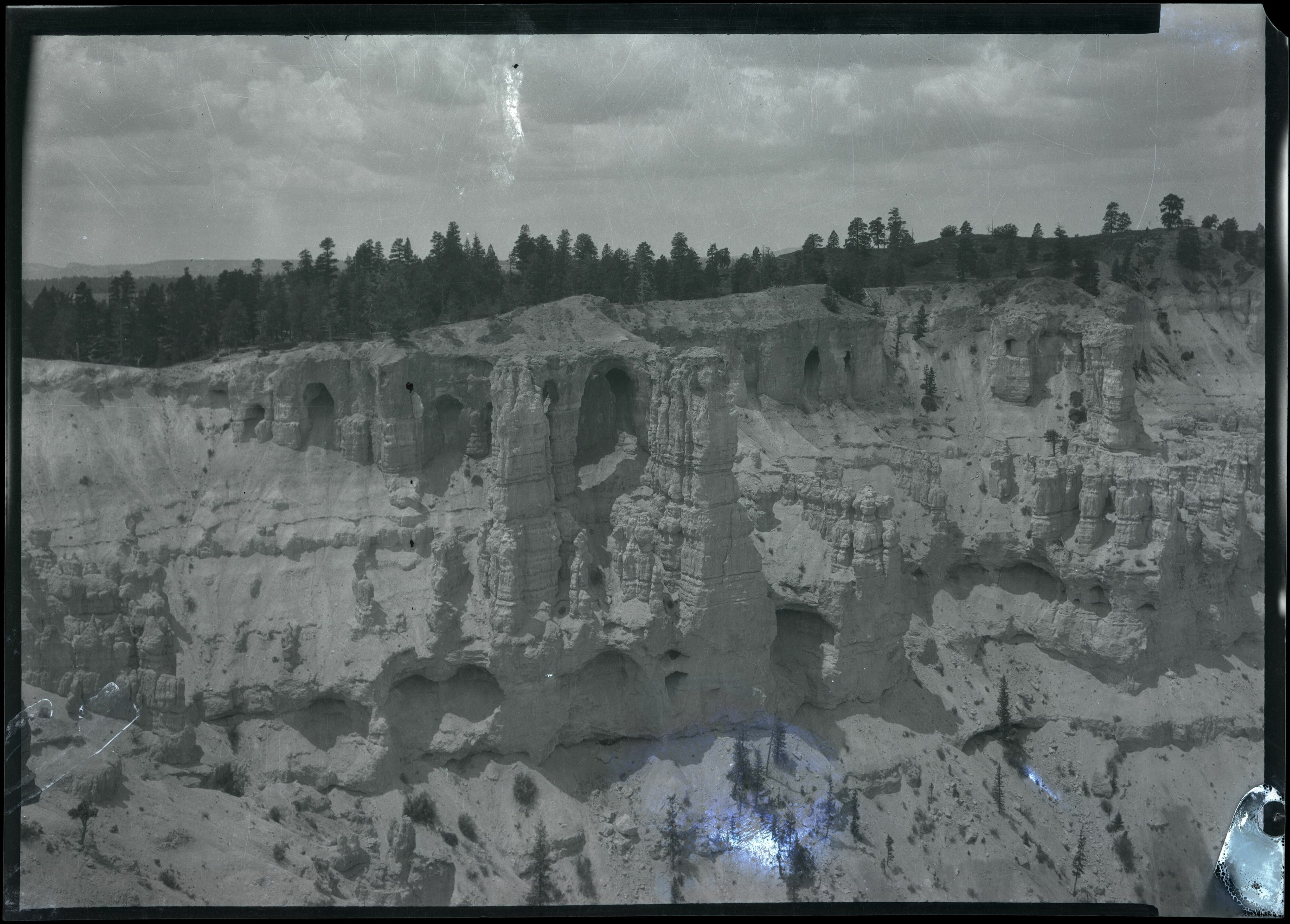
The museum record calls this scene Silent City, viewed from the rim. We retain that archival identification. Dark openings, trees along the skyline, and the edge of the negative give the photograph its particular character.
Look closer. Notice the scratches and bright mark near the lower edge. They belong to the surviving photographic record and have not been painted away.
Courtesy Bryce Canyon National Park, Photographer Maurice Cope, Museum Catalog Number BRCA 532/001-#004
Public-domain reference photograph. NPS JPEG of a nitrate-negative scan; original framing retained. 2781 × 1993 pixels in this edition.
Original archive record ↗Open full supplied image ↗
This digital asset is in the public domain. When publishing this asset for any use, including online, image must credit: Courtesy Bryce Canyon National Park, Photographer Maurice Cope, Museum Catalog Number BRCA 532/001-#004
Catalogue title: Nitrate negative of Silent City from the rim in BRCA. ; BRCA Museum and Archives Image BRCA8875_001_004 ; BRCA 8875
Archive Number: BRCA 532/001-#004
Source checked 2 October 2026. NPS ownership policy.
Full supplied frame · no image retouching
Plate 04 · Hat Shop Trail
1920–1940 Catalogue range
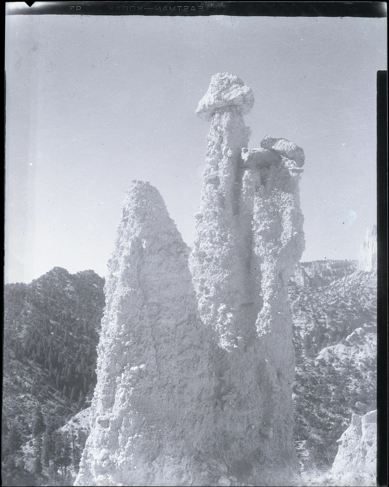
Cope framed three towers against an open sky. The catalogue locates the photograph along the Hat Shop Trail and notes the forest behind them. The vertical format gives most of the frame to the rock itself.
Look closer. The larger tops and narrower columns make the group legible even without color. Keep the full frame in view to see the slope beneath them.
Courtesy Bryce Canyon National Park, Photographer Maurice Cope, Museum Catalog Number BRCA 532/001-#023
Public-domain reference photograph. NPS JPEG of a nitrate-negative scan; original framing retained. 1596 × 1999 pixels in this edition.
Original archive record ↗Open full supplied image ↗
This digital asset is in the public domain. When publishing this asset for any use, including online, image must credit: Courtesy Bryce Canyon National Park, Photographer Maurice Cope, Museum Catalog Number BRCA 532/001-#023
Catalogue title: Nitrate negative of three hoodoos from the Hat Shop Trail in BRCA. Forested area in background. ; BRCA Museum and Archives Image BRCA8875_001_023 ; BRCA 8875
Archive Number: BRCA 532/001-#023
Source checked 2 October 2026. NPS ownership policy.
Full supplied frame · no image retouching
Plate 05 · Wall of Windows / Peekaboo Trail
1920–1940 Catalogue range
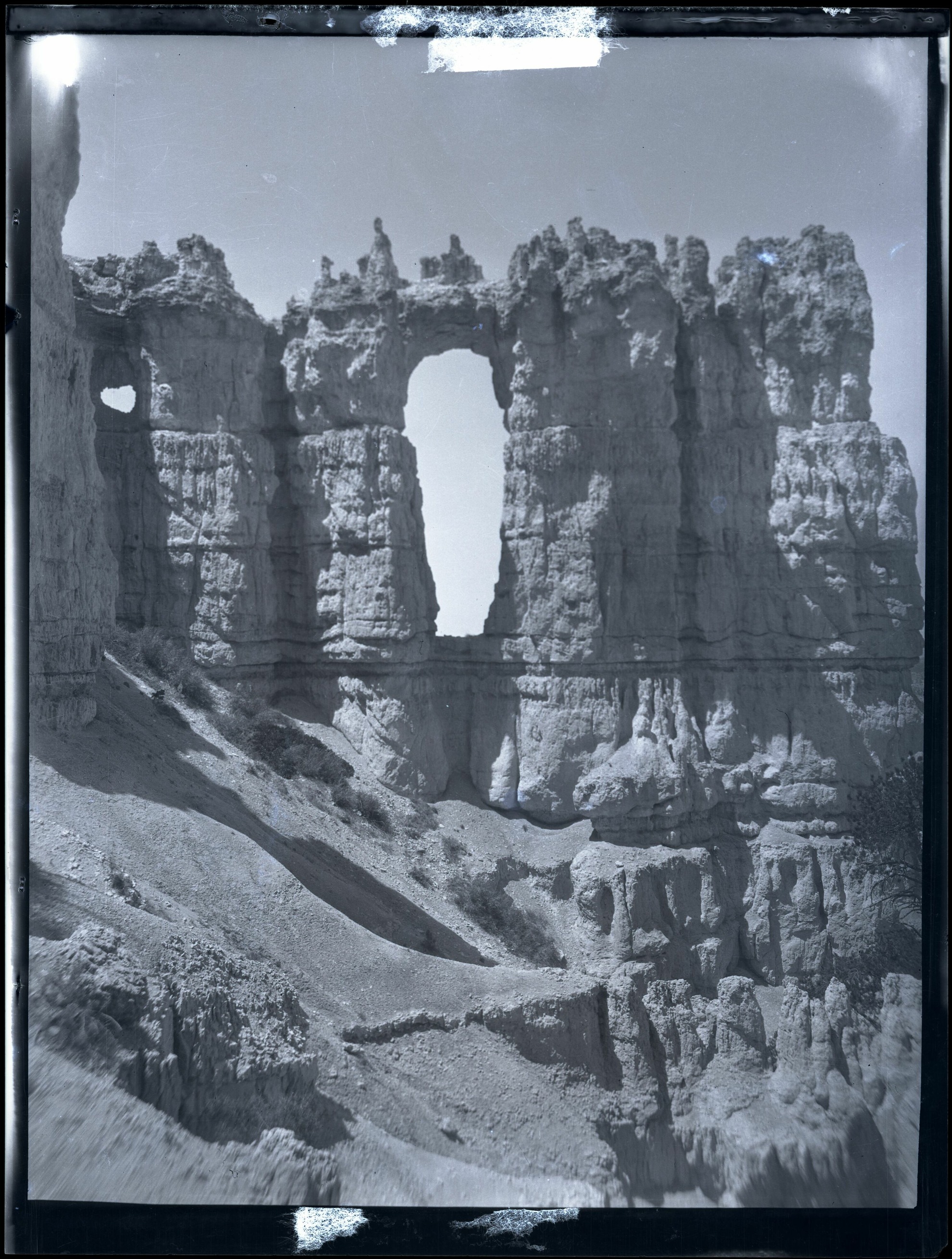
A bright opening divides the central rock wall, with a smaller window to the left. The archive identifies the Wall of Windows and the Peekaboo Trail. The photograph is a record of a particular view, not a measured outline of the openings.
Look closer. Trace the difference between the light sky inside the opening and the sunlit rock outside it. Exposure can hide detail at those edges.
Courtesy Bryce Canyon National Park, Photographer Maurice Cope, Museum Catalog Number BRCA 532/001-#028
Public-domain reference photograph. NPS JPEG of a nitrate-negative scan; original framing retained. 1981 × 2619 pixels in this edition.
Original archive record ↗Open full supplied image ↗
This digital asset is in the public domain. When publishing this asset for any use, including online, image must credit: Courtesy Bryce Canyon National Park, Photographer Maurice Cope, Museum Catalog Number BRCA 532/001-#028
Catalogue title: Nitrate negative of Wall of Windows from the Peekaboo Trail in BRCA. ; BRCA Museum and Archives Image BRCA8875_001_028 ; BRCA 8875
Archive Number: BRCA 532/001-#028
Source checked 2 October 2026. NPS ownership policy.
Full supplied frame · no image retouching
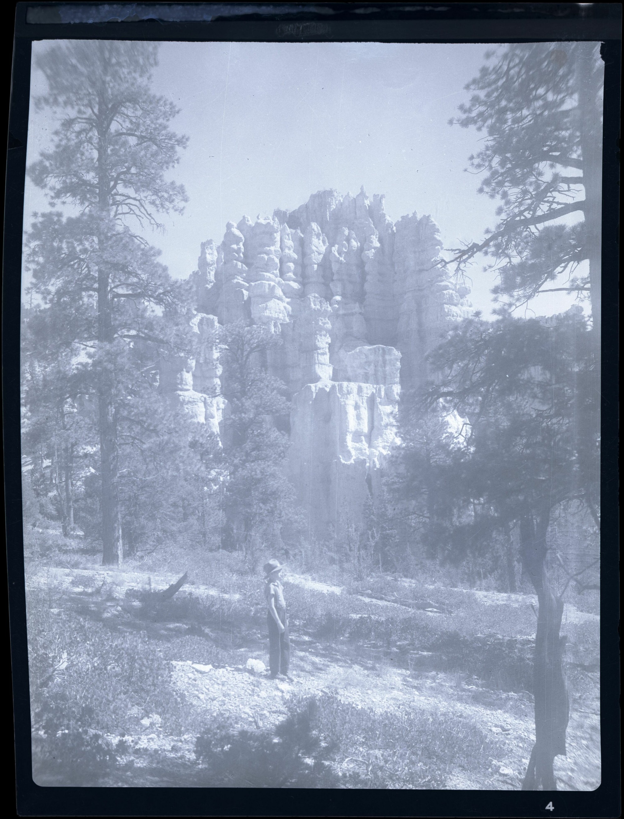
Plate 06 · Queen’s Garden area
1920–1940 Catalogue range
A person stands near the bottom of the frame, almost lost among the trees and rock. The museum description identifies the subject as a boy in the Queen’s Garden area. It does not name him or explain why the photograph was made.
Look closer. Find the figure before looking up at the rock. The photograph offers a human reference for the scene, but no reliable measuring scale.
Courtesy Bryce Canyon National Park, Photographer Maurice Cope, Museum Catalog Number BRCA 532/001-#035
Public-domain reference photograph. NPS JPEG of a nitrate-negative scan; original framing retained. 1991 × 2613 pixels in this edition.
Original archive record ↗Open full supplied image ↗
This digital asset is in the public domain. When publishing this asset for any use, including online, image must credit: Courtesy Bryce Canyon National Park, Photographer Maurice Cope, Museum Catalog Number BRCA 532/001-#035
Catalogue title: Nitrate negative of boy standing in Queens Garden area of BRCA. Trees and vegetation in foreground. Hoodoos in background. ; BRCA Museum and Archives Image BRCA8875_001_035 ; BRCA 8875
Archive Number: BRCA 532/001-#035
Source checked 2 October 2026. NPS ownership policy.
Full supplied frame · no image retouching
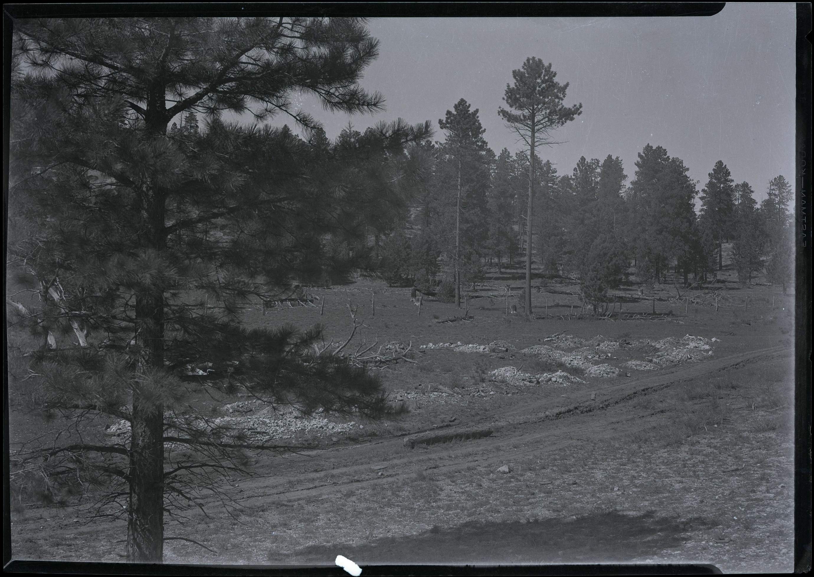
Plate 07 · A park road, location unresolved
1920–1940 Catalogue range
A dirt road curves through a forested setting. The catalogue places the scene in Bryce Canyon National Park, but gives no road name. It records another part of a park visit: the space between the famous views.
Look closer. Read the road as a visible feature in this frame. Its width, surface, and curve do not identify it as a particular modern road.
Courtesy Bryce Canyon National Park, Photographer Maurice Cope, Museum Catalog Number BRCA 532/001-#002
Public-domain reference photograph. NPS JPEG of a nitrate-negative scan; original framing retained. 2759 × 1956 pixels in this edition.
Original archive record ↗Open full supplied image ↗
This digital asset is in the public domain. When publishing this asset for any use, including online, image must credit: Courtesy Bryce Canyon National Park, Photographer Maurice Cope, Museum Catalog Number BRCA 532/001-#002
Catalogue title: Nitrate negative of dirt road in a forested area in BRCA. ; BRCA Museum and Archives Image BRCA8875_001_002 ; BRCA 8875
Archive Number: BRCA 532/001-#002
Source checked 2 October 2026. NPS ownership policy.
Full supplied frame · no image retouching
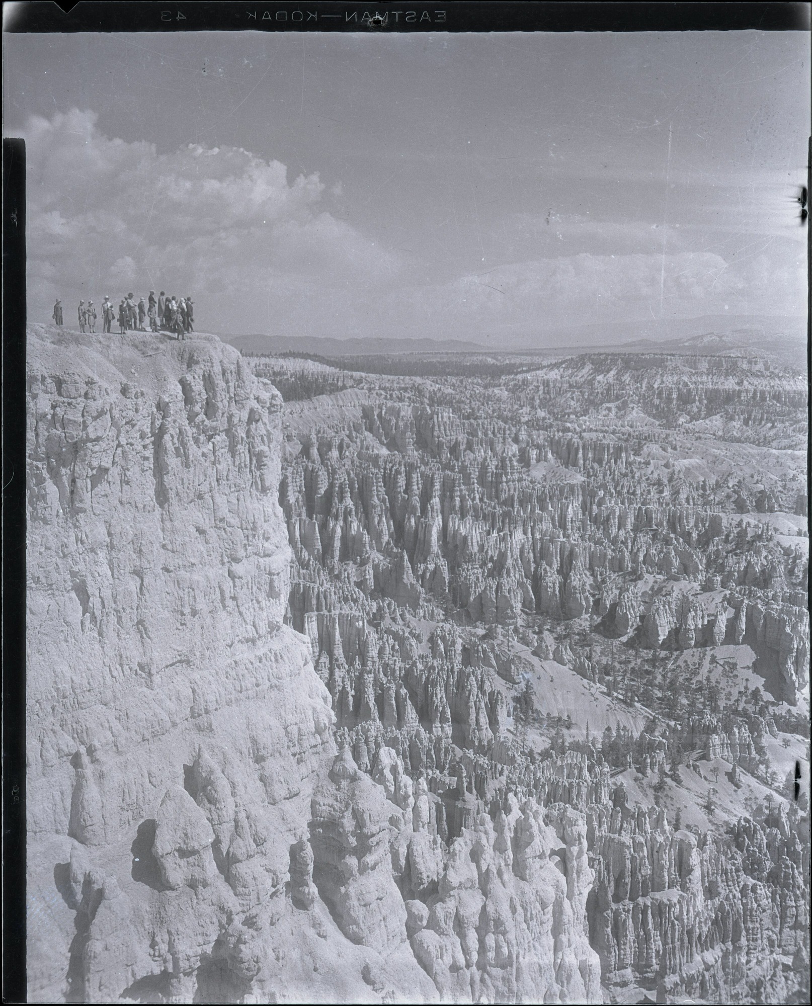
Plate 08 · Ranger-led walk at the amphitheater
1920–1940 Catalogue range
The people occupy only a small corner of this large view. The museum catalogue describes a ranger-led hike at an amphitheater viewpoint. It preserves a scene of interpretation without preserving the words spoken there.
Look closer. Find the group along the left skyline. Their placement shows how the photographer balanced a human gathering with the landscape.
Courtesy Bryce Canyon National Park, Photographer Maurice Cope, Museum Catalog Number BRCA 532/001-#174
Public-domain reference photograph. NPS JPEG of a nitrate-negative scan; original framing retained. 1614 × 2000 pixels in this edition.
Original archive record ↗Open full supplied image ↗
This digital asset is in the public domain. When publishing this asset for any use, including online, image must credit: Courtesy Bryce Canyon National Park, Photographer Maurice Cope, Museum Catalog Number BRCA 532/001-#174
Catalogue title: Nitrate negative of visitors on ranger led hike at viewpoint overlooking amphitheater in BRCA. ; BRCA Museum and Archives Image BRCA8875_001_174 ; BRCA 8875
Archive Number: BRCA 532/001-#174
Source checked 2 October 2026. NPS ownership policy.
Full supplied frame · no image retouching
Plate 09 · Deluxe Quadruplex Cabin
1929 Caption year
Stone chimneys and log walls dominate this cabin photograph. NPS captions the image as a Deluxe Quadruplex Cabin in the lodge area, 1929, and credits the Bryce Canyon National Park Archives. Its accompanying landscape history discusses the deliberate relationship between buildings and their forested setting.
Look closer. Compare the low roof with the surrounding trees. The visual relationship is part of the image; the catalogue does not identify a specific cabin number.
NPS / Bryce Canyon National Park Archives 00350
Public-domain reference photograph. NPS article JPEG; original supplied framing retained. 638 × 426 pixels in this edition.
Original archive record ↗Open full supplied image ↗
Image explicitly credited to NPS on the individual cultural-landscape article; no third-party or copyright credit. NPS Disclaimer, Ownership, applies to NPS-created material.
Catalogue title: Deluxe Quadruplex Cabin in Lodge Area, 1929
NPS Archives 00350; article 850501
Source checked 2 October 2026. NPS ownership policy.
Full supplied frame · no image retouching
Plate 10 · Ranger Station / Residence
1929 Caption year
The building is surrounded by tall pines, with construction materials visible near its front. NPS captions this photograph as Ranger Station/Residence, 1929. The image accompanies the agency’s account of the Old NPS Housing Historic District and the development of park administration.
Look closer. Look at the porch, roof, and materials around the building. They show work in progress without telling us the day or the names of the workers.
NPS
Public-domain reference photograph. NPS article JPEG; original supplied framing retained. 638 × 482 pixels in this edition.
Original archive record ↗Open full supplied image ↗
Image explicitly credited to NPS on the individual cultural-landscape article; no third-party or copyright credit. NPS Disclaimer, Ownership, applies to NPS-created material.
Catalogue title: Ranger Station/Residence, 1929
Article 850504; image 125CC4B0-1DD8-B71B-0B170C23AD964CF1
Source checked 2 October 2026. NPS ownership policy.
Settlers dug the Tropic Ditch from the East Fork of the Sevier River, across the plateau and into Water Canyon at Mossy Cave. The National Park Service dates its completion to 1892 and describes its role in irrigating Tropic and Cannonville.
Source: NPS · Mossy Cave / Water Canyon (10 October 2024).
The early park in photographs, the places they show today, and how the change could be measured.