
Conservancy
The land around the park
Bryce Canyon sits on the edge of the Paunsaugunt Plateau. Below it lie the Paria valley and the towns of Tropic, Cannonville and Bryce Canyon City. The rock, the water and the wildlife do not stop at the park boundary.
Why the wider landscape matters
The park sits on the eastern rim of the Paunsaugunt Plateau. Runoff on the plateau drains toward the East Fork of the Sevier River, which flows north; below the rim, the Paria River flows south as part of the Colorado River system. The divide between them runs along the rim, and the Tropic Ditch, finished in 1892, was dug to carry water across it.
The rock, the water and the three nearest towns share one landscape. That is why the conservancy’s work starts with the land around the park and the communities in it, alongside the park rather than inside it. Nothing has been acquired or protected yet.
Sources: NPS Northern Colorado Plateau Network · Biophysical description of Bryce Canyon; Thornberry-Ehrlich · Bryce Canyon geologic resource evaluation report (NPS) (2005); NPS · Mossy Cave / Water Canyon (10 October 2024).
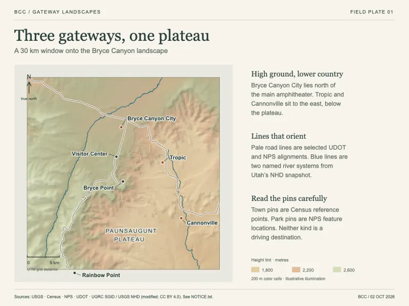 Three gateways, one plateau
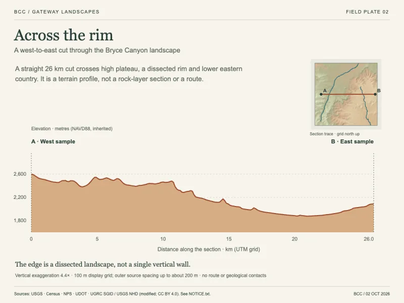 Across the rim
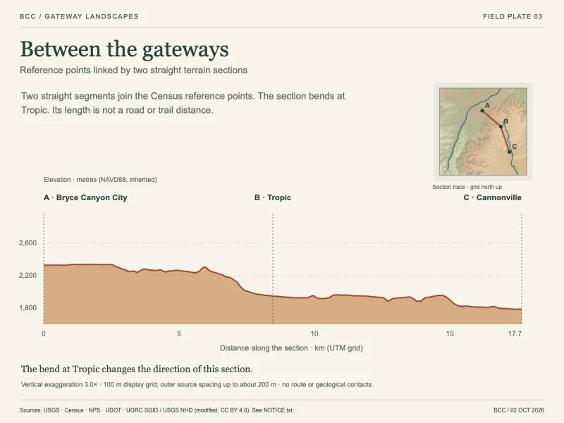 Between the gateways
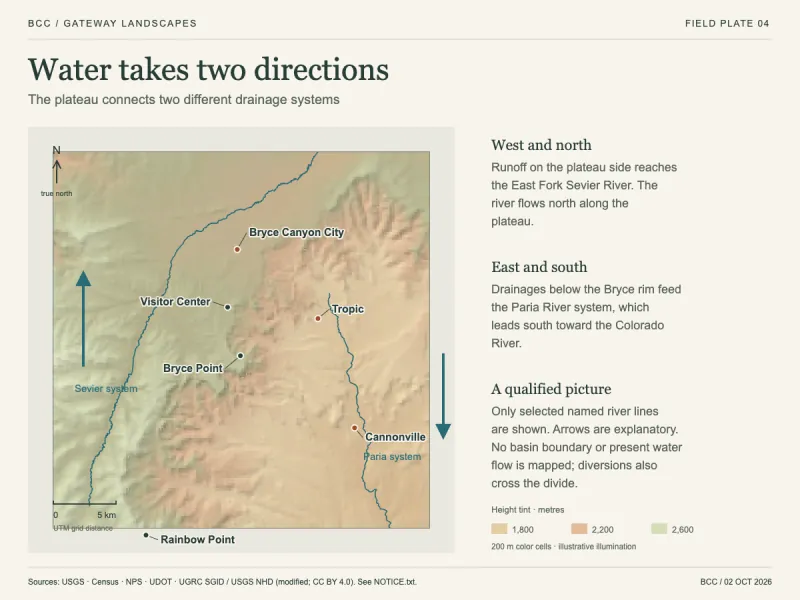 Water takes two directions
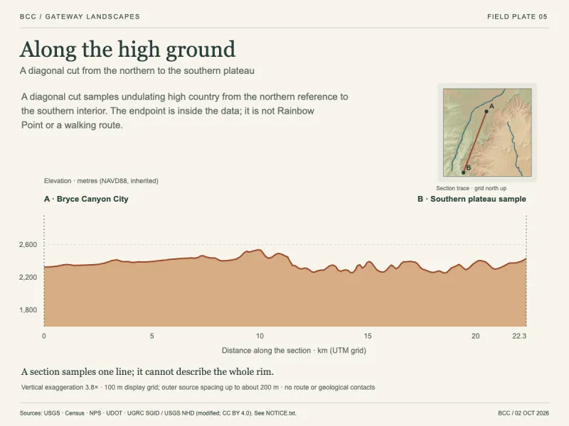 Along the high ground
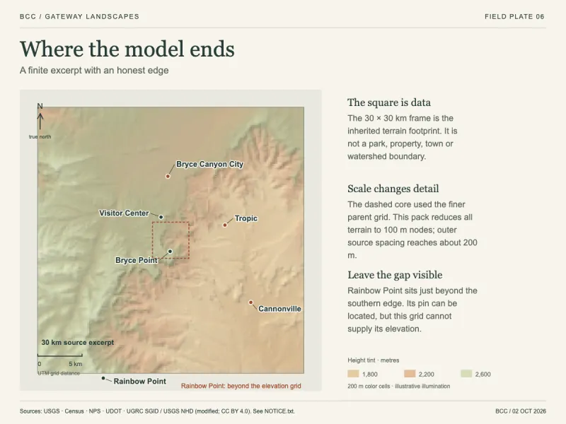 Where the model ends
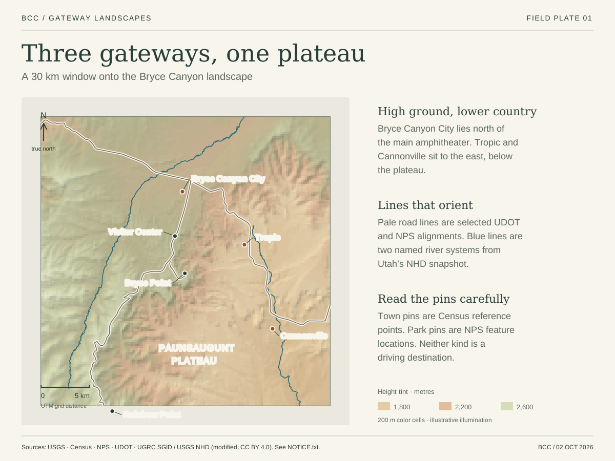
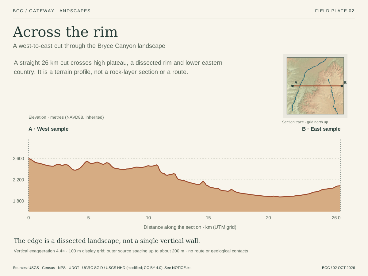
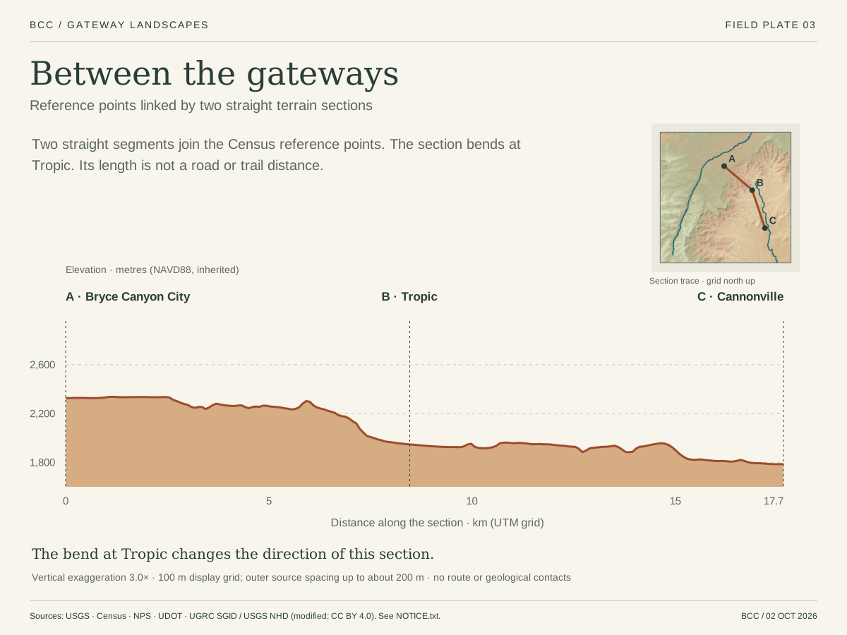
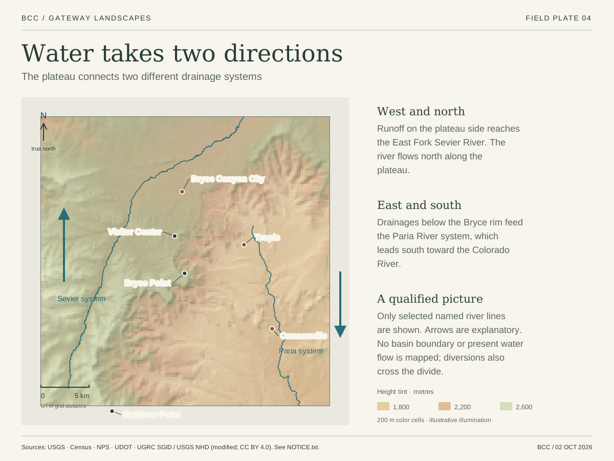
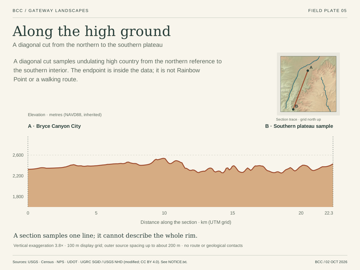
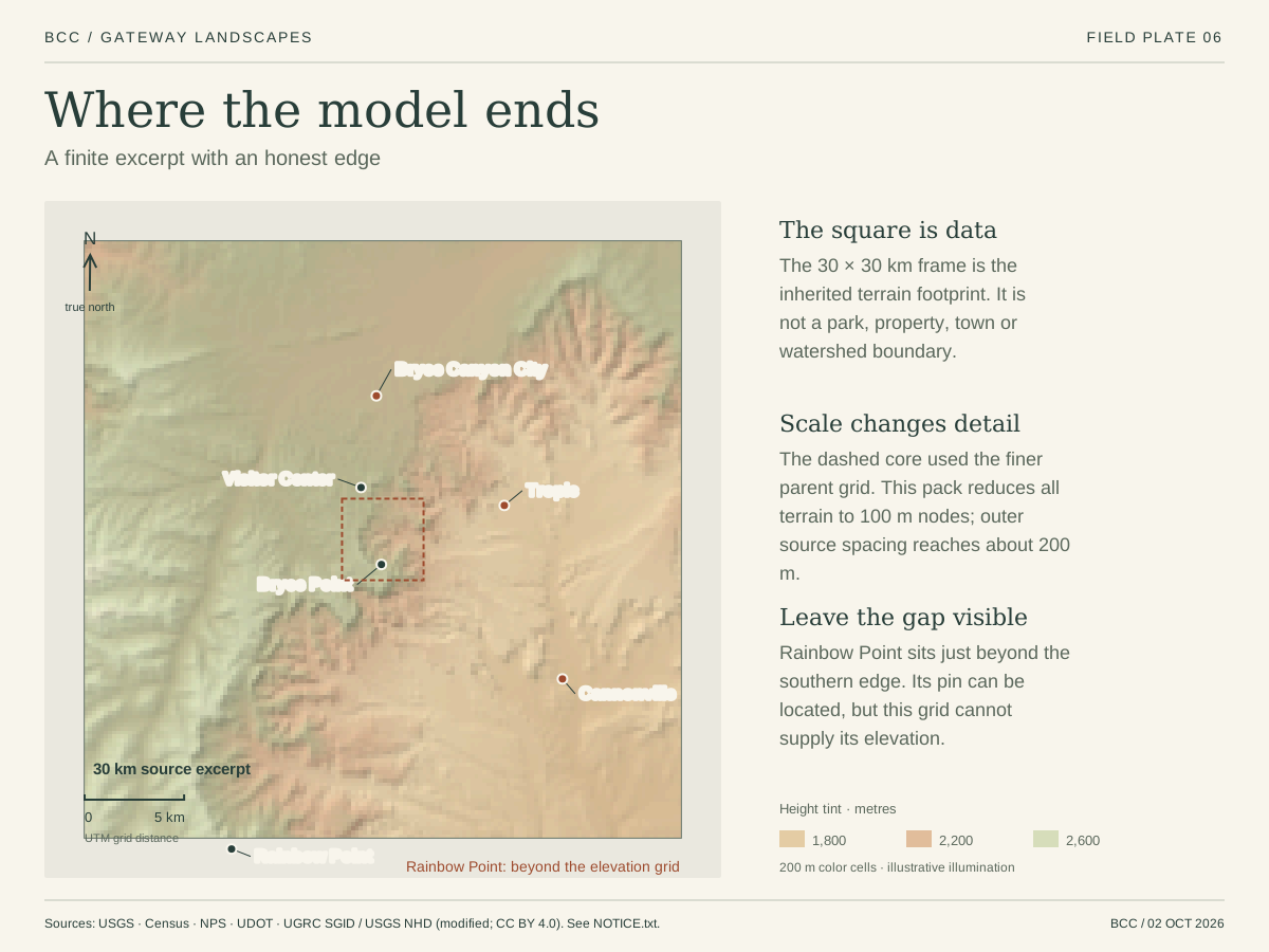
 DerivedSix plates of the regional terrain. Bryce Canyon Conservancy cartography from USGS 3DEP elevation, U.S. Census place points (2026), NPS and UDOT road lines and USGS stream lines; the coverage plate shows where the model ends.
Sources: USGS · 3D Elevation Program; U.S. Census Bureau · TIGERweb incorporated places, 2026 vintage (1 January 2026); Utah Geospatial Resource Center · NHD streams (CC BY 4.0).
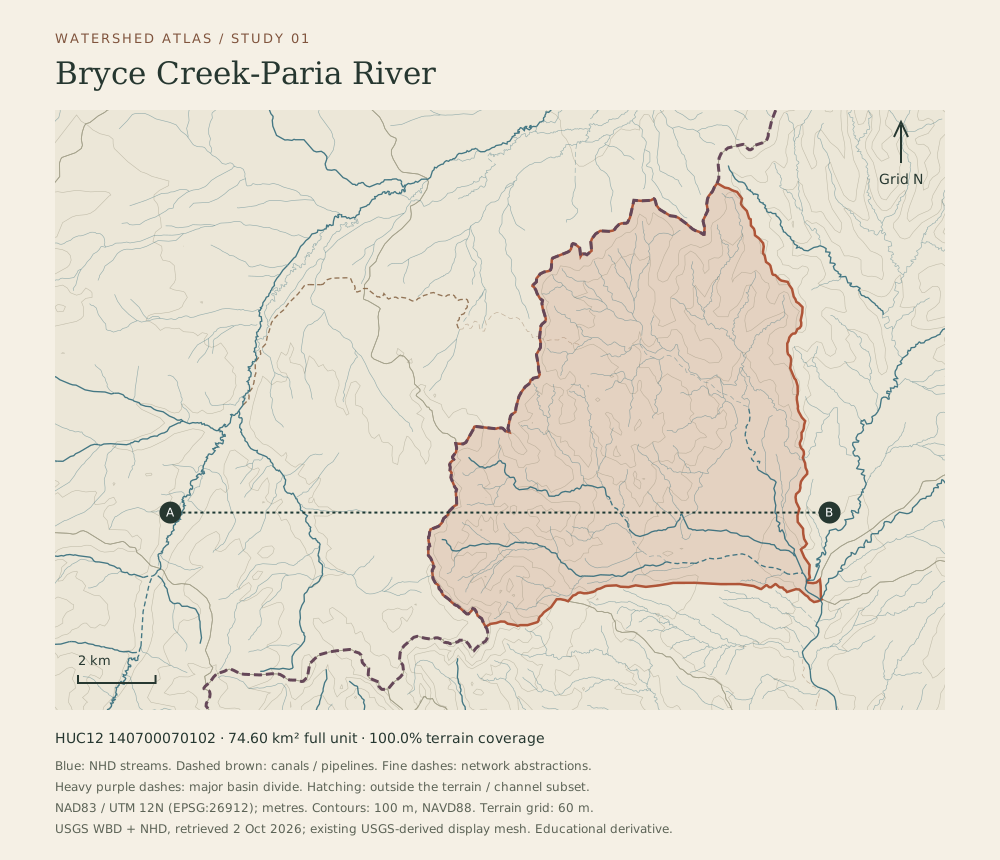 DerivedUSGS Watershed Boundary Dataset and National Hydrography Dataset, verified 2 October 2026. Map by Bryce Canyon Conservancy.
Water for Tropic and Cannonville
Settlers dug the Tropic Ditch from the East Fork of the Sevier River, across the plateau and into Water Canyon at Mossy Cave. The National Park Service dates its completion to 1892 and describes its role in irrigating Tropic and Cannonville.
Sources: NPS · Mossy Cave / Water Canyon (10 October 2024).
The land around the park
The plateau, its towns and its water, and how the conservancy proposes to care for them.