
Northern Bryce
Mossy Cave and Water Canyon
A short trail off Utah Highway 12 follows Water Canyon to a waterfall and a mossy alcove, beside a ditch that has carried irrigation water since 1892.
 Measured
Use the place description to choose what to study, then check the approach, walking effort and current restrictions before leaving.
Conditions & official access sources · Compare walking distance and climb
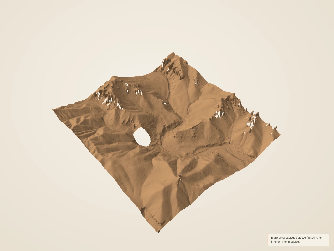
 DerivedMossy Cave drainage: the 2018 USGS lidar surface, seen at an angle from above. The site’s collection has no modern photograph of this place; surface color and lighting are drawn, not measured.
What you’re looking at
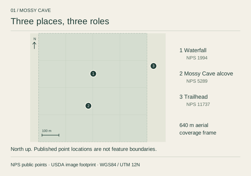
Mossy Cave has its own trailhead on Utah Highway 12, outside the main park entrance and away from the scenic drive. The trail follows Water Canyon, a narrow watercourse through the hoodoo landscape of the northern park. The waterfall, the alcove that gives the place its name and the trailhead are three different places.1,2,3
Water Canyon carries irrigation water. Between 1890 and 1892 settlers dug a ditch from the East Fork of the Sevier River, across the plateau and into the canyon. NPS dates the completion of the Tropic Ditch to 1892 and describes its role in irrigating Tropic and Cannonville; its account singles out the drought of 2002 as an exception. NPS describes the canyon’s lower V-shaped slopes as the work of flowing water.2
The alcove tells a second water story. The NPS wayside describes groundwater seeping through harder limestone and dissolving and eroding the softer rock below it. Moist shade supports moss, and dripping water can freeze. NPS asks visitors to protect the alcove and stay out of it.4,2
Turn it in 3D
Turn the surface, cut a section across it, and compare the aerial color with the laser returns the aircraft recorded. The 3D view loads only when you open it.
Walks from here
- Mossy CaveFollow water toward a shaded alcove. NPS: 0.8 mi, 150 ft of climbing, easy.
Trail figures are the National Park Service’s. They are not current conditions; check NPS notices before a hike.
Living things here
Habitats: Seeps & moist ground, Rocky breaks & rim. Groundwater seeps at the alcove and the ditch carries water through the canyon: NPS notes that seeps, springs and moist soils support plants with different needs from the surrounding dry landscape. The slopes above are rocky breaks.4,11
Living Bryce entries for these habitats:
Care
NPS asks visitors to stay on trails, avoid climbing hoodoos, leave natural objects where they are and avoid feeding or disturbing wildlife. Walking toward a hoodoo’s base can disturb the clay-rich slopes that help protect its foundations, so enjoy the formations from established trails and overlooks.9,10
Read without 3D
The 3D view covers a square about 640 metres on a side. Heights in the lidar returns range from 2,078 m (6,819 ft) to 2,217 m (7,274 ft). The surface is built from what an aircraft could see from above: undersides, overhangs and narrow gaps are not reconstructed.
Data and sources
Datasets
Sources
- National Park Service · Mossy Cave Trail · 2024-10-10
- National Park Service · Mossy Cave · 2024-10-10
- National Park Service · Parking Information
- National Park Service · Mossy Cave wayside · 2024-10-10
- USGS data; public Entwine organization maintained by Hobu · USGS 3DEP LiDAR Point Clouds · 2018 acquisition; LAS published 2019
- US Geological Survey · USGS Lidar Point Cloud UT Southern QL1 2018 12SUG9562 LAS 2019 metadata · 2019-06-03
- USDA FPAC / Farm Service Agency · USDA conterminous US NAIP imagery service · 2024 Utah acquisition, exact flight dates per crop
- National Park Service · Current Conditions · 2026-08-31
- National Park Service · Protect the Hoodoos · 2018-10-16
- National Park Service · Hiking · 2024-10-11
- National Park Service, Bryce Canyon · Plants · April 30, 2023