
South along the plateau
Riggs Spring Loop
South of the high rim, a backcountry loop drops from Rainbow and Yovimpa Points into broad wooded slopes.
 Measured
This page explains a named landscape feature. A model position is not an established trail, parking place or permission to approach the formation.
Conditions & official access sources · Compare walking distance and climb
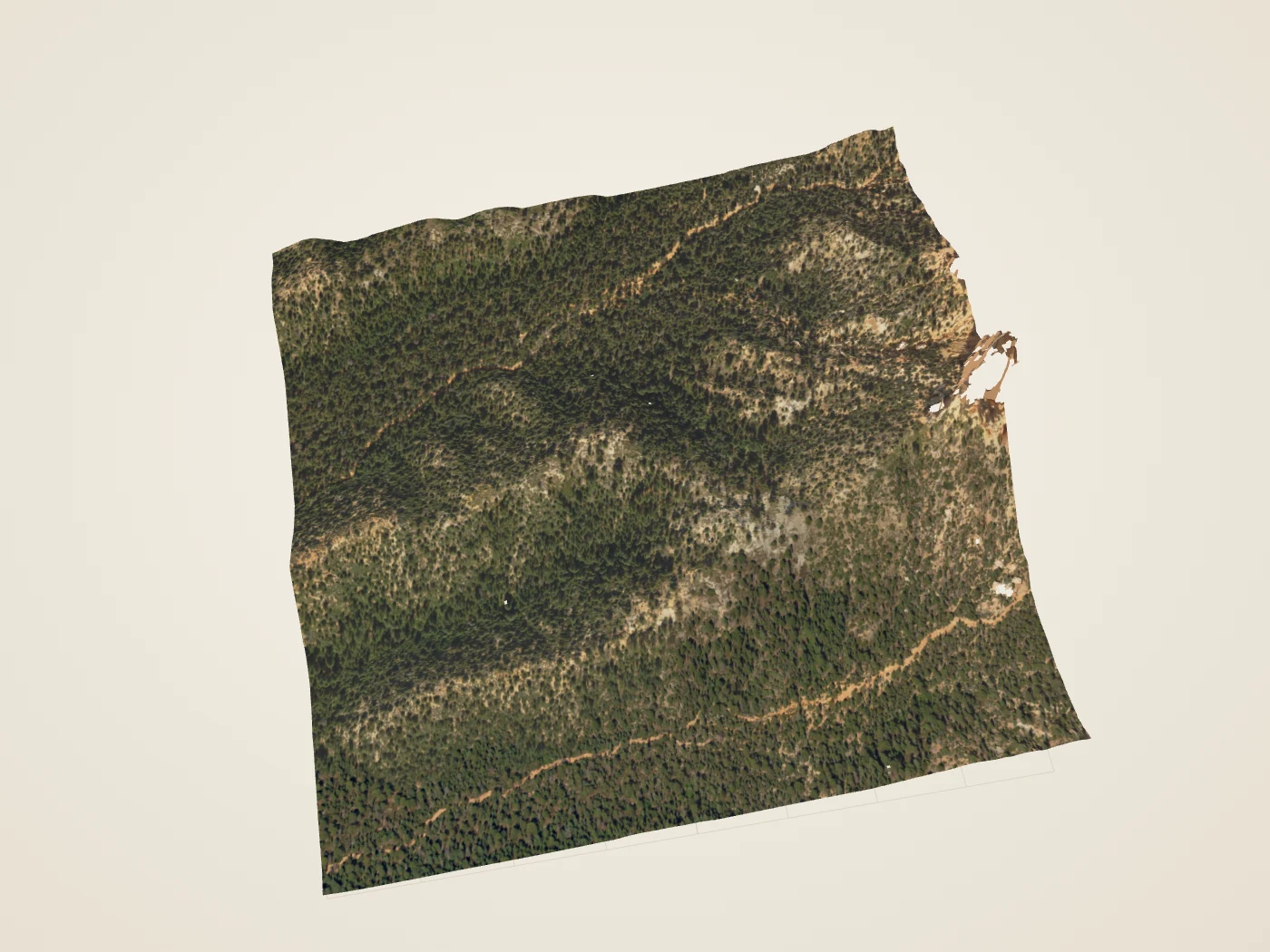
 DerivedRiggs Spring corridor: the 2018 USGS lidar surface, seen at an angle from above. The site’s collection has no modern photograph of this place; surface color and lighting are drawn, not measured.
What you’re looking at
The Riggs Spring Loop leaves the high rim at Rainbow and Yovimpa Points and enters the forested backcountry below them. Broad wooded slopes replace the familiar amphitheater view.1,2
NPS pages publish differing figures for the loop’s length and climb, so check the current NPS trail page and backcountry guidance before planning; the trail guide here records one NPS figure, 8.5 miles with about 2,250 feet of climbing.1,2
The 3D view covers only a one-kilometre square of the eastern slope and Corral Hollow setting. The spring and much of the route lie beyond its edges, and it cannot show water availability or trail conditions.3,1
Turn it in 3D
Turn the surface, cut a section across it, and compare the aerial color with the laser returns the aircraft recorded. The 3D view loads only when you open it.
Walks from here
- Riggs Spring LoopFrom the high rim into southern forests. NPS: 8.5 mi, 2,248 ft of climbing, strenuous.
Trail figures are the National Park Service’s. They are not current conditions; check NPS notices before a hike.
Living things here
Habitats: Mixed-conifer forest. The loop runs through the higher southern forest that NPS describes, with white fir, Douglas-fir, pines and pockets of aspen.8,9
Living Bryce entries for these habitats:
Care
NPS asks visitors to stay on trails, avoid climbing hoodoos, leave natural objects where they are and avoid feeding or disturbing wildlife. Walking toward a hoodoo’s base can disturb the clay-rich slopes that help protect its foundations, so enjoy the formations from established trails and overlooks.6,7
Read without 3D
The 3D view covers a square about 1,024 metres on a side. Heights in the lidar returns range from 2,312 m (7,585 ft) to 2,668 m (8,754 ft). The surface is built from what an aircraft could see from above: undersides, overhangs and narrow gaps are not reconstructed.
Data and sources
Datasets
Sources
- National Park Service · Riggs Spring Loop Trail · 2021-09-21
- National Park Service · Backcountry Hiking and Camping
- USGS data; public Entwine organization maintained by Hobu · USGS 3DEP LiDAR Point Clouds · 2018 acquisition; LAS published 2019
- US Geological Survey · USGS Lidar Point Cloud UT Southern QL1 2018 12SUG9562 LAS 2019 metadata · 2019-06-03
- USDA FPAC / Farm Service Agency · USDA conterminous US NAIP imagery service · 2024 Utah acquisition, exact flight dates per crop
- National Park Service · Protect the Hoodoos · 2018-10-16
- National Park Service · Hiking · 2024-10-11
- National Park Service, Bryce Canyon · Birds · September 11, 2024
- National Park Service, Bryce Canyon · Trees and Shrubs · June 29, 2022