
Northern Bryce
Sinking Ship
A named summit with a slanting skyline, tilted, NPS explains, by faulting along the park’s eastern side.
 Measured
This page explains a named landscape feature. A model position is not an established trail, parking place or permission to approach the formation.
Conditions & official access sources · Compare walking distance and climb
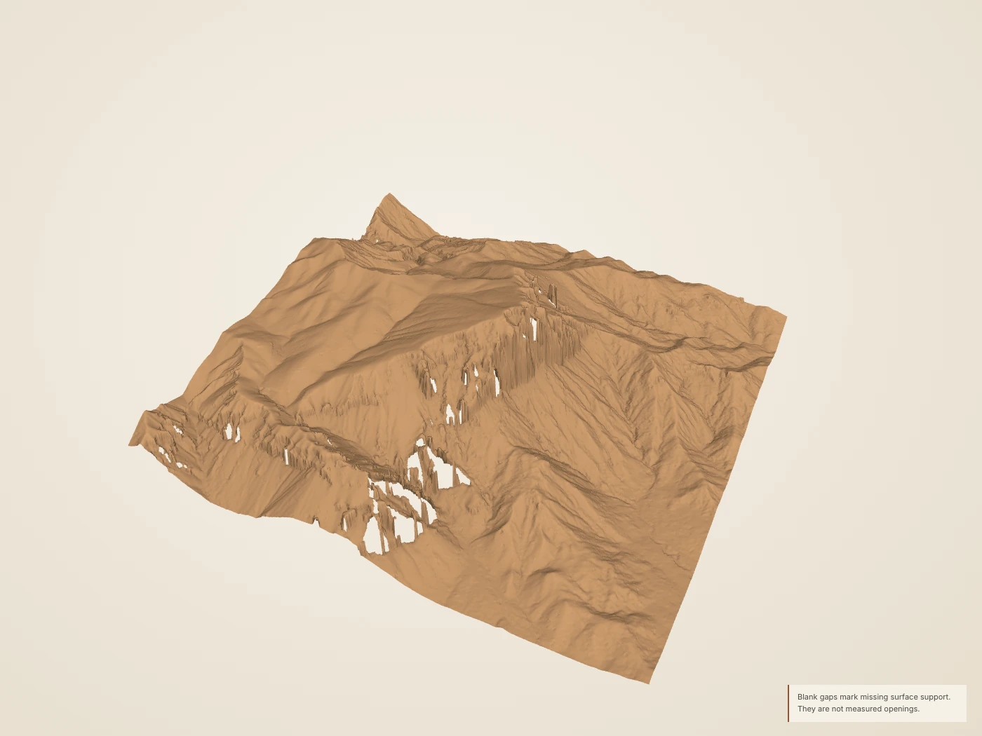
 DerivedSinking Ship: the 2018 USGS lidar surface, seen at an angle from above. The site’s collection has no modern photograph of this place; surface color and lighting are drawn, not measured.
What you’re looking at
Sinking Ship is a named summit with a slanting skyline. It stands apart from the larger plateau edge in the northern park.1,2
NPS relates its tilted appearance to faulting along the eastern edge of the park. The slope of the ground today is not the same thing as the tilt of the rock layers or the movement on a fault; the lidar measures only the surface.2,3
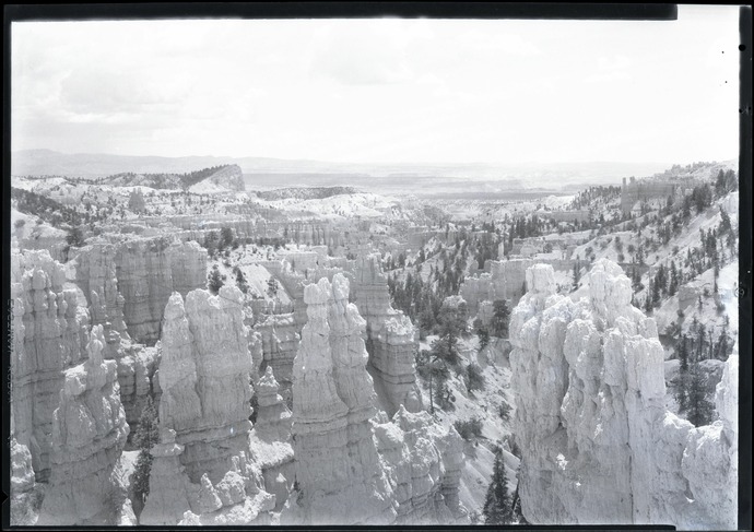
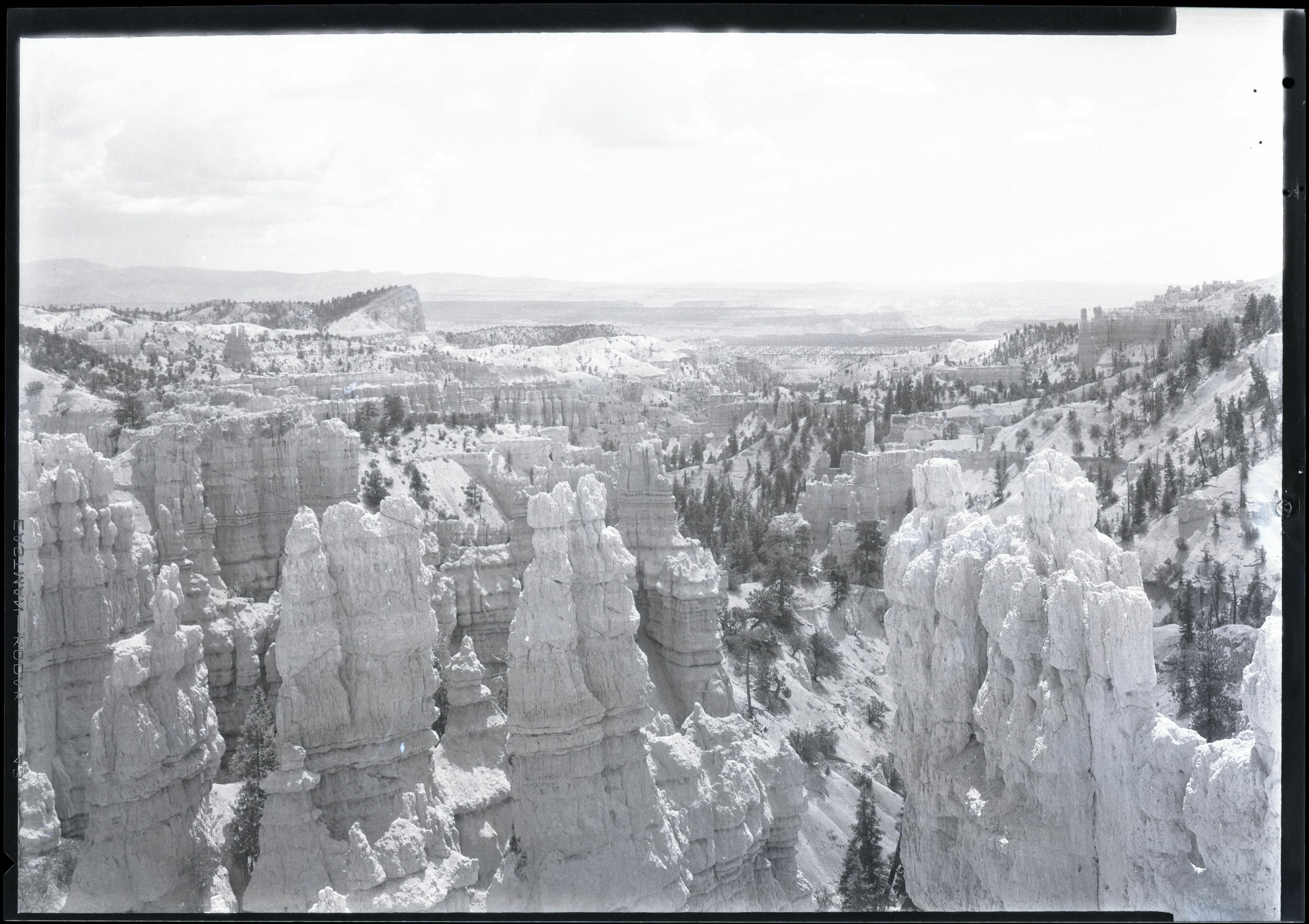
Maurice Cope photographed hoodoos and the Sinking Ship from the rim. The museum catalog gives only a broad date range, 1920 to 1940, for his negatives. His skyline can be set beside today’s terrain, but the two are different kinds of evidence.4
Turn it in 3D
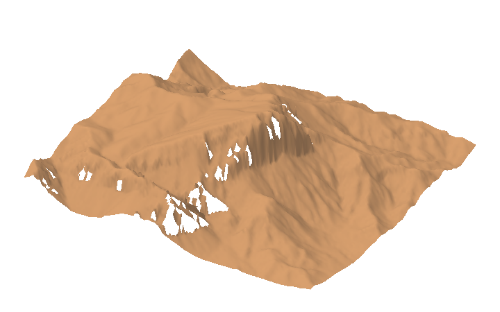
Turn the surface, cut a section across it, and compare the aerial color with the laser returns the aircraft recorded. The 3D view loads only when you open it.
Section and skyline
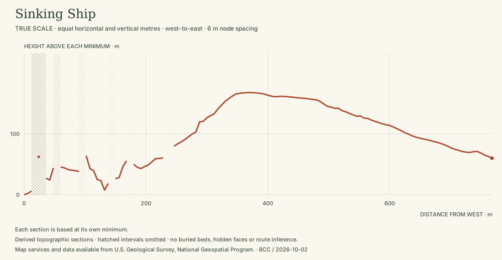 DerivedSinking Ship: the shape above ground. The ground-class section records surface shape. It does not measure bed orientation, locate a fault or extend rock layers below the surface. Compare adjacent slices to see how much the visible shape depends on the cut. A 768 m line at equal horizontal and vertical scale; heights 2,167–2,335 m.3 Section data (JSON) · Drawing (SVG)
Then and now
Early photographs of the same ground. They record a view, not a measured change; the camera positions are not known exactly.
Living things here
Habitats: Rocky breaks & rim. The summit and its slopes are exposed breaks, where NPS notes that rocky ridges support trees adapted to difficult growing sites.9,10
Living Bryce entries for these habitats:
Care
NPS asks visitors to stay on trails, avoid climbing hoodoos, leave natural objects where they are and avoid feeding or disturbing wildlife. Walking toward a hoodoo’s base can disturb the clay-rich slopes that help protect its foundations, so enjoy the formations from established trails and overlooks.7,8
Read without 3D
The 3D view covers a square about 768 metres on a side. Heights in the lidar returns range from 2,110 m (6,922 ft) to 2,346 m (7,696 ft). The surface is built from what an aircraft could see from above: undersides, overhangs and narrow gaps are not reconstructed.
Data and sources
Datasets
Sources
- US Geological Survey / National Geospatial Program · USGS geographic names: northern Bryce landforms
- National Park Service · Fairyland Point · 2024-10-10
- USGS data; public Entwine organization maintained by Hobu · USGS 3DEP LiDAR Point Clouds · 2018 acquisition; LAS published 2019
- Bryce Canyon National Park Museum and Archives · Nitrate negative of hoodoos and the Sinking Ship from the rim in BRCA. ; BRCA Museum and Archives Image BRCA8875_001_003 ; BRCA 8875
- US Geological Survey · USGS Lidar Point Cloud UT Southern QL1 2018 12SUG9562 LAS 2019 metadata · 2019-06-03
- USDA FPAC / Farm Service Agency · USDA conterminous US NAIP imagery service · 2024 Utah acquisition, exact flight dates per crop
- National Park Service · Protect the Hoodoos · 2018-10-16
- National Park Service · Hiking · 2024-10-11
- National Park Service, Bryce Canyon · Plants · April 30, 2023
- National Park Service, Bryce Canyon · Limber Pine · March 3, 2025