
South along the plateau
Swamp Canyon
Where the scenic drive leaves the hoodoo-filled amphitheaters for the forested cliffs and buttes of southern Bryce.
 Measured
Use the place description to choose what to study, then check the approach, walking effort and current restrictions before leaving.
Conditions & official access sources · Compare walking distance and climb
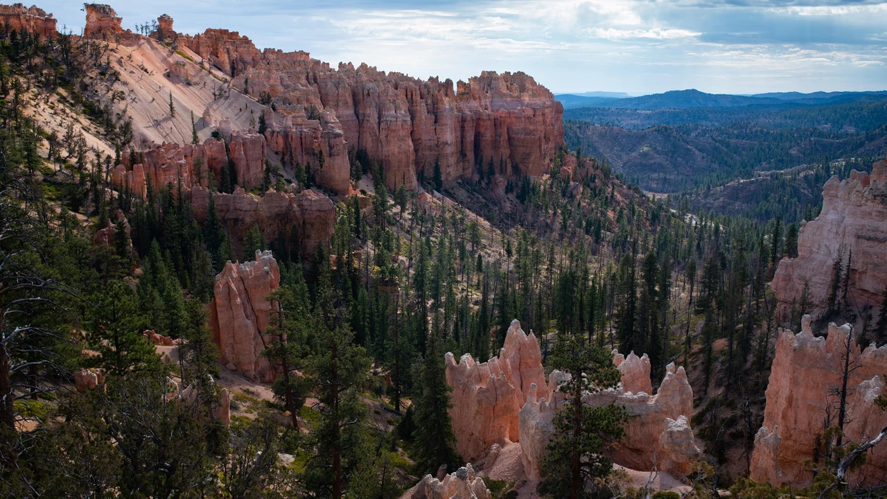
What you’re looking at
NPS describes Swamp Canyon as a transition from the densely packed hoodoos of the Bryce Amphitheater to the more forested cliffs and buttes of the southern park.1
Small creeks and a spring support a wetter pocket below the rim. The wet ground is described by NPS; neither the water nor the plants are mapped by the elevation model.1,2
The overlook is about 6 miles along the main road by the NPS milepost, the northernmost main stop of the southern drive. A trailhead lies near the overlook; the Swamp Canyon Loop needs separate planning.1,2,3
Turn it in 3D
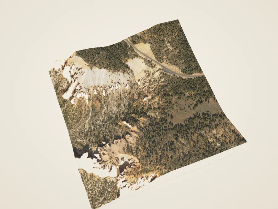
 DerivedSwamp Canyon head: the 2018 lidar surface, seen at an angle.
Turn the surface, cut a section across it, and compare the aerial color with the laser returns the aircraft recorded. The 3D view loads only when you open it.
Section and skyline
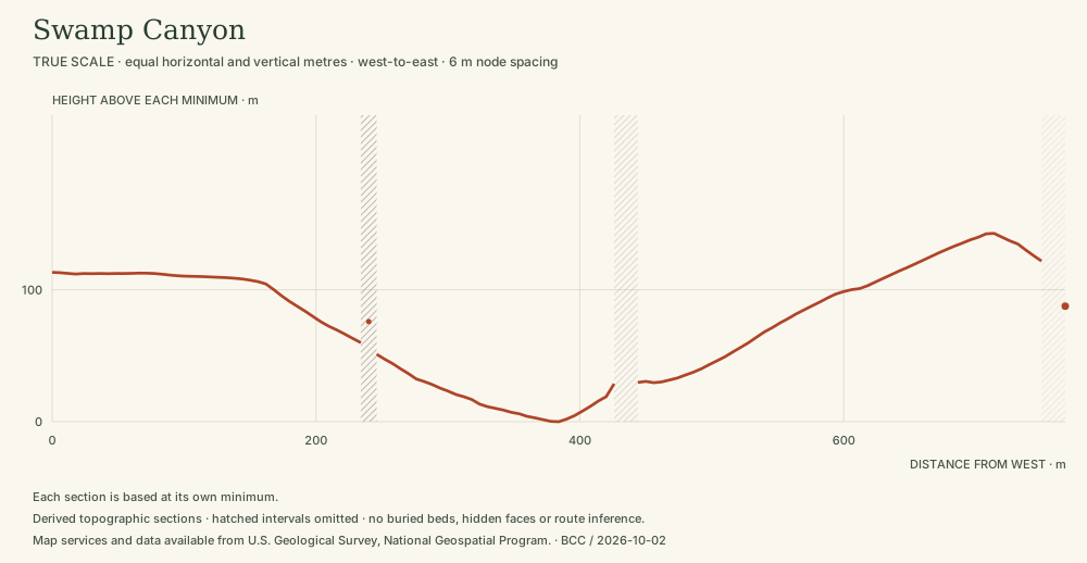 DerivedSwamp Canyon: the interruptions matter. Leave the omitted intervals open. The southern packets omit unsupported nodes and some abrupt interpolated cliff or isolated-patch geometry. Nearby valid endpoints alone are not permission to connect a segment. A 768 m line at equal horizontal and vertical scale; heights 2,365–2,508 m.4 Section data (JSON) · Drawing (SVG)
Walks from here
- Swamp Canyon LoopA quieter, more forested landscape. NPS: 4 mi, 800 ft of climbing, moderate.
Trail figures are the National Park Service’s. They are not current conditions; check NPS notices before a hike.
Add it to a visit plan Find it on the park map Read it along the scenic drive
Living things here
Habitats: Seeps & moist ground, Ponderosa forest. NPS describes wetter vegetation below the rim here; seeps, springs and moist soils support plants with different needs from the surrounding dry landscape. Ponderosa pine and manzanita characterize the middle elevations.1,10,11
Living Bryce entries for these habitats:
Care
NPS asks visitors to stay on trails, avoid climbing hoodoos, leave natural objects where they are and avoid feeding or disturbing wildlife. Walking toward a hoodoo’s base can disturb the clay-rich slopes that help protect its foundations, so enjoy the formations from established trails and overlooks.8,9
Read without 3D
The 3D view covers a square about 768 metres on a side. Heights in the lidar returns range from 2,324 m (7,623 ft) to 2,536 m (8,319 ft). The surface is built from what an aircraft could see from above: undersides, overhangs and narrow gaps are not reconstructed.
Data and sources
Datasets
- Overlook photographs
- Terrain for 20 places
- Lidar return samples
- Canyon sections
- Trails and profiles
- Park destinations and roads
Sources
- National Park Service · Swamp Canyon · 2026-08-15
- National Park Service · Southern Scenic Drive Viewpoints · 2024-04-09
- National Park Service · Parking Information
- USGS data; public Entwine organization maintained by Hobu · USGS 3DEP LiDAR Point Clouds · 2018 acquisition; LAS published 2019
- US Geological Survey · USGS Lidar Point Cloud UT Southern QL1 2018 12SUG9562 LAS 2019 metadata · 2019-06-03
- USDA FPAC / Farm Service Agency · USDA conterminous US NAIP imagery service · 2024 Utah acquisition, exact flight dates per crop
- National Park Service · Current Conditions · 2026-08-31
- National Park Service · Protect the Hoodoos · 2018-10-16
- National Park Service · Hiking · 2024-10-11
- National Park Service, Bryce Canyon · Plants · April 30, 2023
- National Park Service, Bryce Canyon · Trees and Shrubs · June 29, 2022