Stills, measured sections and all six essays are available below.
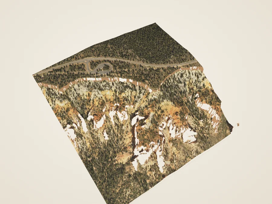
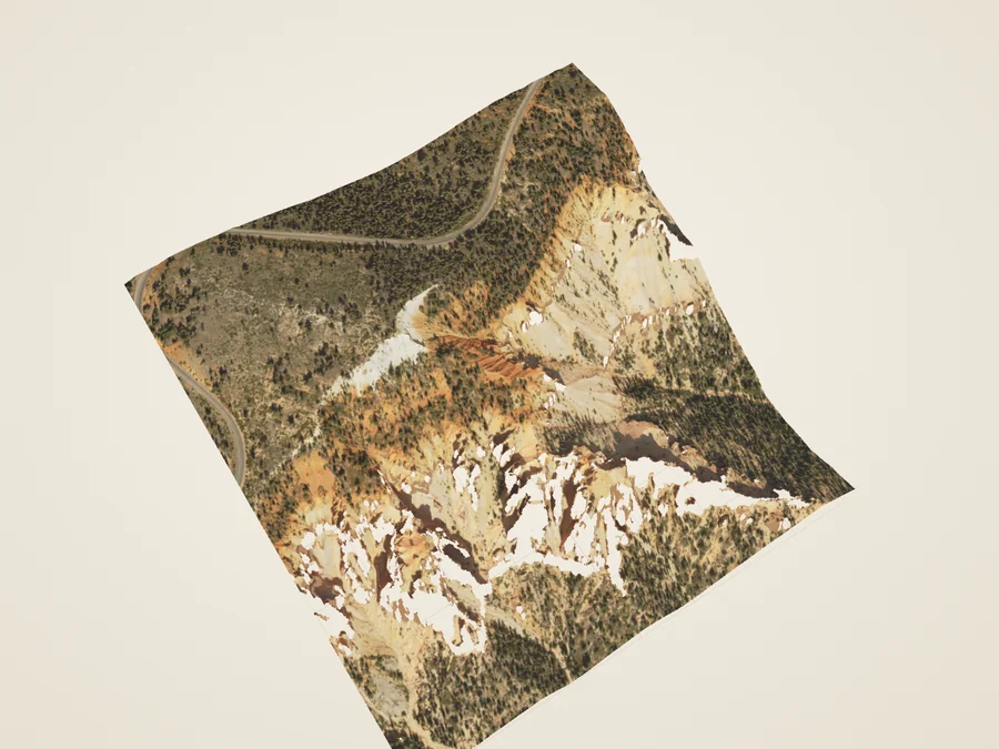
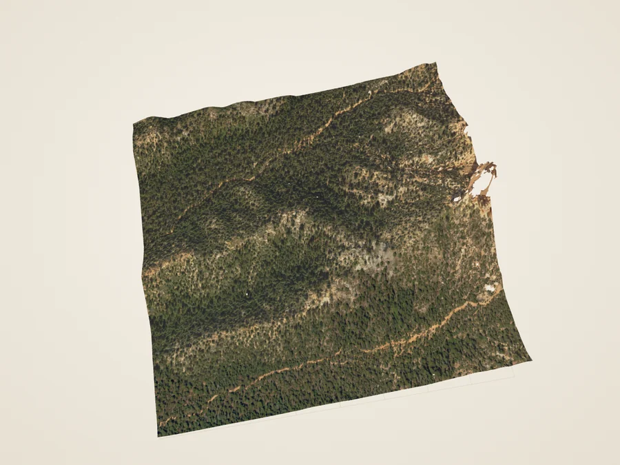
Drag sideways to turn. Arrow keys turn and tilt; + / − zoom; Home resets. Vertical swipes scroll. Views remain overhead: these surfaces do not resolve cliff faces.
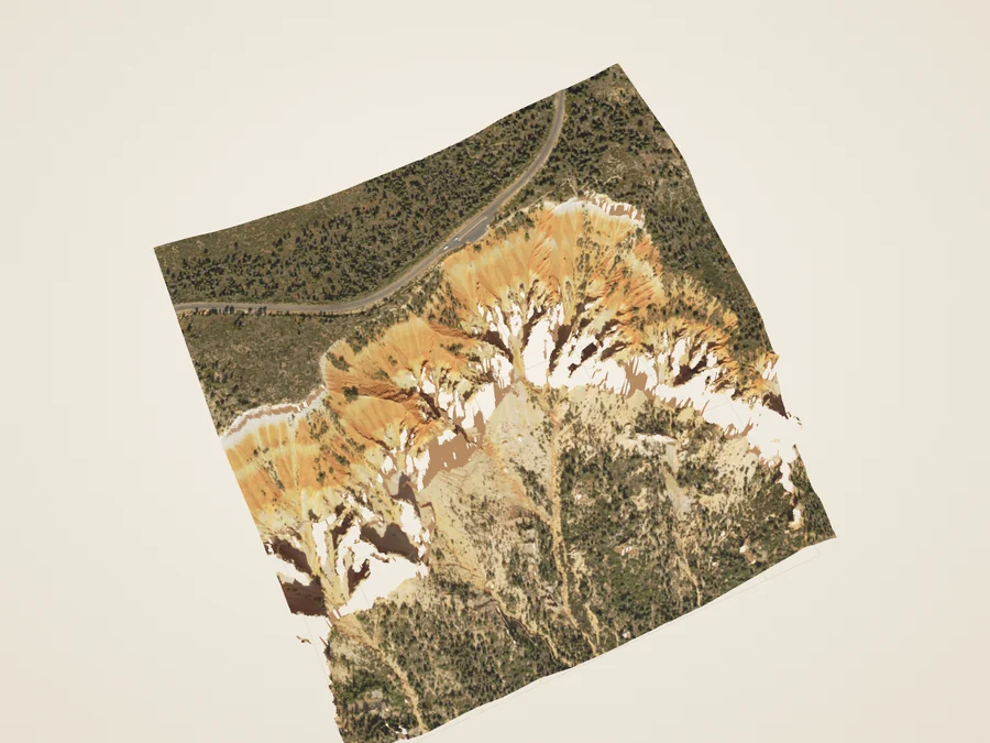
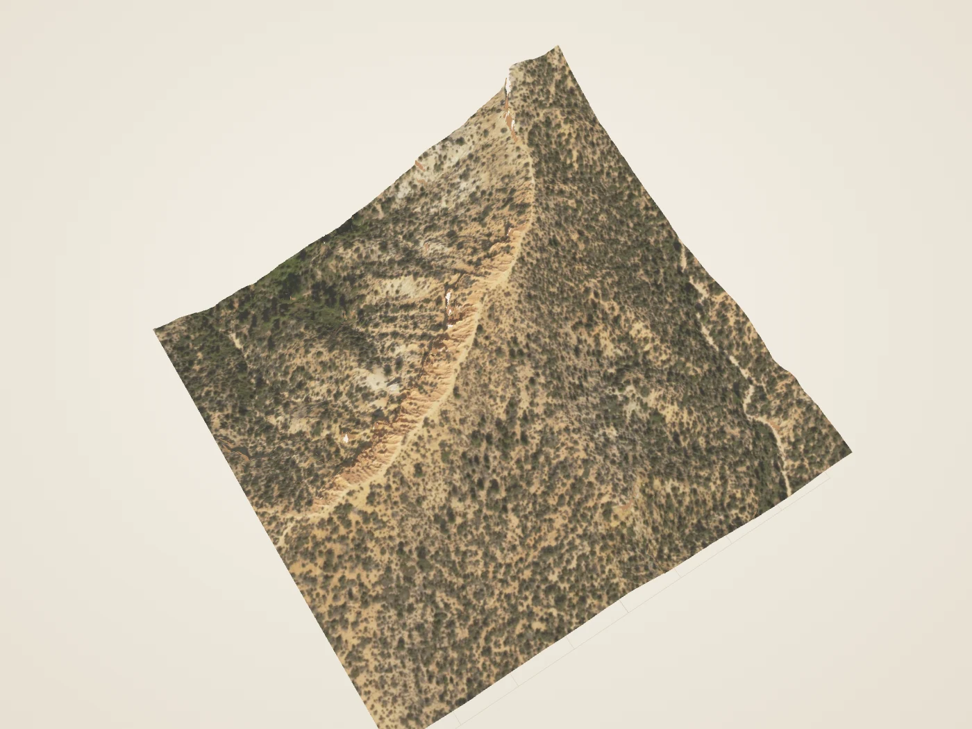
2018 measured airborne returns; a derived terrain surface. Material and lighting are illustrative.
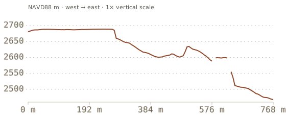
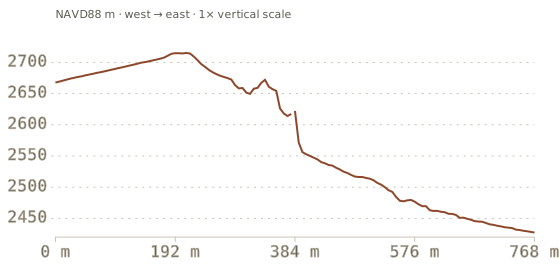
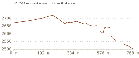
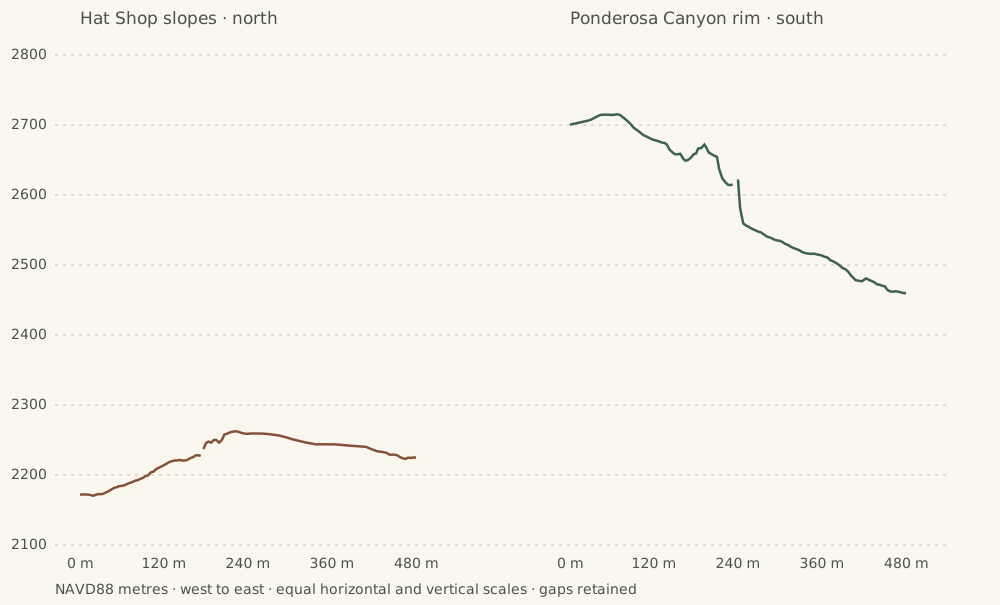
A measured slice
West to east, at true scale
Surface elevations in NAVD88 metres. Omitted fine samples break the line; gaps are not physical openings. No internal strata are drawn.
Six footprints, one larger landscape
The edge keeps changing.
The southern studies move from the Hat Shop slopes below Bryce Point to the forested backcountry near Riggs Spring. Each square is a separate measured footprint. Farview and Piracy share one square and count as one study.
These bounded landscapes extend the earlier eight-study collection. Agua Canyon and Rainbow/Yovimpa remain separate existing exhibits. No road, trail or connection between the squares is reconstructed.
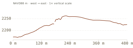
Compare a slope below the main amphitheater with a rim sector farther south. Both lines use the survey’s ground class and the same 480 m horizontal span. Their elevation difference describes these two slices; it does not measure an uplift rate, a continuous gradient, or the age of either landscape.
Derived Two 480 m ground sections, not a continuous plateau transect. Different slope positions and canopy sampling limit the comparison. Values and method. Scroll sideways on narrow screens.
The complete reading edition
Six ways to read the south
Actual model stills, measured sections and the source limits of every study. All remain available without JavaScript or 3D graphics.
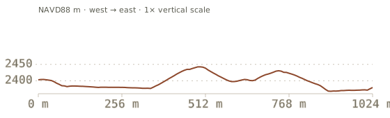
Derived 2018 ground + 2024 aerial color · 480 m footprint · gaps are data omissionsDerived Source-classified ground · central slice · NAVD88 m
01 / Below the main rim
Hat Shop slopes
The hats are small. The slope that carries them is a much larger story.
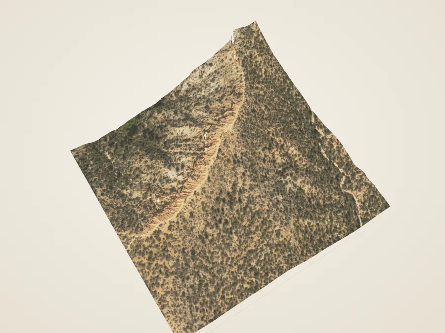
Below Bryce Point, the Hat Shop is a cluster of narrow pinnacles with large boulder caps. This study places the group within its surrounding slope. Compare the ground surface with the original laser returns: the survey’s ground classification can omit both vegetation and standing formations.
The selected ground returns describe the hillside. Other source returns may sample a cap or a tree crown; the point cloud alone does not label them as rock. A single-height surface cannot represent a cap and the narrower column beneath it at the same horizontal position.
A ground-surface study around Hat Shop, not a complete model of the balanced rocks. Ground classification can omit the pillars; cap undersides, narrow necks and hidden faces remain unresolved.
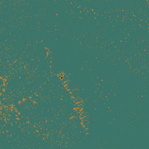
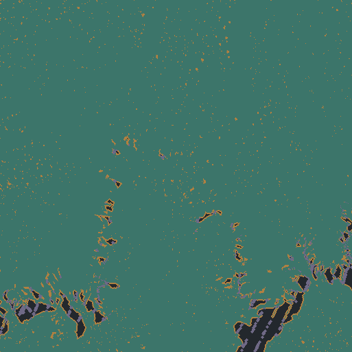
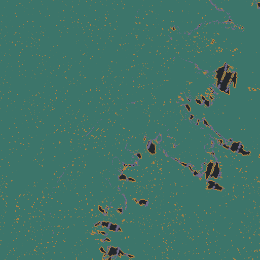
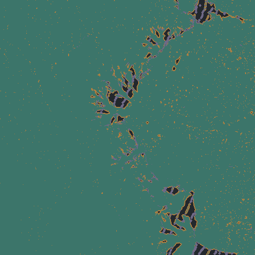
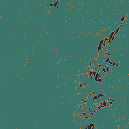
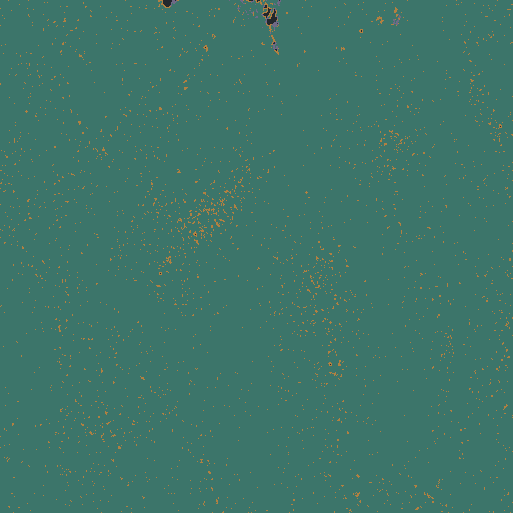
Footprint, source & scaleDerived North-up coverage: teal = ground returns in the grid bin; ochre = short fill; gray = source gap; purple = omitted cliff/fragment nodes. Gaps in a terrain study are not physical openings.
Measured basis
7,889,705 source returns in this 480 × 480 m footprint; source-classified ground.
Elevation
2137–2276 m NAVD88 across supported terrain; relief is a crop statistic, not trail ascent.
Three grids
3.75 m / 1.875 m / 0.9375 m; finer export spacing is not increased survey accuracy.
Coverage
95.01% directly sampled nodes; 4.93% nearest fill within 3 m; 0.06% not drawn (source gaps or conservative cliff/fragment masks).
Color
USDA NAIP, 2024-07-23; 0.6 m source pixels. A separate acquisition from the 2018 lidar. Steep slopes fade to neutral relief.
Coordinates
WGS84 / UTM 12N; source NAVD88 / Geoid12B heights retained. Metres; x east, y up, z south; 1× vertical scale.
Footprint center
37.5916° N, 112.1441° W. Editorial crop center, not an arrival point.
The NPS Hat Shop viewpoint and the GNIS pillar locator are separate mapped points about 137 m apart. Both lie within this crop; neither defines the exact boundary of the group.
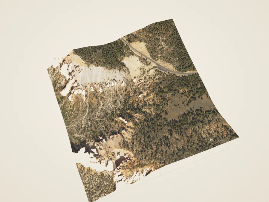
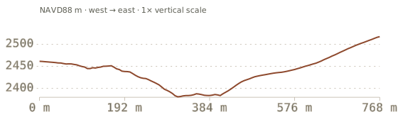
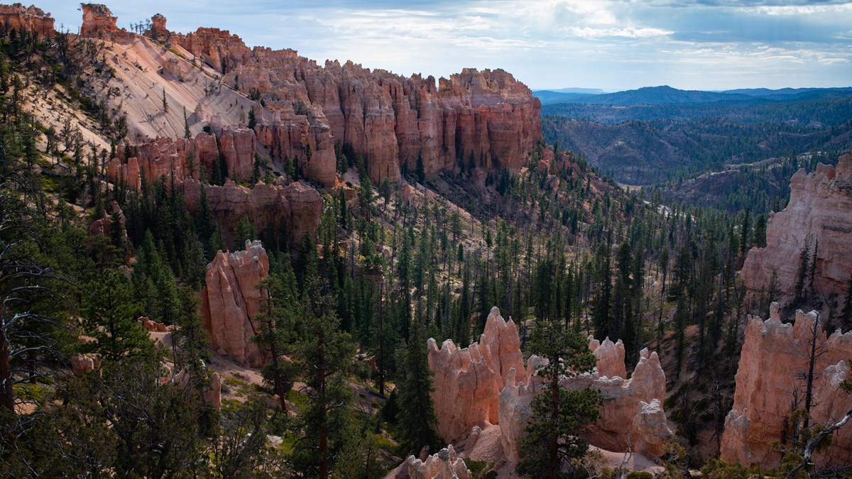
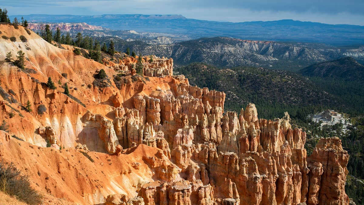
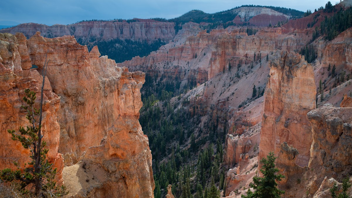
Derived 2018 ground + 2024 aerial color · 768 m footprint · gaps are data omissionsDerived Source-classified ground · central slice · NAVD88 mCompare the photographed landscapeNPS / Peter Densmore · Swamp Canyon. A broader ground-level view; distant terrain and hidden cliff details are outside this model. The photograph is not a texture or an accuracy certification.
02 / The southern transition
Swamp Canyon head
Beyond the main amphitheater, wooded hollows become part of the view.
NPS describes Swamp Canyon as a transition from densely packed hoodoos to the cliffs and buttes of southern Bryce. This crop concentrates on the head of the canyon near the overlook. Its ground surface separates the shape of the slope from the canopy above it.
Move a west-to-east section down the crop. Higher ground breaks into hollows with different depths. These are profiles of the source-classified ground surface, not trail elevations, stream measurements or mapped rock layers.
Only the overlook sector is included. The full canyon, its spring and downstream drainage are outside this bounded study. Ground classification may omit standing rock and still misses hidden cliff faces.
Footprint, source & scaleDerived North-up coverage: teal = ground returns in the grid bin; ochre = short fill; gray = source gap; purple = omitted cliff/fragment nodes. Gaps in a terrain study are not physical openings.
Measured basis
20,138,585 source returns in this 768 × 768 m footprint; source-classified ground.
Elevation
2324–2517 m NAVD88 across supported terrain; relief is a crop statistic, not trail ascent.
Three grids
6 m / 3 m / 1.5 m; finer export spacing is not increased survey accuracy.
Coverage
93.67% directly sampled nodes; 2.89% nearest fill within 3 m; 3.44% not drawn (source gaps or conservative cliff/fragment masks).
Color
USDA NAIP, 2024-07-23; 0.6 m source pixels. A separate acquisition from the 2018 lidar. Steep slopes fade to neutral relief.
Coordinates
WGS84 / UTM 12N; source NAVD88 / Geoid12B heights retained. Metres; x east, y up, z south; 1× vertical scale.
Footprint center
37.5858° N, 112.2120° W. Editorial crop center, not an arrival point.
NPS describes wetter vegetation below the rim. The model does not map wetness, identify species or locate a spring.
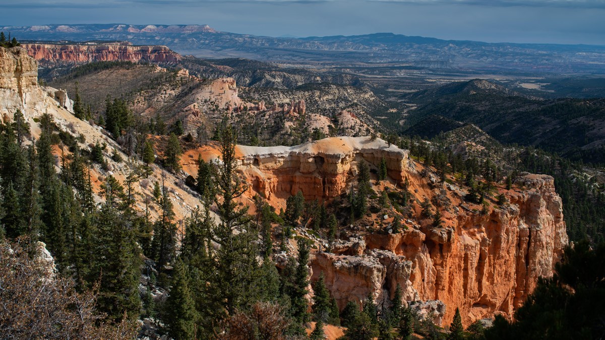
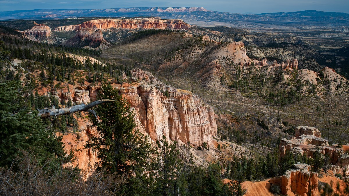
Derived 2018 ground + 2024 aerial color · 768 m footprint · gaps are data omissionsDerived Source-classified ground · central slice · NAVD88 mCompare the photographed landscapeNPS / Peter Densmore · Farview Point. A broader ground-level view; distant terrain and hidden cliff details are outside this model. The photograph is not a texture or an accuracy certification.NPS / Peter Densmore · Piracy Point. A broader ground-level view; distant terrain and hidden cliff details are outside this model. The photograph is not a texture or an accuracy certification.
03 / One ridge, two views
Farview & Piracy
Two overlooks share a ridge. Their views open toward different parts of the plateau edge.
Farview and Piracy belong in one study: NPS links them by a short path, with Piracy to the north. This local footprint contains both mapped overlooks. Compare the two oblique views, then turn north-up to see the ridge and the beginnings of its adjoining slopes.
NPS uses Piracy Point to explain competition between neighboring drainages. The section lets you inspect local relief; the full Sheep Creek and Willis Creek watersheds extend beyond this crop. No drainage capture date is calculated.
One footprint and one exhibit, with two mapped viewpoints. The long-distance Grand Staircase panorama and the full watershed divide are not reconstructed. Camera presets are aerial study views, not photographs from the overlooks.
Footprint, source & scaleDerived North-up coverage: teal = ground returns in the grid bin; ochre = short fill; gray = source gap; purple = omitted cliff/fragment nodes. Gaps in a terrain study are not physical openings.
Measured basis
21,292,131 source returns in this 768 × 768 m footprint; source-classified ground.
Elevation
2413–2693 m NAVD88 across supported terrain; relief is a crop statistic, not trail ascent.
Three grids
6 m / 3 m / 1.5 m; finer export spacing is not increased survey accuracy.
Coverage
93.43% directly sampled nodes; 3.34% nearest fill within 3 m; 3.23% not drawn (source gaps or conservative cliff/fragment masks).
Color
USDA NAIP, 2024-07-23; 0.6 m source pixels. A separate acquisition from the 2018 lidar. Steep slopes fade to neutral relief.
Coordinates
WGS84 / UTM 12N; source NAVD88 / Geoid12B heights retained. Metres; x east, y up, z south; 1× vertical scale.
Footprint center
37.5453° N, 112.2448° W. Editorial crop center, not an arrival point.
The published NPS locators are about 273 m apart. They are retained as overlook positions, independently of the editorial mesh center.
Derived 2018 ground + 2024 aerial color · 768 m footprint · gaps are data omissionsDerived Source-classified ground · central slice · NAVD88 mCompare the photographed landscapeNPS / Peter Densmore · Ponderosa Canyon. A broader ground-level view; distant terrain and hidden cliff details are outside this model. The photograph is not a texture or an accuracy certification.
04 / Higher southern forests
Ponderosa Canyon rim
A forest can hide the slope without changing the height of the ground.
Ponderosa Canyon is named for trees below the overlook. NPS contrasts these with the mixed conifer forest at the higher rim. Switch between ground, aerial color and source returns to distinguish the elevation of the land from vegetation above it.
The profile samples the ground class from the 2018 survey. The return sample also contains echoes from higher surfaces, and the 2024 aerial image records the canopy. These layers describe different things at different dates.
The point cloud does not identify tree species. Aerial color is not a vegetation inventory, and ground filtering can omit standing formations. The full canyon and distant plateau are outside this crop.
Footprint, source & scaleDerived North-up coverage: teal = ground returns in the grid bin; ochre = short fill; gray = source gap; purple = omitted cliff/fragment nodes. Gaps in a terrain study are not physical openings.
Measured basis
20,487,525 source returns in this 768 × 768 m footprint; source-classified ground.
Elevation
2426–2751 m NAVD88 across supported terrain; relief is a crop statistic, not trail ascent.
Three grids
6 m / 3 m / 1.5 m; finer export spacing is not increased survey accuracy.
Coverage
93.51% directly sampled nodes; 2.96% nearest fill within 3 m; 3.53% not drawn (source gaps or conservative cliff/fragment masks).
Color
USDA NAIP, 2024-07-23; 0.6 m source pixels. A separate acquisition from the 2018 lidar. Steep slopes fade to neutral relief.
Coordinates
WGS84 / UTM 12N; source NAVD88 / Geoid12B heights retained. Metres; x east, y up, z south; 1× vertical scale.
Footprint center
37.5031° N, 112.2603° W. Editorial crop center, not an arrival point.
The forest-zone interpretation comes from NPS. It is context for the measured relief, not a classification produced from image color.
Derived 2018 ground + 2024 aerial color · 768 m footprint · gaps are data omissionsDerived Source-classified ground · central slice · NAVD88 mCompare the photographed landscapeNPS / Peter Densmore · Black Birch Canyon. A broader ground-level view; distant terrain and hidden cliff details are outside this model. The photograph is not a texture or an accuracy certification.
05 / The southern amphitheaters
Black Birch Canyon rim
The plateau edge is divided into smaller hollows before it opens into the larger canyon.
Black Birch Canyon lies north of Rainbow Point. NPS places it within the southern amphitheater landscape. This overlook-sector crop studies the nearby rim: use the north-up plan to follow higher ridges, then move the section to compare the hollows between them.
The shape changes from one slice to the next because each section crosses a different part of the dissected edge. The scale stays fixed. The name is not evidence of a particular tree species: NPS describes Black Birch as a probable historical misidentification of aspen.
This is the overlook sector, not the full named drainage. Larger-scale downstream connections and the distant skyline are outside the model; no route line is inferred.
Footprint, source & scaleDerived North-up coverage: teal = ground returns in the grid bin; ochre = short fill; gray = source gap; purple = omitted cliff/fragment nodes. Gaps in a terrain study are not physical openings.
Measured basis
20,168,427 source returns in this 768 × 768 m footprint; source-classified ground.
Elevation
2456–2745 m NAVD88 across supported terrain; relief is a crop statistic, not trail ascent.
Three grids
6 m / 3 m / 1.5 m; finer export spacing is not increased survey accuracy.
Coverage
92.31% directly sampled nodes; 3.69% nearest fill within 3 m; 4.01% not drawn (source gaps or conservative cliff/fragment masks).
Color
USDA NAIP, 2024-07-23; 0.6 m source pixels. A separate acquisition from the 2018 lidar. Steep slopes fade to neutral relief.
Coordinates
WGS84 / UTM 12N; source NAVD88 / Geoid12B heights retained. Metres; x east, y up, z south; 1× vertical scale.
Footprint center
37.4873° N, 112.2510° W. Editorial crop center, not an arrival point.
The correct overlook locator is retained. A differently located NPS parking record with a similar name is excluded from this study.
Derived 2018 ground + 2024 aerial color · 1024 m footprint · gaps are data omissionsDerived Source-classified ground · central slice · NAVD88 m
06 / Beyond the road end
Riggs Spring corridor
South of the high rim, broad wooded slopes replace the familiar amphitheater view.
The Riggs Spring Loop enters the forested backcountry below Rainbow and Yovimpa Points. This separate crop studies part of the eastern slope and Corral Hollow setting. It does not repeat the earlier high-rim model or attempt to model the entire loop.
Use the section to read the relief beneath the canopy. Compare it with the broader NPS topographic map: this one-kilometre square is a small part of the loop's landscape. The spring and much of the route are beyond its edges.
A corridor landscape, with no delivered trail polyline or water-source location. It cannot establish current trail access, water availability, route distance or hiking ascent. Ground-class gaps remain open.
Footprint, source & scaleDerived North-up coverage: teal = ground returns in the grid bin; ochre = short fill; gray = source gap; purple = omitted cliff/fragment nodes. Gaps in a terrain study are not physical openings.
Measured basis
41,713,279 source returns in this 1024 × 1024 m footprint; source-classified ground.
Elevation
2312–2667 m NAVD88 across supported terrain; relief is a crop statistic, not trail ascent.
Three grids
8 m / 4 m / 2 m; finer export spacing is not increased survey accuracy.
Coverage
97.99% directly sampled nodes; 1.86% nearest fill within 3 m; 0.15% not drawn (source gaps or conservative cliff/fragment masks).
Color
USDA NAIP, 2024-07-23; 0.6 m source pixels. A separate acquisition from the 2018 lidar. Steep slopes fade to neutral relief.
Coordinates
WGS84 / UTM 12N; source NAVD88 / Geoid12B heights retained. Metres; x east, y up, z south; 1× vertical scale.
Footprint center
37.4634° N, 112.2342° W. Editorial crop center, not an arrival point.
NPS pages publish differing loop lengths and ascent figures. Those operational numbers are not reused here; this exhibit measures only its terrain footprint.
USGS airborne lidar sampled these landscapes in 2018. All six studies use the survey’s ground class to avoid presenting tree crowns as rock. At each grid node we keep the highest selected return. Missing nodes take their nearest sampled grid node only within 3 m. Interpolated nodes with more than 12 m of relief across a 3 × 3 neighborhood, and isolated patches smaller than 100 m², are omitted. This prevents sparse samples from becoming artificial vertical strips; the original returns remain available.
The three grids are nested samples of one fine surface. They never add a hidden wall, arch opening, cap underside or rock layer. Ground filtering can remove standing rock. A fine grid, a filled patch or a successful render cannot establish a complete landform.
Profiles name their sampled surface. Their distances are horizontal UTM distances; elevations stay in NAVD88 metres. Omitted fine nodes break profile segments even if both endpoints have data. Gaps can represent sparse source coverage or a conservative cliff mask, not a physical opening.
Three different kinds of evidence
Measured: the source return positions and classifications. Derived: meshes, masks, sections and their statistics. Illustrative: relief color, light and category colors. None is a current view.
The aerial layer is separate 2024 USDA NAIP photography, at 0.6 m source resolution. It records canopy and acquisition shadows. Because overhead pixels cannot photograph a cliff face, slopes steeper than about 49° blend toward neutral relief; at about 73° they use relief entirely. Date differences and alignment limits remain.
No geologic contact, species observation, spring position, route line or erosion forecast is inferred. For visits, use current NPS conditions and the visit-planning pages.
USGS 3DEP LiDAR Point Clouds — USGS data; public Entwine organization maintained by Hobu. Lossless public EPT copy, independent measured returns, public-domain data rights. Only the anonymous usgs-lidar-public bucket was used; no requester-pays bucket. Checked 2026-10-02.
USGS Lidar Point Cloud UT Southern QL1 2018 12SUG9562 LAS 2019 metadata — US Geological Survey. Project acquisition interval 2018-04-27 to 2018-07-29, publication date, source limitations. The generic XML horizontal reference is malformed (UTM zone 30); native LAS WKT and EPT metadata control coordinate interpretation instead. Checked 2026-10-02.
USDA conterminous US NAIP imagery service — USDA FPAC / Farm Service Agency. Locked primary-raster RGB crops, image identities and acquisition dates. Per-model imagery.json retains exact requests, extents and hashes. Checked 2026-10-02.
National Agriculture Imagery Program (NAIP) Imagery — US Department of Agriculture, data.gov catalog. Dataset-specific rights, aerial acquisition and orthorectification. This does not grant rights to Utah Hexagon or Google licensed imagery, neither of which is used. Checked 2026-10-02.
National Agriculture Imagery Program (NAIP) — Utah Geospatial Resource Center. Utah 2018-and-later NAIP is 0.6 m imagery with a stated horizontal accuracy of +/-4 m; source service and flight-date fields. Sampling a mesh more finely does not improve image resolution. Checked 2026-10-02.
Hat Shop — National Park Service. Balanced-rock hoodoo identity and relationship to Bryce Point; no operational trail metrics reused. Checked 2026-10-02.
Swamp Canyon — National Park Service. Southern landscape transition, overlook identity and broader canyon context; no wetland or species mapping. Checked 2026-10-02.
Farview Point — National Park Service. Piracy north of Farview and local plateau context; distant panorama is outside the crop. Checked 2026-10-02.
Piracy Point — National Park Service. Sheep Creek and Willis Creek drainage interpretation; no capture date or calibrated watershed simulation. Checked 2026-10-02.
Ponderosa Canyon — National Park Service. Forest zones in relation to elevation and named overlook. Neither species nor geological contacts inferred from color. Checked 2026-10-02.
Black Birch Canyon — National Park Service. Overlook and southern amphitheater context; probable aspen naming confusion. Checked 2026-10-02.
Riggs Spring Loop Trail — National Park Service. Forest and slope setting; NPS-credited historical topographic map used for comparison. Published route metrics differ from newer NPS records and are not used. Checked 2026-10-02.
Backcountry Hiking and Camping — National Park Service. Riggs/Under-the-Rim context and source disagreement record, not current trip guidance. Checked 2026-10-02.
Paria View — National Park Service. Candidate identity; deferred for distinct footprint priority. Checked 2026-10-02.
Whiteman Bench Picnic Area — National Park Service. Candidate identity and broad bench context; no wildfire-area calculation. Checked 2026-10-02.
Geographic Names — Landforms — US Geological Survey. Independent named-feature locators, including Hat Shop 1441625, Farview 1441016, Piracy 1444459 and Corral Hollow 1439972. Points do not define a feature boundary. Valley records include multiple positions, not a trail polyline. Checked 2026-10-02.
NPS Public Points of Interest — National Park Service. Mapped overlook positions; Hat Shop Hoodoos Viewpoint 9513. Accuracy is unknown, scaled or >=14 m for used records. Existing travel coordinates remain unchanged; similar names with different roles are not substituted. Checked 2026-10-02.
NPS disclaimer: ownership — National Park Service. Five comparison images explicitly credited NPS Photo / Peter Densmore and the NPS-credited Riggs topographic map. Uncredited Hat Shop hero and separately credited Riggs photograph are excluded from redistributed comparison assets. Checked 2026-10-02.
Map services and data available from U.S. Geological Survey, National Geospatial Program. Aerial imagery: USDA Farm Service Agency / FPAC, NAIP 2024. Mapped public overlooks: National Park Service. Comparison photographs: NPS / Peter Densmore. Three.js 0.186.1, MIT; existing local Gelasio and Inter fonts, SIL OFL. Renderer license. No claim to original U.S. Government works. No agency affiliation or endorsement is implied.
Local browser and source checks do not replace field surveying, independent scientific review, physical-device testing or assistive-user review. These remain separate.

 Derived 2018 ground + 2024 aerial color · 480 m footprint · gaps are data omissions