
Geology laboratory · Experiment 03
What a picture shows,
and what it cannot.
Three Bryce scenes. Six small decisions. Practice separating what a picture shows from an explanation that needs more evidence.
Practice with reconstructions. These are existing source-backed model views, with interpreted details. They are not new field observations, photographs, or assessments of rock stability.
The complete observation guide is available below. Interactive questions appear when the page is ready.
Read all three stopsAn observer’s notebook
Notice · explain · checkStop 1 of 3 · question 1 of 2
The scene image is unavailable. The scene description and every question remain available beside it.
 Derived Methods & credits.
First, observe
Which statement is supported directly by this depicted shape?
Your note stays in this open page. It is not sent or saved; reloading clears it. Each stop keeps its own note while you explore.
Your observation trail
The reading trail
A useful habit:
keep two columns.
Write what you notice in one column and what you think it means in another. Add the evidence you would need to connect them.
Every question and explanation is available here without JavaScript.
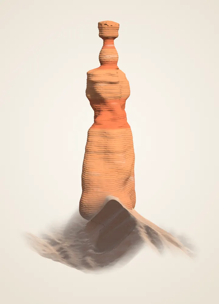
Stop 1 · Thor’s Hammer
A cap and a neck
Which statement is supported directly by this depicted shape?
The cap is wider than the neck beneath it. The relative widths are visible. Strength and timing need evidence this picture does not provide.
The source reconstruction also carries uncertainty: its neck width was constrained with a photograph, while hidden depth was interpreted. An outline is still different from a strength test.
Which is the most useful next evidence for a resistance explanation?
Field descriptions of the rock’s texture, cement and composition. Material descriptions can test a resistance explanation. Brightening an image or naming a shape adds no material evidence.
NPS connects varied hoodoo profiles with differences in rock material. The lab’s colored resistance bands are hypotheses inherited from shape, not results from sampling Thor’s Hammer.
Existing BCC reconstruction: 2018 USGS lidar; neck outline adjusted from an NPS photograph. Colors and fine texture are drawn. Model methods · Primary reading.
Stop 2 · Natural Bridge
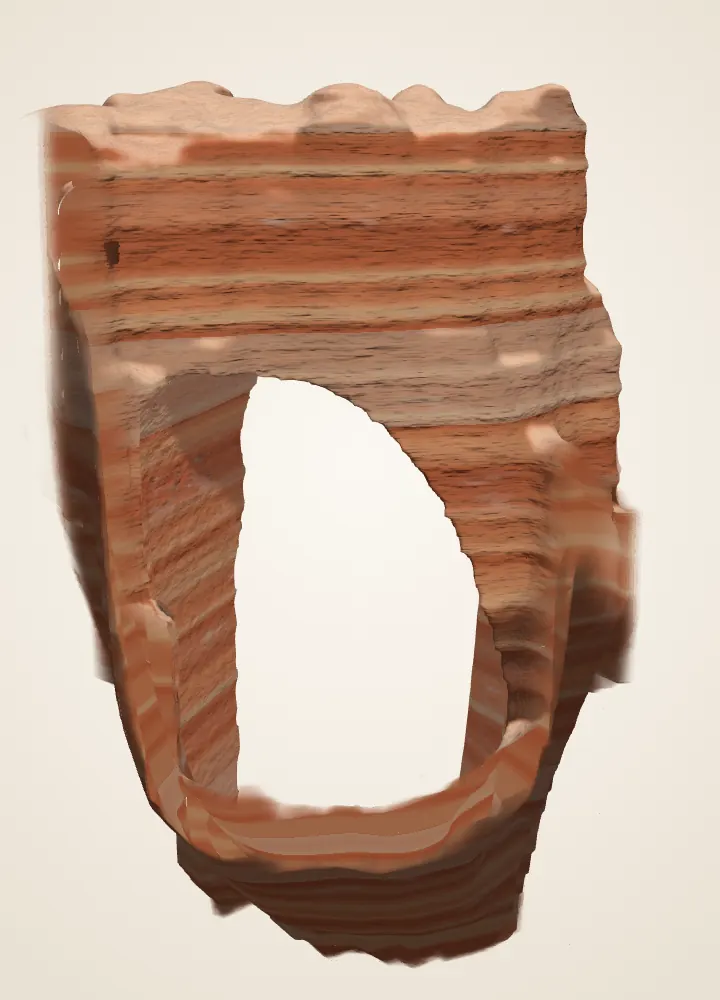
A name and an opening
What visible relationship makes this a window through a fin?
Rock remains connected above the opening. The roof connects the two sides above the opening. This reconstruction does not show a live stream or establish past stream flow.
A window describes an opening. Frost, solution, gravity and removal can work together; no single photograph or reconstruction establishes their exact contributions.
Does the name Natural Bridge establish that a river carved the opening?
No. A place name is not enough evidence for its origin. The name alone cannot establish the process. NPS discusses this landmark among arches/windows and cautions that the bridge-versus-arch distinction is imprecise.
Avoid replacing one absolute claim with another: water can contribute to weathering and erosion even when a landmark is called an arch. The exhibit does not date an opening or forecast its roof failure.
Existing BCC reconstruction: 2018 USGS lidar and an opening interpreted using a credited 2014 USGS photograph. Bands and fine texture are drawn. Model methods · Primary reading.
Stop 3 · Bryce Amphitheater
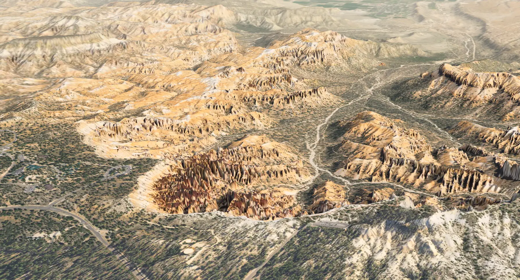
A color and a rock unit
What can a color difference in this model establish by itself?
The displayed patches look different; their rock units need more evidence. You can observe the displayed difference. You cannot identify a mapped formation or a strength contrast from color alone.
This image combines terrain with processed aerial imagery. A formation is defined using geological properties and geographic relationships, not an image color threshold.
Which comparison would best test a proposed formation boundary?
The published geologic map, its legend and field descriptions. Compare the published geological interpretation with field descriptions and its stated scale. Extra image precision does not create missing geological evidence.
The lab does not draw mapped contacts onto this terrain. Bryce’s amphitheaters occupy an eroding plateau margin; the shape of that margin and the identity of its rock units are related but different questions.
Existing BCC model render: USGS elevation and 2021 USDA NAIP imagery, with processed color and lighting. A derived landscape view, not a geologic map or live view. Model methods · Primary reading.
Take the habit outside
From an established trail or overlook, make a sketch without approaching an edge or disturbing the rock. Record a visible shape, then write one possible explanation and one question it leaves open. Keep uncertain unit names blank. Consult current NPS conditions and the geology and care field note for a visit.
These exercises are original learning prompts. A convincing explanation needs observations, source context and appropriate methods; completing a quiz does not establish conditions or safety at a real site.
What the scenes inherit
The Thor and Natural Bridge views reuse the copied reconstruction posters unchanged. The terrain view reuses the existing USGS/USDA-derived render. Their original licenses, credits and reconstruction limits remain in Methods & credits and the claim register. No new media were acquired for this challenge. Sources checked October 2, 2026.
Primary reading and source dates
- National Park Service, Bryce Canyon National Park · Hoodoos. 2021-09-04. Weathering/erosion distinction; water and frost; depositional setting; variable resistance.
- National Park Service, Bryce Canyon National Park · Wall and Narrows. 2021-09-04. Fins bounded by fractures; runoff removes weathered fragments; differential erosion.
- National Park Service, Bryce Canyon National Park · Arches. 2015-02-24. Windows in fins; gravity; qualified bridge/arch terminology; Natural Bridge as an example.
- National Park Service, Geologic Resources Inventory · NPS Geodiversity Atlas—Bryce Canyon National Park, Utah. 2024-06-17. Joint-controlled landforms; horseshoe-shaped amphitheaters; Claron on the Paunsaugunt rim.
- US Geological Survey · Geologic map of Bryce Canyon National Park and vicinity, southwestern Utah (I-2108) — William E. Bowers. 1991 (USGS catalogue); map commonly cited as 1990. Lower pink and upper white informal members; local variation and missing white member; bed resistance interpreted in earlier field studies; contacts are not inferred from lidar.
- National Park Service, Bryce Canyon National Park · Deciphering Nature’s Palette wayside. 2024-01-08. Upper white/lower pink terminology; limestone with silt/clay and interbedded materials; introductory age range.
- Utah Geological Survey, Survey Notes 55(2) · Mapping Geologic Hazards in and Near Bryce Canyon National Park — Tyler Knudsen. 2023-05-01. Eastern escarpment, drainage contrast and active mass wasting; broad regional age range.
- Utah Geological Survey · Interim geologic map of the Parowan quadrangle, Iron County, Utah (OFR-764) — Tyler R. Knudsen. 2024. Fluvial, floodplain and lake environments; soil modification; revised local-versus-regional age interpretation. Does not supply a new Bryce geologic map.
- Science 314(5802), 1127–1129 · Bedrock Fracture by Ice Segregation in Cold Regions — Julian B. Murton, Rorik Peterson and Jean-Claude Ozouf. 2006-11-17. Ice segregation can fracture porous bedrock under experimental freezing regimes; simple freeze-count or volume-expansion explanations are incomplete.
- US Geological Survey, Geology and Ecology of National Parks · Geology of Bryce Canyon National Park. Update date not stated. Carbonate dissolution in weakly acidic water; sedimentary rock record. Loose grouping of named units in the overview is not used as a stratigraphic authority.
- National Park Service, Bryce Canyon National Park · Grand Staircase. Update date not stated. Regional sequence across Bryce, Zion and Grand Canyon; broad setting only.
- National Park Service, Geology · NPS Stratotype Inventory. Update date not stated. Hierarchy of formation, member and bed; mapping requires multiple geological properties.
Retrieval date: October 2, 2026. Media were not copied from these reading sources. The downloadable register records inherited model/asset rights separately.