Check before leaving
Read current NPS alerts, road and trail information, facility hours and the linked weather forecast. Ask at the Visitor Center about trail surfaces. This catalogue is dated, with no live closure or weather feed.

Weather unavailable
Observed at Bryce Canyon Airport. Conditions at the rim can differ.
NWS · KBCE airport · time unavailable
Forecast unavailable. Use the NWS source below.
Forecast issue time unavailable
Park updates unavailable
Check NPS for the latest closures and conditions.
Bryce field guide · Make room to notice
A few good stops. Time to linger. Find a visit that fits the day you have, with the path details to make your own choices.
NPS sources checked October 2, 2026 · Check today’s conditions
Start with an example
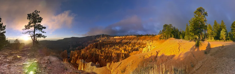
For a short visit, consider Sunset Point and the paved rim approach at Sunrise Point. This example stays above the amphitheater; it does not include the Queen’s Garden descent or a walk between the two stops.
115 of 120 minutes used; only 5 minutes spare. These are BCC’s modeled allowances for a car visit in fall, with the viewpoints preference and no shorter time cap. They are not measured travel times. Entrance queues and travel to the park are extra. The model allows about 1.4 km on foot, including approaches; it does not guarantee an accessible path or a comfortable pace.
If that margin feels too tight, remove Sunrise and spend longer at Sunset. Changing to the shuttle changes transfer and waiting allowances; check the official route and schedule. Do not squeeze a below-rim hike into the remaining minutes.
Load these two stops · Review the loaded plan · Read or print the place details
After loading, review the settings shown: links carry stops and the time budget, not walking, season or transport preferences. In the web edition, use Share stops for a reusable link; the offline edition offers Export stop IDs. Use Print this plan for your edited itinerary. Check official conditions before travelling. Example evaluated October 14, 2026; the catalogue retains its October 2 source dates. How the estimates work.
The planner needs JavaScript and its local data files. If controls do not appear, reload this page or use the complete reading and print guide. All place details below remain available.
02 · A possible visit
Optional local storage includes your choices. No account or submission.
Download the offline plannerOne HTML file. Open it from Files or a browser; current-condition links still need a connection.
For the driving-map handoff, export ordered public place IDs. How transfers are estimated · NPS shuttle map & schedule
03 · Choose with the details
29 places and services. Distances and slopes are published NPS figures, with unknowns left visible. Descriptions do not establish today’s surface, opening or suitability for a particular visitor.
Start with current conditions, exhibits and ranger information. Ask about the access guide, film and Junior Ranger booklet.
Ramp grades and approach distance are not quantified here. Auditorium has a captioned 24-minute film; ask for audio description or assisted listening.
Facilities. Accessible restroom stalls and drinking water listed by NPS. Check current hours and holiday exceptions; a film can require extra waiting time.
BCC planning allowance: 30 minutes here; 160 m on foot, including return approach. BCC allowance, not a measured travel time. Includes approach, viewing and photo pauses.
Dated description; current surface, access and availability are unknown.
NPS sources · checked 2026-10-02: Visitor Center · Bryce Canyon accessibility · Current Conditions · Operating Hours & Seasons.
A short paved approach to the Bryce Amphitheater. Look across the clustered pillars before deciding whether to add a rim walk.
Surface condition and maintenance are not verified live.
Facilities. NPS lists year-round restrooms and water in the restroom, plus seasonal exterior fill stations. The access guide says the restroom may require assistance; availability is not live.
BCC planning allowance: 25 minutes here; 350 m on foot, including return approach. BCC allowance, not a measured travel time. Includes approach, viewing and photo pauses.
Dated description; current surface, access and availability are unknown.
NPS sources · checked 2026-10-02: Bryce Canyon accessibility · Visiting in Winter · Sunset Point to Sunrise Point Hike.
A longer paved approach to the rim and the Queen’s Garden trailhead. This stop ends below the steep, unpaved upper viewpoint.
Paved approach only. The extra 24 m to the upper viewpoint is unpaved, with 20.7% maximum grade and 16.2% maximum cross-slope; excluded from this stop.
Facilities. Restrooms and water at the nearby General Store are seasonal. Do not depend on the store in winter.
BCC planning allowance: 40 minutes here; 1050 m on foot, including return approach. BCC allowance, not a measured travel time. Includes approach, viewing and photo pauses.
Dated description; current surface, access and availability are unknown.
NPS sources · checked 2026-10-02: Bryce Canyon accessibility · Visiting in Winter · Sunset Point to Sunrise Point Hike.
An amphitheater view from the lower overlook. The middle and upper overlooks are separate, much steeper extensions.
Lower overlook only. The unpaved 373 m extension to middle/upper overlooks reaches a reported 26% maximum grade; excluded.
Facilities. NPS winter guidance says restrooms here close in winter; verify current facilities.
BCC planning allowance: 20 minutes here; 180 m on foot, including return approach. BCC allowance, not a measured travel time. Includes approach, viewing and photo pauses.
Dated description; current surface, access and availability are unknown.
NPS sources · checked 2026-10-02: Bryce Canyon accessibility · Visiting in Winter.
A paved approach to the first overlook. This plan does not require continuing to the farther end of the point.
First overlook only. The additional 78 m to the end is excluded. NPS reports route-wide grades; the first section was not separately measured. Ice can affect the path.
Facilities. Facilities at this stop are not confirmed in this record. Carry needed water; verify nearby services.
BCC planning allowance: 25 minutes here; 220 m on foot, including return approach. BCC allowance, not a measured travel time. Includes approach, viewing and photo pauses.
Dated description; current surface, access and availability are unknown.
NPS sources · checked 2026-10-02: Bryce Canyon accessibility · Visiting in Winter.
A compacted-sediment overlook at the north end of the amphitheater. Viewpoint visit only; Fairyland Loop is a separate long hike.
Surface condition and maintenance are not verified live.
Facilities. NPS lists no services or shuttle at Fairyland Point.
BCC planning allowance: 20 minutes here; 100 m on foot, including return approach. BCC allowance, not a measured travel time. Includes approach, viewing and photo pauses.
Dated description; current surface, access and availability are unknown.
NPS sources · checked 2026-10-02: Bryce Canyon accessibility · Visiting in Winter · Fairyland Loop.
A paved approach to the first overlook, with a longer sloping extension beyond. Its spur road is seasonally closed to vehicles.
First overlook only. The extra 192 m sloping extension is excluded. Grades and cross-slopes are unknown in the consulted table.
Facilities. Facilities at this stop are not confirmed in this record. Carry needed water; verify nearby services.
BCC planning allowance: 20 minutes here; 120 m on foot, including return approach. BCC allowance, not a measured travel time. Includes approach, viewing and photo pauses.
Dated description; current surface, access and availability are unknown.
NPS sources · checked 2026-10-02: Bryce Canyon accessibility · Visiting in Winter.
A roadside viewpoint along the southern drive. Seeing the overlook does not require taking the separate backcountry loop.
Surface condition and maintenance are not verified live.
Facilities. NPS lists no services at the Swamp Canyon trailhead. Carry needed water and plan restroom stops elsewhere.
BCC planning allowance: 15 minutes here; 100 m on foot, including return approach. BCC allowance, not a measured travel time. Includes approach, viewing and photo pauses.
Dated description; current surface, access and availability are unknown.
NPS sources · checked 2026-10-02: Bryce Canyon accessibility · Drive the Southern Scenic Drive · Visiting in Winter · Swamp Canyon Loop.
A short paved overlook approach on the southern drive. Nearby Piracy Point uses an unpaved path and is listed separately.
Surface condition and maintenance are not verified live.
Facilities. NPS access guide lists accessible restroom stalls; winter guidance lists restrooms here. Current opening and water availability must be checked.
BCC planning allowance: 15 minutes here; 100 m on foot, including return approach. BCC allowance, not a measured travel time. Includes approach, viewing and photo pauses.
Dated description; current surface, access and availability are unknown.
NPS sources · checked 2026-10-02: Bryce Canyon accessibility · Drive the Southern Scenic Drive · Visiting in Winter.
An unpaved walk from the Farview parking area. Compare the terrain detail with Farview before choosing the extension.
Surface condition and maintenance are not verified live.
Facilities. Facilities at this stop are not confirmed in this record. Carry needed water; verify nearby services.
BCC planning allowance: 35 minutes here; 700 m on foot, including return approach. BCC allowance, not a measured travel time. Includes approach, viewing and photo pauses.
Dated description; current surface, access and availability are unknown.
NPS sources · checked 2026-10-02: Bryce Canyon accessibility · Drive the Southern Scenic Drive · Visiting in Winter.
A close-to-parking view of a natural rock opening. Use the overlook to study the opening; this is not a route to its base.
Surface condition and maintenance are not verified live.
Facilities. Facilities at this stop are not confirmed in this record. Carry needed water; verify nearby services.
BCC planning allowance: 20 minutes here; 100 m on foot, including return approach. BCC allowance, not a measured travel time. Includes approach, viewing and photo pauses.
Dated description; current surface, access and availability are unknown.
NPS sources · checked 2026-10-02: Bryce Canyon accessibility · Drive the Southern Scenic Drive · Visiting in Winter.
A short paved viewpoint on the southern drive. Leave time to look into the landscape rather than adding another hike.
Surface condition and maintenance are not verified live.
Facilities. Facilities at this stop are not confirmed in this record. Carry needed water; verify nearby services.
BCC planning allowance: 15 minutes here; 100 m on foot, including return approach. BCC allowance, not a measured travel time. Includes approach, viewing and photo pauses.
Dated description; current surface, access and availability are unknown.
NPS sources · checked 2026-10-02: Bryce Canyon accessibility · Drive the Southern Scenic Drive · Visiting in Winter.
A compact roadside stop on the southern drive. The approach is short, but NPS still reports measurable slope.
Surface condition and maintenance are not verified live.
Facilities. Facilities at this stop are not confirmed in this record. Carry needed water; verify nearby services.
BCC planning allowance: 15 minutes here; 100 m on foot, including return approach. BCC allowance, not a measured travel time. Includes approach, viewing and photo pauses.
Dated description; current surface, access and availability are unknown.
NPS sources · checked 2026-10-02: Bryce Canyon accessibility · Drive the Southern Scenic Drive · Visiting in Winter.
A paved viewpoint with an incline. NPS does not quantify its approach distance in the consulted table.
Surface condition and maintenance are not verified live.
Facilities. Facilities at this stop are not confirmed in this record. Carry needed water; verify nearby services.
BCC planning allowance: 15 minutes here; 100 m on foot, including return approach. BCC allowance, not a measured travel time. Includes approach, viewing and photo pauses.
Dated description; current surface, access and availability are unknown.
NPS sources · checked 2026-10-02: Bryce Canyon accessibility · Drive the Southern Scenic Drive · Visiting in Winter.
A paved sloping approach at the southern end of the road. The higher southern drive adds substantial travel time.
NPS lists 359 ft alongside 107 m, which do not exactly convert. Retain its 107 m approach figure and use a rounded 270 m return allowance; not a survey.
Facilities. NPS access guide lists accessible restroom stalls; winter guidance lists restrooms here. Current opening and water availability must be checked.
BCC planning allowance: 25 minutes here; 270 m on foot, including return approach. BCC allowance, not a measured travel time. Includes approach, viewing and photo pauses.
Dated description; current surface, access and availability are unknown.
NPS sources · checked 2026-10-02: Bryce Canyon accessibility · Drive the Southern Scenic Drive · Visiting in Winter.
A short paved approach at the road’s end. Pair with Rainbow Point using the same parking area when conditions permit.
Surface condition and maintenance are not verified live.
Facilities. Facilities at this stop are not confirmed in this record. Carry needed water; verify nearby services.
BCC planning allowance: 20 minutes here; 100 m on foot, including return approach. BCC allowance, not a measured travel time. Includes approach, viewing and photo pauses.
Dated description; current surface, access and availability are unknown.
NPS sources · checked 2026-10-02: Bryce Canyon accessibility · Drive the Southern Scenic Drive · Visiting in Winter.
An out-and-back paved rim walk: half a mile each way, plus the parking approach. Turn around earlier for a shorter view; the planner budgets the full return.
Paved does not mean flat: NPS reports local maximum grade 16.5% and cross-slope 12.2%. Confirm conditions and suitability. This is a complete out-and-back, not a one-way route relying on a shuttle return.
Facilities. NPS lists year-round restrooms and water in the restroom, plus seasonal exterior fill stations. The access guide says the restroom may require assistance; availability is not live. General Store services at the other end are seasonal.
BCC planning allowance: 90 minutes here; 1950 m on foot, including return approach. BCC allowance: upper NPS walking time plus roughly 20% for pauses and an approach allowance. Transfers and a separate day rest reserve are additional.
Dated description; current surface, access and availability are unknown.
NPS sources · checked 2026-10-02: Sunset Point to Sunrise Point Hike · Hiking at Bryce Canyon · Visiting in Winter · Bryce Canyon accessibility.
A forest loop at the high southern end of the park. Its natural surface and steep sections matter even though NPS calls the overall hike easy.
Published route metrics do not describe today’s surface or every obstacle. Parking approaches are additional.
Facilities. The trail page calls Rainbow-area restrooms seasonal, while winter guidance lists restrooms there. Verify current opening. No park shuttle or on-trail water refill is assumed.
BCC planning allowance: 90 minutes here; 1750 m on foot, including return approach. BCC allowance: upper NPS walking time plus roughly 20% for pauses and an approach allowance. Transfers and a separate day rest reserve are additional.
Dated description; current surface, access and availability are unknown.
NPS sources · checked 2026-10-02: Bristlecone Loop Trail · Hiking at Bryce Canyon · Visiting in Winter.
A streamside walk reached from SR 12, outside the main park drive. It starts uphill and returns downhill; the grotto is not a promise of a flowing waterfall.
Published route metrics do not describe today’s surface or every obstacle. Parking approaches are additional.
Facilities. NPS lists an accessible restroom at the trailhead. No park shuttle. If the lot is full, return later; roadside parking along SR 12 is not permitted. Check park admission guidance.
BCC planning allowance: 90 minutes here; 1450 m on foot, including return approach. BCC allowance: upper NPS walking time plus roughly 20% for pauses and an approach allowance. Transfers and a separate day rest reserve are additional.
Dated description; current surface, access and availability are unknown.
NPS sources · checked 2026-10-02: Mossy Cave Trail · Hiking at Bryce Canyon · Visiting in Winter.
An out-and-back descent among hoodoos from Sunrise Point. The climb back is part of the outing; the NPS rating is moderate.
Published route metrics do not describe today’s surface or every obstacle. Parking approaches are additional.
Facilities. NPS lists seasonal restrooms and a water-fill station at the General Store near Sunrise Point. No refill is assumed on the trail.
BCC planning allowance: 165 minutes here; 3900 m on foot, including return approach. BCC allowance: upper NPS walking time plus roughly 20% for pauses and an approach allowance. Transfers and a separate day rest reserve are additional.
Dated description; current surface, access and availability are unknown.
NPS sources · checked 2026-10-02: Queen’s Garden Trail · Hiking at Bryce Canyon · Visiting in Winter.
An out-and-back descent north of Sunrise Point to a formation reached by a spur. Keep time and energy for the return climb.
Published route metrics do not describe today’s surface or every obstacle. Parking approaches are additional.
Facilities. NPS lists seasonal restrooms and a water-fill station at the General Store near Sunrise Point. No refill is assumed on the trail.
BCC planning allowance: 240 minutes here; 5900 m on foot, including return approach. BCC allowance: upper NPS walking time plus roughly 20% for pauses and an approach allowance. Transfers and a separate day rest reserve are additional.
Dated description; current surface, access and availability are unknown.
NPS sources · checked 2026-10-02: Tower Bridge · Hiking at Bryce Canyon · Visiting in Winter.
A long, steep loop reached from Bryce Point. NPS advises clockwise travel and yielding to horses and mules.
Published route metrics do not describe today’s surface or every obstacle. Parking approaches are additional.
Facilities. NPS lists seasonal pit toilets along the loop. No drinking-water refill is assumed on trail.
BCC planning allowance: 310 minutes here; 9150 m on foot, including return approach. BCC allowance: upper NPS walking time plus roughly 20% for pauses and an approach allowance. Transfers and a separate day rest reserve are additional.
Dated description; current surface, access and availability are unknown.
NPS sources · checked 2026-10-02: Peekaboo Loop · Hiking at Bryce Canyon · Visiting in Winter.
A substantial hoodoo and rim circuit. This record starts and ends at Fairyland Point; no shuttle pickup is assumed there.
NPS main description says 8.0 miles; its access block says 7.8. Use the longer 8.0-mile distance for planning. Winter road closure changes access to this specific start.
Facilities. No services or shuttle at Fairyland Point. This plan returns to its starting point.
BCC planning allowance: 375 minutes here; 13100 m on foot, including return approach. BCC allowance: upper NPS walking time plus roughly 20% for pauses and an approach allowance. Transfers and a separate day rest reserve are additional.
Dated description; current surface, access and availability are unknown.
NPS sources · checked 2026-10-02: Fairyland Loop · Hiking at Bryce Canyon · Visiting in Winter.
A more rugged, less-signed backcountry loop. NPS recommends carrying a map. It is available for deliberate comparison, not added by a preset.
Published route metrics do not describe today’s surface or every obstacle. Parking approaches are additional.
Facilities. NPS lists no services or shuttle at this trailhead. Carry a map and all needed water.
BCC planning allowance: 305 minutes here; 6600 m on foot, including return approach. BCC allowance: upper NPS walking time plus roughly 20% for pauses and an approach allowance. Transfers and a separate day rest reserve are additional.
Dated description; current surface, access and availability are unknown.
NPS sources · checked 2026-10-02: Swamp Canyon Loop · Hiking at Bryce Canyon · Visiting in Winter.
A practical facilities stop near Sunrise Point. Check the current opening before depending on its restrooms or supplies.
NPS pages describe winter closure differently. Treat exact dates as unconfirmed.
Facilities. Accessible restroom listed. Nearby trail pages list seasonal water fill. No booking, product, price or open-now claim.
BCC planning allowance: 20 minutes here; 200 m on foot, including return approach. BCC allowance, not a measured travel time. Includes approach, viewing and photo pauses.
Dated description; current surface, access and availability are unknown.
NPS sources · checked 2026-10-02: Bryce Canyon General Store · Bryce Canyon accessibility · Visiting in Winter · Operating Hours & Seasons · Sunset Point to Sunrise Point Hike.
The shuttle station outside the park is an NPS-recommended boarding and parking location. The planner itself starts at the park Visitor Center.
Buses have powered wheelchair lifts and space for two wheelchairs according to NPS. Boarding capacity and wait are not guaranteed.
Facilities. 2026 published shuttle season: April 3–October 18. Check exact dates, last bus, proof of admission and parking before travel.
Dated description; current surface, access and availability are unknown.
NPS sources · checked 2026-10-02: Park Shuttle · Bryce Canyon accessibility.
No places match. Clear the search or choose another type.
04 · Know the return
Published trail distance includes the return or complete loop, but not parking approaches. NPS’s difficulty label is a broad description, not a judgment about your group. Every amphitheater descent includes a climb back.
| Walk | Distance | Ascent | NPS time / rating | Surface | Max. grade | Min. width |
|---|---|---|---|---|---|---|
| Sunset–Sunrise paved rim walk | 1 mi | 40 ft | 1 h Easy | Concrete | 16.5% | 182.9 cm |
| Bristlecone Loop | 1 mi | 200 ft | 1 h Easy | Native sediment | 20% | 129.5 cm |
| Mossy Cave Trail | 0.8 mi | 150 ft | 1 h Easy | Native sediment | 23% | 81 cm |
| Queen’s Garden Trail | 1.8 mi | 450 ft | 1–2 h Moderate | Native sediment | 25% | 84 cm |
| Navajo Loop · full summer loop | 1.3 mi | 515 ft | 1–2 h Moderate | Native sediment | 30% | 64 cm |
| Queen’s Garden / Navajo combination | 2.9 mi | 625 ft | 2–3 h Moderate | Native sediment | 30% | 64 cm |
| Tower Bridge walk | 3 mi | 760 ft | 2–3 h Moderate | Native sediment | Not published | Not published |
| Peekaboo Loop | 5.5 mi | 1560 ft | 3–4 h Strenuous | Native sediment | 27% | 122 cm |
| Fairyland Loop · from Fairyland Point | 8 mi | 1900 ft | 4–5 h Strenuous | Native sediment | 25% | 41 cm |
| Swamp Canyon Loop | 4 mi | 800 ft | 3–4 h Moderate | Native sediment | Not published | Not published |
05 · Before you go
Read current NPS alerts, road and trail information, facility hours and the linked weather forecast. Ask at the Visitor Center about trail surfaces. This catalogue is dated, with no live closure or weather feed.
Fairyland and Paria spur roads close to vehicles in winter; Wall Street closes seasonally. The southern road can close temporarily after snow. Paved paths can be icy. The planner keeps winter and unknown-season suggestions near the amphitheater and leaves unpaved hikes for a fresh conditions check.
The shuttle serves the amphitheater, not the southern drive or Mossy Cave. NPS describes roughly 15-minute arrivals and a 50-minute loop. Check the dedicated 2026 schedule (April 3–October 18), service hours and last departure; a season choice is not proof of service on your date. No Rainbow bus tour is assumed.
Pack drinking water, food, sun protection, layers and footwear suited to the surface. Carry a trail map. NPS emphasizes high elevation, the return climb on amphitheater hikes and traction needs in winter. Choose distances for your group; this planner does not assess fitness or medical needs.
NPS advises going inside a substantial building or hard-top vehicle when you hear thunder, and waiting at least 30 minutes after the last thunder before returning outside. A viewpoint or shuttle shelter is not a storm shelter. Use current forecasts and NPS guidance.
Stay on established trails and behind barriers. Leave rocks and plants in place, give wildlife space and carry out waste. Compare hoodoo shapes from a viewpoint or make a sketch; no closer approach is needed for an observation.
Dated guide · current decisions
No stop here is marked “open now.” Snow, road work, weather, parking and facility hours can change the visit. A smaller plan is a useful plan.
Evidence & editorial choices
We begin with finite, edited lists of places for scenery, short walks, geology and longer hikes. A stop is suggested only when it fits the selected rules. This is a planning aid, not an optimized route, live service or assessment of fitness.
Two hours means 120 minutes; a half day 240; a full day 480. Two days are separate 480-minute budgets. A shorter cap is optional. Each day includes a return to the Visitor Center and 10, 25 or 60 minutes for rest according to its length. Getting to the park and entrance delays are extra.
Car transfers use coarse zone allowances, including parking time. The road-end allowance is 50 minutes from the center; NPS describes about 40 minutes of driving. Shuttle estimates follow the published order within an approximate 50-minute circuit, adding 15 minutes of waiting for each boarding. Manual reversal may require another circuit. None is a promised arrival time.
Stop allowances include time to approach, look and take photographs. Walks use the upper NPS time plus a pause and approach allowance. Approximate daily on-foot allowances are 1.8, 4.5, 8 or 16 km, including parking approaches; shuttle connections add a 200 m allowance each. Unmeasured approaches and individual pace can add more. At most one below-rim hike is suggested per day.
Winter and undecided-season plans omit the southern drive and unpaved hikes pending a conditions check. That is a planning choice, distinct from NPS’s seasonal closures. Paved / step-free preference selects documented paved approaches or facilities, while retaining slope details and unknown step counts. No route is guaranteed accessible.
Reordering keeps your choices and displays overruns. Adding a stop requires room within the modeled limits. Share links omit all preferences except the time budget. Optional saving stays in this browser. The loaded page needs no network for planning; the downloadable edition also works after closing and reopening it.
Retrieval date is not a live-condition check. NPS-authored facts and measurements are paraphrased. No new agency photographs, maps, logos or third-party media were copied. NPS rights notice. No claim to original U.S. Government works.
Viewpoint approach lengths, grade and cross-slope; visitor center ramps, film access and restroom limitations; shuttle lifts.
Trail comparison, altitude context, carrying water, sun/weather preparation and staying on established trails.
Seasonal Fairyland/Paria road and Wall Street closures, southern road uncertainty, winter surfaces and seasonal facilities.
Where to verify alerts, roads and weather; latest trail conditions at the visitor center. Dynamic alerts were not captured as an all-clear.
2026 season April 3–October 18, service area, boarding and parking, about 15-minute frequency and 50-minute loop; no Rainbow bus tour.
About 40 minutes from visitor center to road end, 2–3 hours for drive/viewpoints, south-first recommendation, winter gate, viewpoint context.
Exhibits, ranger information, film, Junior Ranger booklets, drinking water, restrooms and current program information.
Link to current facility hours and seasonal operations; generic shuttle date conflicts with the dedicated 2026 schedule, which takes precedence here.
Location near Sunrise Point, restrooms, wheelchair-accessibility amenity, seasonal closure; exact operating dates require confirmation.
Move inside a substantial building or hard-top vehicle when thunder is heard; shuttle shelters and overlooks are not safe storm shelters.
1 mile round trip, 40 ft ascent, concrete surface, grade/cross-slope/width, seasonal water and restroom details.
1 mile loop, 200 ft ascent, 1 hour, firm native sediment, grades/width, no shuttle, winter snow limitations.
0.8 mile round trip, 150 ft ascent, 1 hour, terrain metrics, SR 12 access, no shuttle, restroom, no roadside parking.
1.8 mile round trip, 450 ft ascent, 1–2 hours, terrain metrics and Sunrise trailhead.
2.9 mile loop, 625 ft ascent, 2–3 hours; clockwise suggestion, Two Bridges winter alternative, terrain metrics.
3 mile round trip, 760 ft ascent, 2–3 hours; north of Sunrise trailhead, natural surface, seasonal nearby services.
8 mile planning distance, 1900 ft ascent, 4–5 hours, grades/width; no shuttle/services at Fairyland Point; winter snow limitation.
5.5 mile loop, 1560 ft ascent, 3–4 hours, grades/width; horse/mule right-of-way and seasonal toilets.
4 mile loop, 800 ft ascent, 3–4 hours, natural surface, no services/shuttle, fewer signs and winter snow limitation.
The existing photograph, logo and local Gelasio / Inter fonts retain their site credits and font license. No coordinates or terrain model are supplied by this planner. Download the dated catalogue.
Places
Twenty-three places from Mossy Cave to Riggs Spring, each with its photograph, terrain, canyon section, early photographs, best light, walks and sources.
See all places